Category:Dorfkirche Rönnebeck (Brandenburg)
Jump to navigation
Jump to search
| Object location | | View all coordinates using: OpenStreetMap |
|---|
church building in Oberhavel district, Brandenburg state, Germany _church_E_2015.jpg) | |||||
| Upload media | |||||
| Instance of | |||||
|---|---|---|---|---|---|
| Location | Rönnebeck (Brandenburg), Sonnenberg, Oberhavel District, Brandenburg, Germany | ||||
| Heritage designation | |||||
 | |||||
This is the category of the Brandenburger Baudenkmal (cultural heritage monument) with the ID 09165209 (Wikidata)
|
English: Church in Rönnebeck, Sonnenberg municipality, Oberhavel district, Brandenburg state, Germany
Deutsch: Kirche in Rönnebeck, Gemeinde Sonnenberg, Landkreis Oberhavel, Land Brandenburg, Deutschland
Français : Église de Rönnebeck, commune de Sonnenberg, arrondissement de Haute-Havel, état fédéral de Brandebourg, Allemagne
Pages in category "Dorfkirche Rönnebeck (Brandenburg)"
This category contains only the following page.
Media in category "Dorfkirche Rönnebeck (Brandenburg)"
The following 8 files are in this category, out of 8 total.
-
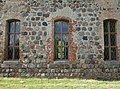 Dorfkirche Rönnebeck (Brandenburg) 2020 Fenster.jpg 4,826 × 3,598; 8.11 MB
-
 Dorfkirche Rönnebeck (Brandenburg) 2020 Friedhofstor.jpg 4,864 × 3,648; 5.53 MB
-
 Dorfkirche Rönnebeck (Brandenburg) 2020 W.jpg 3,648 × 4,864; 6.51 MB
-
 Dorfkirche Rönnebeck (Brandenburg) 2020 Westportal.jpg 4,864 × 3,648; 7.17 MB
-
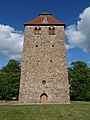
 Rönnebeck (Brandenburg) church 2015 WNW.jpg 1,532 × 1,878; 1.73 MB
-
 Rönnebeck (Brandenburg) church E 2015.jpg 2,967 × 1,617; 2.76 MB
-
 Rönnebeck (Brandenburg) church N 2015.JPG 2,534 × 1,864; 2.47 MB
-
 Rönnebeck (Brandenburg) church NW 2015.JPG 2,592 × 1,944; 2.18 MB
_2020_Fenster.jpg)
_2020_Friedhofstor.jpg)
_2020_W.jpg)
_2020_Westportal.jpg)
_church_2015_WNW.jpg)
_church_N_2015.JPG)
_church_NW_2015.JPG)
Categories:
- Churches in Sonnenberg (Brandenburg)
- Cultural heritage monuments in Sonnenberg (Brandenburg)
- Rönnebeck (Brandenburg)
- Churches in Kirchenkreis Oberes Havelland
- Lutheran churches in Brandenburg
- Fieldstone churches in Brandenburg
- Gothic churches in Brandenburg
- 13th-century churches in Brandenburg
- Brick Gothic church towers in Brandenburg