Category:Dorfkirche Paaren (Potsdam)
Jump to navigation
Jump to search
| Object location | | View all coordinates using: OpenStreetMap |
|---|
| NO WIKIDATA ID FOUND! Search for Dorfkirche Paaren (Potsdam) on Wikidata | |
| Upload media |
This is the category of the Brandenburger Baudenkmal (cultural heritage monument) with the ID 09156748 (Wikidata)
|
Español: Vista de la iglesia en Paaren, ciudad de Potsdam0, estado federado de Brandeburgo, Alemania
Address:
Paarener Mühlenweg 1, 14476 Potsdam-Paaren
Pages in category "Dorfkirche Paaren (Potsdam)"
This category contains only the following page.
Media in category "Dorfkirche Paaren (Potsdam)"
The following 7 files are in this category, out of 7 total.
-
 Dorfkirche Paaren (Potsdam) 2020 ESE.jpg 4,864 × 3,648; 4.24 MB
-
 Dorfkirche Paaren (Potsdam) 2020 Fenster.jpg 3,598 × 4,826; 3.81 MB
-
 Dorfkirche Paaren (Potsdam) 2020 N.jpg 4,980 × 4,619; 5.98 MB
-
 Dorfkirche Paaren (Potsdam) 2020 NW.jpg 3,648 × 4,864; 4.42 MB
-
 Dorfkirche Paaren (Potsdam) 2020 Turmhaube.jpg 3,648 × 4,864; 3.69 MB
-
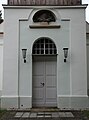 Dorfkirche Paaren (Potsdam) 2020 Westportal.jpg 3,586 × 4,816; 3.63 MB
-
 Potsdam OT Uetz-Paaren Dorfkirche Baudenkmal.JPG 1,800 × 1,995; 919 KB
_2020_ESE.jpg)
_2020_Fenster.jpg)
_2020_N.jpg)
_2020_NW.jpg)
_2020_Turmhaube.jpg)
_2020_Westportal.jpg)
