Category:Dorfkirche Münchehofe (Hoppegarten)
Jump to navigation
Jump to search
| Object location | | View all coordinates using: OpenStreetMap |
|---|
church building in Märkisch-Oderland district, Germany  | |||||
| Upload media | |||||
| Instance of | |||||
|---|---|---|---|---|---|
| Location | Münchehofe, Hoppegarten, Märkisch-Oderland District, Brandenburg, Germany | ||||
| Heritage designation | |||||
 | |||||
This is the category of the Brandenburger Baudenkmal (cultural heritage monument) with the ID 09180546 (Wikidata)
|
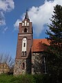
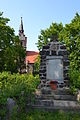
English: Pictures of the church in Münchehofe , Hoppegarten municipality, Märkisch-Oderland district, Brandenburg state, Germany
Deutsch: Bilder der Kirche in Münchehofe , Gemeinde Hoppegarten , Landkreis Märkisch-Oderland , Land Brandenburg, Deutschland.
Français : Photos de l'église à Münchehofe , commune de Hoppegarten , arrondissement de Märkisch-Oderland , état fédéral de Brandebourg, Allemagne
Media in category "Dorfkirche Münchehofe (Hoppegarten)"
The following 33 files are in this category, out of 33 total.
-
 Dorfkirche Münchehofe 2013 1.JPG 4,608 × 3,072; 6.54 MB
-
 Dorfkirche Münchehofe 2013 2.JPG 3,072 × 4,608; 6.6 MB
-
 Dorfkirche Münchehofe 2013 3.JPG 3,072 × 4,608; 6.38 MB
-
 Dorfkirche Münchehofe 2013 4.JPG 3,072 × 4,608; 6.45 MB
-
 Dorfkirche Münchehofe 2013 5.JPG 4,608 × 3,072; 6.02 MB
-
 Dorfkirche Münchehofe 2013 6.JPG 4,608 × 3,072; 6.72 MB
-
 Dorfkirche Münchehofe Chor Nordansicht.jpg 4,608 × 3,456; 6.13 MB
-
 Dorfkirche Münchehofe Chor Südansicht.jpg 4,608 × 3,456; 5.86 MB
-
 Dorfkirche Münchehofe Kirchenschiff Nordansicht.jpg 4,608 × 3,456; 5.72 MB
-
 Dorfkirche Münchehofe Kirchenschiff Nordseite zugesetztes Fenster.jpg 3,456 × 4,608; 5.28 MB
-
 Dorfkirche Münchehofe Kirchenschiff Südseite Portal.jpg 4,608 × 3,456; 6.45 MB
-
 Dorfkirche Münchehofe Nordansicht mit Einfriedung.jpg 4,608 × 3,456; 5.75 MB
-
 Dorfkirche Münchehofe Nordansicht.jpg 4,608 × 3,456; 5.41 MB
-
 Dorfkirche Münchehofe Ostansicht.jpg 4,608 × 3,456; 5.67 MB
-
 Dorfkirche Münchehofe Südansicht.jpg 4,608 × 3,456; 5.84 MB
-
 Dorfkirche Münchehofe Westportal.jpg 4,608 × 3,456; 5.66 MB
-
 Dorfkirche Münchehofe Westturm Südansicht.jpg 3,456 × 4,608; 5.14 MB
-
 Dorfkirche Münchehofe Westturm Westansicht.jpg 3,456 × 4,608; 4.08 MB
-
 Dorfkirche von Münchehofe 1.JPG 4,608 × 3,072; 4.87 MB
-
 Dorfkirche von Münchehofe 2.JPG 3,072 × 4,608; 5.39 MB
-
 Dorfkirche von Münchehofe 3.JPG 4,608 × 3,072; 6.83 MB
-
 Dorfkirche von Münchehofe 4.JPG 3,072 × 4,608; 7.51 MB
-
 Dorfkirche von Münchehofe 5.JPG 4,608 × 3,072; 6.88 MB
-
 Dorfkirche von Münchehofe 6.JPG 3,072 × 4,608; 7.83 MB
-
 Dorfkirche von Münchehofe 7.JPG 4,608 × 3,072; 7.82 MB
-
 Dorfkirche von Münchehofe 8.JPG 4,608 × 3,072; 7.68 MB
-
 Kirche Münchehofe 1.JPG 3,072 × 4,608; 7.4 MB
-
 Kirche Münchehofe 6.JPG 4,608 × 3,072; 7.44 MB
-
 Kriegerdenkmal Münchehofe 2.JPG 4,608 × 3,072; 7.91 MB
-
 Kriegerdenkmal Münchehofe 6.JPG 3,072 × 4,608; 7.37 MB
-
 Münchehofe view from Dahlwitzer Landstraße.jpg 2,048 × 1,536; 1.75 MB
-
 Münchehofe Village Church Bell Tower.jpg 1,536 × 2,048; 958 KB
-
 Münchehofe Village Church.jpg 1,536 × 2,048; 914 KB


