Category:Dorfkirche Löwenberg
Jump to navigation
Jump to search
| Object location | | View all coordinates using: OpenStreetMap |
|---|
church building in Brandenburg state, Germany  | |||||
| Upload media | |||||
| Instance of | |||||
|---|---|---|---|---|---|
| Location | Löwenberger Land, Oberhavel District, Brandenburg, Germany | ||||
| Heritage designation | |||||
 | |||||
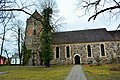
This is the category of the Brandenburger Baudenkmal (cultural heritage monument) with the ID 09165207 (Wikidata)
|
Deutsch: Ansichten der Kirche in Löwenberg, Gemeinde Löwenberger Land, Landkreis Oberhavel, Land Brandenburg, Deutschland.
English: Pictures of the church in Löwenberg, Löwenberger Land municipality, Oberhavel district, Brandenburg state, Germany
Français : Photos de l'église à Löwenberg, commune de Löwenberger Land, arrondissement de Oberhavel, état fédéral de Brandebourg, Allemagne
Media in category "Dorfkirche Löwenberg"
The following 18 files are in this category, out of 18 total.
-
 DKdmdKR 12036.jpg 2,000 × 2,457; 421 KB
-
 Dorfkirche Löwenberg (Mark) 2018 NNE.jpg 4,864 × 3,648; 9.36 MB
-
 Dorfkirche Löwenberg (Mark) 2018 NNW.jpg 3,648 × 4,864; 9.79 MB
-
 Dorfkirche Löwenberg (Mark) 2018 NW.jpg 4,507 × 4,036; 11.51 MB
-
 Dorfkirche Löwenberg (Mark) 2018 S.jpg 6,339 × 4,132; 13.08 MB
-
 Dorfkirche Löwenberg (Mark) 2018 SE.jpg 5,383 × 4,755; 13.2 MB
-
 Dorfkirche Löwenberg (Mark) 2018 SW.jpg 4,864 × 3,648; 9.39 MB
-
 Dorfkirche Löwenberg (Mark) 2018 Südportal.jpg 4,808 × 3,574; 6.88 MB
-
 Dorfkirche Löwenberg (Mark) 2018 W.jpg 3,648 × 4,864; 8.38 MB
-
 Dorfkirche Löwenberg (Mark) 2018 Westportal.jpg 4,864 × 3,648; 7.46 MB
-
 Loewenberg church.jpg 3,000 × 2,160; 1.09 MB
-
 Löwenberg Dorfkirche (1).JPG 6,000 × 4,000; 6.7 MB
-
 Löwenberg Dorfkirche (2).JPG 6,000 × 4,000; 6.39 MB
-
 Löwenberg Dorfkirche (3).JPG 4,890 × 3,585; 5.96 MB
-
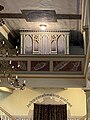
 Löwenberg Dorfkirche Orgel (01).jpg 3,989 × 2,760; 2.51 MB
-
 Löwenberg Dorfkirche Orgel (02).jpg 3,266 × 2,890; 2.11 MB
-
 Löwenberg Dorfkirche Orgel (03).jpg 2,961 × 3,934; 1.88 MB
-
 Löwenberg Dorfkirche Orgel (04).jpg 2,980 × 3,988; 3.09 MB

_2018_NNE.jpg)
_2018_NNW.jpg)
_2018_NW.jpg)
_2018_S.jpg)
_2018_SE.jpg)
_2018_SW.jpg)
_2018_S%C3%BCdportal.jpg)
_2018_W.jpg)
_2018_Westportal.jpg)
.JPG)
.JPG)
.JPG)
.jpg)
.jpg)
.jpg)
.jpg)