Category:Dorfkirche Kröbeln
Jump to navigation
Jump to search
| Object location | | View all coordinates using: OpenStreetMap |
|---|
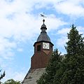
church building in Brandenburg state, Germany  | |||||
| Upload media | |||||
| Instance of | |||||
|---|---|---|---|---|---|
| Location | Kröbeln, Bad Liebenwerda, Elbe-Elster District, Brandenburg, Germany | ||||
| Street address |
| ||||
| Architectural style | |||||
| Heritage designation | |||||
| Inception |
| ||||
| Religion or worldview | |||||
 | |||||
This is the category of the Brandenburger Baudenkmal (cultural heritage monument) with the ID 09135424 (Wikidata)
|
Media in category "Dorfkirche Kröbeln"
The following 6 files are in this category, out of 6 total.
-
 Dorfkirche Kröbeln IMG 9829 c.jpg 2,315 × 1,676; 1.01 MB
-
 Dorfkirche Kröbeln IMG 9834.jpg 3,841 × 3,456; 2.29 MB
-
 Kirche Kröbeln 1 b.jpg 3,359 × 4,246; 2.09 MB
-
 Kirche Kröbeln 1.jpg 3,456 × 5,184; 2.37 MB
-
 Kirche Kröbeln IMG 9814.jpg 2,358 × 2,350; 455 KB
-
 Kroebeln Kirche.jpg 3,407 × 5,451; 9.73 MB


