Category:Dorfkirche Kerzendorf
Jump to navigation
Jump to search
| Object location | | View all coordinates using: OpenStreetMap |
|---|
This is the category of the Brandenburger Baudenkmal (cultural heritage monument) with the ID 09105585 (Wikidata)
|
church building in Teltow-Fläming district, Brandenburg state, Germany  | |||||
| Upload media | |||||
| Instance of | |||||
|---|---|---|---|---|---|
| Location | Kerzendorf, Ludwigsfelde, Teltow-Fläming District, Brandenburg, Germany | ||||
| Street address |
| ||||
| Architectural style | |||||
| Heritage designation | |||||
| Inception |
| ||||
| Beam |
| ||||
| Width |
| ||||
| Length |
| ||||
| Area |
| ||||
| Religion or worldview | |||||
 | |||||
Media in category "Dorfkirche Kerzendorf"
The following 11 files are in this category, out of 11 total.
-
 Dorfkirche Kerzendorf Kirchenschiff Nordansicht.jpg 4,608 × 3,456; 5.24 MB
-
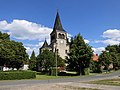
 Dorfkirche Kerzendorf Nordansicht.jpg 4,608 × 3,456; 5.16 MB
-
 Dorfkirche Kerzendorf Nordostansicht.jpg 4,608 × 3,456; 5.35 MB
-
 Dorfkirche Kerzendorf Ostansicht.jpg 4,608 × 3,456; 4.51 MB
-
 Dorfkirche Kerzendorf Südansicht.jpg 4,608 × 3,456; 6.58 MB
-
 Dorfkirche Kerzendorf Westansicht.jpg 3,456 × 4,608; 3.63 MB
-
 Dorfkirche Kerzendorf Westportal.jpg 4,608 × 3,456; 5.44 MB
-
 Dorfkirche Kerzendorf Westturm Nordansicht.jpg 3,456 × 4,608; 3.2 MB
-
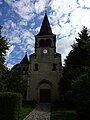
 Kerzendorf - Dorfkirche (Village Church) - geo.hlipp.de - 37952.jpg 480 × 640; 92 KB
-
 Kirche Kerzendorf - panoramio.jpg 4,608 × 3,456; 5.73 MB
-
 KircheKerzendorf.jpg 957 × 940; 415 KB


_-_geo.hlipp.de_-_37952.jpg)
