Category:Dorfkirche Kötzlin
Jump to navigation
Jump to search
| Object location | | View all coordinates using: OpenStreetMap |
|---|
 | |||||
| Upload media | |||||
| Instance of | |||||
|---|---|---|---|---|---|
| Location | Q116995126, Kyritz, Ostprignitz-Ruppin District, Brandenburg, Germany | ||||
| Heritage designation | |||||
 | |||||
This is the category of the Brandenburger Baudenkmal (cultural heritage monument) with the ID 09170561 (Wikidata)
|
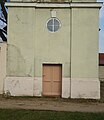
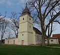
English: Church in Kötzlin, Kyritz municipality, Ostprignitz-Ruppin district, Brandenburg state, Germany
Deutsch: Dorfkirche in Kötzlin, Stadt Kyritz, Landkreis Ostprignitz-Ruppin, Land Brandenburg, Deutschland.
Français : Église de Kötzlin, commune de Kyritz, arrondissement Prignitz-de-l'Est-Ruppin, état fédéral de Brandebourg, Allemagne
Media in category "Dorfkirche Kötzlin"
The following 8 files are in this category, out of 8 total.
-
 Kötzlin church 2016 N.JPG 4,864 × 3,648; 7.02 MB
-
 Kötzlin church 2016 NE.jpg 5,048 × 4,747; 5.88 MB
-
 Kötzlin church 2016 NW.jpg 5,371 × 4,664; 11.57 MB
-
 Kötzlin church 2016 portal.JPG 3,459 × 3,987; 4.04 MB
-
 Kötzlin church 2016 S.JPG 4,864 × 3,648; 7.34 MB
-
 Kötzlin church 2016 SE.JPG 4,864 × 3,648; 6.46 MB
-
 Kötzlin church 2016 SW.JPG 4,864 × 3,648; 8.14 MB
-
 Kötzlin church 2016 WSW.jpg 5,066 × 4,637; 10.52 MB


