Category:Dorfkirche Hoppegarten
Jump to navigation
Jump to search
| Object location | | View all coordinates using: OpenStreetMap |
|---|
 | |||||
| Upload media | |||||
| Instance of | |||||
|---|---|---|---|---|---|
| Location | Hoppegarten, Märkisch-Oderland District, Brandenburg, Germany | ||||
| Heritage designation | |||||
 | |||||
This is the category of the Brandenburger Baudenkmal (cultural heritage monument) with the ID 09180479 (Wikidata)
|
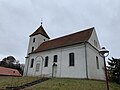
English: Pictures of the church in Hoppegarten, Müncheberg municipality, Märkisch-Oderland district, Brandenburg state, Germany
Deutsch: Bilder der Kirche in Hoppegarten, Gemeinde Müncheberg, Landkreis Märkisch-Oderland, Land Brandenburg, Deutschland.
Français : Photos de l'église à Hoppegarten, commune de Müncheberg, arrondissement de Märkisch-Oderland, état fédéral de Brandebourg, Allemagne
Media in category "Dorfkirche Hoppegarten"
The following 11 files are in this category, out of 11 total.
-
 Dorfkirche Hoppegarten Epitaph Südseite.jpg 3,024 × 4,032; 3.02 MB
-
 Dorfkirche Hoppegarten Kirchenschiff Südansicht.jpg 4,032 × 3,024; 2.58 MB
-
 Dorfkirche Hoppegarten Kirchturm Nordwestansicht.jpg 3,024 × 4,032; 1.48 MB
-
 Dorfkirche Hoppegarten Kirchturm Südansicht Erdgeschoss.jpg 3,024 × 4,032; 2.53 MB
-
 Dorfkirche Hoppegarten Kirchturm Südansicht Glockengeschoss.jpg 3,024 × 4,032; 1.45 MB
-
 Dorfkirche Hoppegarten Kirchturm Westansicht Glockengeschoss.jpg 3,024 × 4,032; 1.15 MB
-
 Dorfkirche Hoppegarten Kirchturm Westportal.jpg 3,024 × 4,032; 2.65 MB
-
 Dorfkirche Hoppegarten Nordwestansicht.jpg 4,032 × 3,024; 2.49 MB
-
 Dorfkirche Hoppegarten Südostansicht.jpg 4,032 × 3,024; 1.94 MB
-
 Hoppegarten (Müncheberg) Dorfkirche.JPG 3,039 × 2,430; 696 KB
-
 Kirche Hoppegarten Müncheberg.jpg 3,872 × 2,592; 3.4 MB


_Dorfkirche.JPG)
