Category:Dorfkirche Hönow
Jump to navigation
Jump to search
| Object location | | View all coordinates using: OpenStreetMap |
|---|
church building in Hoppegarten, Landkreis Märkisch-Oderland, Brandenburg, Germany    | |||||
| Upload media | |||||
| Instance of | |||||
|---|---|---|---|---|---|
| Location | Hönow, Hoppegarten, Märkisch-Oderland District, Brandenburg, Germany | ||||
| Heritage designation | |||||
 | |||||
This is the category of the Brandenburger Baudenkmal (cultural heritage monument) with the ID 09180476 (Wikidata)
|
English: Pictures of the church in Hönow , Hoppegarten municipality, Märkisch-Oderland district, Brandenburg state, Germany
Deutsch: Bilder der Kirche in Hönow , Gemeinde Hoppegarten, Landkreis Märkisch-Oderland, Land Brandenburg, Deutschland.
Français : Photos de l'église à Hönow , commune de Hoppegarten, arrondissement de Märkisch-Oderland, état fédéral de Brandebourg, Allemagne
Subcategories
This category has only the following subcategory.
*
- Interior of Dorfkirche Hönow (8 F)
Media in category "Dorfkirche Hönow"
The following 12 files are in this category, out of 12 total.
-
 Bundesarchiv Bild 183-2005-0717-508, Berlin-Hönow, Kirche.jpg 800 × 569; 52 KB
-
 Bundesarchiv Bild 183-2005-0717-509, Berlin-Hönow, Kirche.jpg 567 × 800; 72 KB
-
 Den Opfern von Krieg und Willkür Hönow.jpg 4,032 × 3,024; 10.14 MB
-
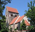
 Dorfkirche Hönow.jpg 4,032 × 3,024; 8.4 MB
-
 Dorfkirche in Hönow.jpg 4,032 × 3,024; 8.11 MB
-
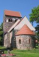
 Hoenow church1.JPG 617 × 565; 113 KB
-
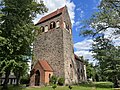
 Hoenow church2.JPG 418 × 607; 75 KB
-
 Hoppegarten Dorfkirche Hönow asv2022-09 img1.jpg 5,185 × 4,321; 11.93 MB
-
 Hoppegarten Dorfkirche Hönow asv2022-09 img2.jpg 3,770 × 4,713; 11.98 MB
-
 Hönow Dorfkirche.jpg 4,032 × 3,024; 7.47 MB
-
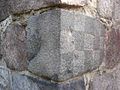
 HönowKirkeSkakbrætsten.JPG 960 × 1,280; 149 KB
-
 HönowKirkeSkakbrætstenNær.JPG 1,280 × 960; 154 KB


