Category:Dorfkirche Großhartmannsdorf
Jump to navigation
Jump to search
| Object location | | View all coordinates using: OpenStreetMap |
|---|
| Upload media | |||||
| Instance of | |||||
|---|---|---|---|---|---|
| Location |
| ||||
 | |||||
| (Wikidata) |
Media in category "Dorfkirche Großhartmannsdorf"
The following 13 files are in this category, out of 13 total.
-
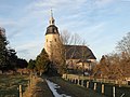
 20171213300DR Großhartmannsdorf Kirche und Kunstgraben.jpg 3,573 × 2,355; 4.49 MB
-
 20171213305DR Großhartmannsdorf Kirche und Kunstgraben.jpg 3,510 × 2,640; 4.93 MB
-
 20171213310DR Großhartmannsdorf Kirche und Kunstgraben.jpg 3,410 × 2,579; 5.77 MB
-
 20171213315DR Großhartmannsdorf Kirche und Kunstgraben.jpg 2,438 × 3,282; 6.51 MB
-
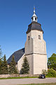
 20171213320DR Großhartmannsdorf Kirche.jpg 2,369 × 3,308; 4.09 MB
-
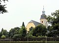
 Grosshartmannsdorf Church.jpg 2,543 × 3,814; 4.03 MB
-
 Grosshartmannsdorf Kirche.jpg 2,304 × 3,456; 3.07 MB
-
 Großhartmannsdorf, die Dorfkirche.jpg 3,940 × 2,844; 2.48 MB
-
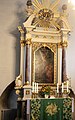 Großhartmannsdorf, Dorfkirche, der Altar.JPG 2,607 × 4,167; 2.67 MB
-
 Großhartmannsdorf, Dorfkirche, die Kanzel.JPG 2,067 × 3,843; 2.09 MB
-
 Großhartmannsdorf, Dorfkirche, die Orgel.JPG 3,597 × 2,534; 2.83 MB
-
 Großhartmannsdorf, Dorfkirche, Loge.JPG 3,350 × 2,873; 3.05 MB
-
 Großhartmannsdorf, Dorfkirche.JPG 2,556 × 3,843; 2.55 MB


