Category:Dorfkirche Groß Schulzendorf
Jump to navigation
Jump to search
| Object location | | View all coordinates using: OpenStreetMap |
|---|
church building in Ludwigsfelde, Teltow-Fläming district, Brandenburg state, Germany  | |||||
| Upload media | |||||
| Instance of | |||||
|---|---|---|---|---|---|
| Location | Groß Schulzendorf, Ludwigsfelde, Teltow-Fläming District, Brandenburg, Germany | ||||
| Street address |
| ||||
| Heritage designation | |||||
| Inception |
| ||||
| Width |
| ||||
| Length |
| ||||
| Area |
| ||||
| Religion or worldview | |||||
 | |||||
This is the category of the Brandenburger Baudenkmal (cultural heritage monument) with the ID 09105685 (Wikidata)
|
Pages in category "Dorfkirche Groß Schulzendorf"
This category contains only the following page.
Media in category "Dorfkirche Groß Schulzendorf"
The following 17 files are in this category, out of 17 total.
-
 Dorfkirche Groß Schulzendorf 2024 E Panorama.jpg 4,032 × 3,024; 6.13 MB
-
 Dorfkirche Groß Schulzendorf 2024 Fenster.jpg 1,916 × 3,457; 1.37 MB
-
 Dorfkirche Groß Schulzendorf 2024 NE.jpg 2,842 × 2,842; 2.34 MB
-
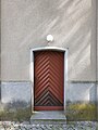 Dorfkirche Groß Schulzendorf 2024 Westportal.jpg 2,934 × 3,913; 3.57 MB
-
 Dorfkirche Groß Schulzendorf - Deutschland - panoramio.jpg 2,592 × 1,944; 2.61 MB
-
 Dorfkirche Groß Schulzendorf Nordansicht.jpg 4,608 × 3,456; 4.94 MB
-
 Dorfkirche Groß Schulzendorf Nordostansicht.jpg 4,608 × 3,456; 4.94 MB
-
 Dorfkirche Groß Schulzendorf Ostansicht.jpg 4,608 × 3,456; 5.04 MB
-
 Dorfkirche Groß Schulzendorf Ostseite.JPG 4,000 × 2,664; 6.52 MB
-
 Dorfkirche Groß Schulzendorf Südansicht.jpg 4,608 × 3,456; 5.77 MB
-
 Dorfkirche Groß Schulzendorf Südostansicht.jpg 4,608 × 3,456; 6.47 MB
-
 Dorfkirche Groß Schulzendorf Westturm Nordwestansicht.jpg 3,456 × 4,608; 3.8 MB
-
 Dorfkirche Groß Schulzendorf Westturm Pforte.jpg 4,608 × 3,456; 5.61 MB
-
 Dorfkirche Groß Schulzendorf Westturm Südansicht.jpg 3,456 × 4,608; 5.05 MB
-
 Dorfkirche Groß Schulzendorf Westturm Südwestansicht.jpg 3,456 × 4,608; 4.59 MB
-
 Gross Schulzendorf1 Brandenburg.JPG 720 × 540; 109 KB
-
 Kirche Groß Schulzendorf - panoramio.jpg 4,320 × 3,240; 5.15 MB


