Category:Dorfkirche Grabow (Mühlenfließ)
Jump to navigation
Jump to search
| Object location | | View all coordinates using: OpenStreetMap |
|---|
church building in Potsdam-Mittelmark district, Brandenburg state, Germany _2018_SE.jpg) ,_Dorfkirche_(11).jpg) | |||||
| Upload media | |||||
| Instance of | |||||
|---|---|---|---|---|---|
| Location | Grabow (Mühlenfließ), Mühlenfließ, Potsdam-Mittelmark District, Brandenburg, Germany | ||||
| Heritage designation | |||||
 | |||||
This is the category of the Brandenburger Baudenkmal (cultural heritage monument) with the ID 09190218 (Wikidata)
|
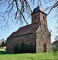
English: Pictures of the church in Grabow , Mühlenfließ municipality, Potsdam-Mittelmark district, Brandenburg state, Germany
Deutsch: Bilder der Kirche in Grabow , Gemeinde Mühlenfließ, Landkreis Potsdam-Mittelmark, Land Brandenburg, Deutschland.
Français : Photos de l'église à Grabow , commune de Mühlenfließ, arrondissement de Potsdam-Mittelmark, état fédéral de Brandebourg, Allemagne
Subcategories
This category has only the following subcategory.
Media in category "Dorfkirche Grabow (Mühlenfließ)"
The following 12 files are in this category, out of 12 total.
-
 Dorfkirche Grabow (Mühlenfließ) 2018 E.jpg 3,648 × 4,864; 5.35 MB
-
 Dorfkirche Grabow (Mühlenfließ) 2018 NE.jpg 4,864 × 3,648; 7.4 MB
-
 Dorfkirche Grabow (Mühlenfließ) 2018 NW.jpg 4,127 × 4,242; 8.72 MB
-
 Dorfkirche Grabow (Mühlenfließ) 2018 S.jpg 4,864 × 3,648; 5.85 MB
-
 Dorfkirche Grabow (Mühlenfließ) 2018 SE.jpg 4,864 × 3,648; 6.49 MB
-
 Dorfkirche Grabow (Mühlenfließ) 2018 SW.jpg 4,864 × 3,648; 5.57 MB
-
 Dorfkirche Grabow (Mühlenfließ) 2018 Turm.jpg 3,648 × 4,864; 4.73 MB
-
 Dorfkirche Grabow (Mühlenfließ) 2018 vermauerte Südportale.jpg 4,864 × 3,648; 8.27 MB
-
 Dorfkirche Grabow (Mühlenfließ) 2018 Westportal.jpg 3,648 × 4,864; 8.35 MB
-
 Dorfteich III und Dorfkirche Grabow (Mühlenfließ) 2018 N.jpg 4,864 × 3,648; 10.15 MB
-
 Grabow (Mühlenfließ), Dorfkirche (01).jpg 4,377 × 4,731; 5.02 MB
-
 Grabow (Mühlenfließ), Dorfkirche (13).jpg 5,574 × 3,881; 6.03 MB
_2018_E.jpg)
_2018_NE.jpg)
_2018_NW.jpg)
_2018_S.jpg)
_2018_SW.jpg)
_2018_Turm.jpg)
_2018_vermauerte_S%C3%BCdportale.jpg)
_2018_Westportal.jpg)
_2018_N.jpg)
,_Dorfkirche_(01).jpg)
,_Dorfkirche_(13).jpg)