Category:Dorfkirche Friedrichsthal (Oranienburg)
Jump to navigation
Jump to search
| Object location | | View all coordinates using: OpenStreetMap |
|---|
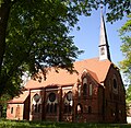
church building in Oberhavel district, Brandenburg state, Germany  | |||||
| Upload media | |||||
| Instance of | |||||
|---|---|---|---|---|---|
| Location | Friedrichsthal, Oranienburg, Oranienburg, Oberhavel District, Brandenburg, Germany | ||||
| Street address |
| ||||
| Architectural style | |||||
| Heritage designation | |||||
| Inception |
| ||||
| Width |
| ||||
| Length |
| ||||
| Area |
| ||||
 | |||||
This is the category of the Brandenburger Baudenkmal (cultural heritage monument) with the ID 09165410 (Wikidata)
|
Pages in category "Dorfkirche Friedrichsthal (Oranienburg)"
This category contains only the following page.
Media in category "Dorfkirche Friedrichsthal (Oranienburg)"
The following 10 files are in this category, out of 10 total.
-
 Dorfkirche Friedrichsthal 2018 E.jpg 3,648 × 4,864; 3.52 MB
-
 Dorfkirche Friedrichsthal 2018 Fenster.jpg 2,981 × 2,236; 1.57 MB
-
 Dorfkirche Friedrichsthal 2018 Hauptportal.jpg 3,243 × 4,864; 3.02 MB
-
 Dorfkirche Friedrichsthal 2018 NW.jpg 3,648 × 4,864; 4.23 MB
-
 Dorfkirche Friedrichsthal 2018 S.jpg 3,648 × 4,864; 5.45 MB
-
 Dorfkirche Friedrichsthal 2018 W.jpg 3,648 × 4,864; 4.94 MB
-
 Friedrichsthal church.jpg 1,530 × 1,488; 471 KB
-

-

-
 Oranienburg - Friedrichsthal - Evangelische Kirche - 2013.jpg 2,048 × 1,365; 3.95 MB


Categories:
- Churches in Oranienburg
- Cultural heritage monuments in Oranienburg
- Churches in Kirchenkreis Oberes Havelland
- Lutheran churches in Brandenburg
- Ludwig von Tiedemann
- Gothic Revival brick churches in Brandenburg
- Churches in Brandenburg built in 1897
- 1890s brick churches in Brandenburg
- Friedrichsthal (Oranienburg)