Category:Dorfkirche Eichstädt (Oberkrämer)
Jump to navigation
Jump to search
| Object location | | View all coordinates using: OpenStreetMap |
|---|
church building in Oberhavel district, Brandenburg state, Germany  | |||||
| Upload media | |||||
| Instance of | |||||
|---|---|---|---|---|---|
| Location | Eichstädt, Oberkrämer, Oberhavel District, Brandenburg, Germany | ||||
| Heritage designation | |||||
 | |||||
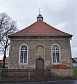
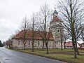
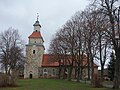
Deutsch: Die Dorfkirche Eichstädt (auch Kultur- und Kinderkirche), Gemeinde Oberkrämer, Landkreis Oberhavel, Land Brandenburg, Deutschland
English: Church in Eichstädt, Oberkrämer municipality, Oberhavel district, Brandenburg state, Germany
Français : Église de Eichstädt, commune de Oberkrämer, arrondissement de Haute-Havel, état fédéral de Brandebourg, Allemagne
This is the category of the Brandenburger Baudenkmal (cultural heritage monument) with the ID 09165025 (Wikidata)
|
Pages in category "Dorfkirche Eichstädt (Oberkrämer)"
This category contains only the following page.
Media in category "Dorfkirche Eichstädt (Oberkrämer)"
The following 14 files are in this category, out of 14 total.
-
 Dorfkirche Eichstädt 2018 E.jpg 4,056 × 4,398; 6.42 MB
-
 Dorfkirche Eichstädt 2018 NNE.jpg 4,864 × 3,648; 7.76 MB
-
 Dorfkirche Eichstädt 2018 NNW.jpg 4,826 × 3,598; 6.55 MB
-
 Dorfkirche Eichstädt 2018 S.jpg 4,864 × 3,648; 6.34 MB
-
 Dorfkirche Eichstädt 2018 SE.jpg 4,595 × 3,834; 7.52 MB
-
 Dorfkirche Eichstädt 2018 SSE.jpg 4,864 × 3,648; 7.5 MB
-
 Dorfkirche Eichstädt 2018 SW.jpg 4,456 × 4,730; 7.97 MB
-
 Dorfkirche Eichstädt 2018 Südportal.jpg 3,636 × 4,854; 6.43 MB
-
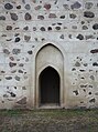 Dorfkirche Eichstädt 2018 Südwestportal.jpg 3,598 × 4,826; 6.66 MB
-
 Dorfkirche Eichstädt 2018 Turmhaube.jpg 3,246 × 4,582; 3.34 MB
-
 Eichstädt church 2016 NW.JPG 4,864 × 3,648; 6.94 MB
-
 Eichstädt Dorfkirche.jpg 4,961 × 3,721; 8.21 MB
-
 Eichstädt-Oberkrämer-Dorfkirche-Nordseite.JPG 3,072 × 2,304; 1.88 MB
-
 Eichstädt-Oberkrämer-Dorfkirche-Ostseite.JPG 3,072 × 2,304; 1.87 MB


