Category:Dorfkirche Beerfelde
Jump to navigation
Jump to search
| Object location | | View all coordinates using: OpenStreetMap |
|---|
church building in Oder-spree district, Brandenburg state, Germany  | |||||
| Upload media | |||||
| Instance of | |||||
|---|---|---|---|---|---|
| Location | Beerfelde, Steinhöfel, Oder-Spree District, Brandenburg, Germany | ||||
| Heritage designation | |||||
 | |||||
This is the category of the Brandenburger Baudenkmal (cultural heritage monument) with the ID 09115104 (Wikidata)
|
Media in category "Dorfkirche Beerfelde"
The following 24 files are in this category, out of 24 total.
-
 Beerfelde, Dorfkirche.jpg 2,997 × 1,832; 1.14 MB
-
 BeerfeldeKirkeSkakbrætsten1.JPG 1,280 × 960; 74 KB
-
 BeerfeldeKirkeSkakbrætsten1Nær.JPG 1,280 × 960; 79 KB
-
 BeerfeldeKirkeSkakbrætsten2.JPG 3,264 × 2,448; 4.02 MB
-
 BeerfeldeKirkeSkakbrætsten2Nær.JPG 810 × 594; 58 KB
-
 BeerfeldeKirkeSkakbrætsten2NærS.jpg 3,264 × 2,448; 547 KB
-
 BeerfeldeKirkeSkakbrætsten3Nær.jpg 3,264 × 2,448; 602 KB
-
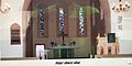 Dorfkirche Beerfelde Altar (FoP-Germany).jpg 3,628 × 1,802; 1.5 MB
-
 Dorfkirche Beerfelde Altarretabel vor Restaurierung (FoP-Germany).jpg 2,891 × 2,411; 1.74 MB
-
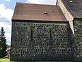 Dorfkirche Beerfelde Chor Nordansicht.jpg 4,032 × 3,024; 3.54 MB
-
 Dorfkirche Beerfelde Chor Südansicht.jpg 4,032 × 3,024; 5.22 MB
-
 Dorfkirche Beerfelde Kanzel 2008 (FoP-Germany).jpg 2,218 × 3,256; 1.35 MB
-
 Dorfkirche Beerfelde Kanzel vor 1960 (FoP-Germany).jpg 2,120 × 3,385; 1.38 MB
-
 Dorfkirche Beerfelde Kirchenschiff Mittelportal.jpg 4,032 × 3,024; 5.61 MB
-
 Dorfkirche Beerfelde Kirchenschiff Südansicht Anbau.jpg 3,024 × 4,032; 4.62 MB
-
 Dorfkirche Beerfelde Kirchenschiff Südansicht.jpg 4,032 × 3,024; 5.3 MB
-
 Dorfkirche Beerfelde Nordostansicht.jpg 4,032 × 3,024; 3.13 MB
-
 Dorfkirche Beerfelde Nordwestansicht.jpg 3,024 × 4,032; 1.98 MB
-
 Dorfkirche Beerfelde Ostansicht.jpg 3,024 × 4,032; 4.03 MB
-
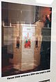
 Dorfkirche Beerfelde Schachbrettstein (FoP-Germany).jpg 2,693 × 2,183; 2.15 MB
-
 Dorfkirche Beerfelde Südostansicht.jpg 4,032 × 3,024; 4.46 MB
-
 Dorfkirche Beerfelde Westansicht.jpg 3,024 × 4,032; 2.84 MB
-
 Dorfkirche Beerfelde Westportal.jpg 4,032 × 3,024; 3.39 MB
-
 Dorfkirche Beerfelde Westturm Südansicht.jpg 3,024 × 4,032; 4.28 MB


.jpg)
.jpg)


.jpg)
.jpg)


.jpg)


