Category:Dorfkirche Böhne
Jump to navigation
Jump to search
| Object location | | View all coordinates using: OpenStreetMap |
|---|
 | |||||
| Upload media | |||||
| Instance of | |||||
|---|---|---|---|---|---|
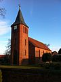
| Location | Böhne (Rathenow), Rathenow, Havelland District, Brandenburg, Germany | ||||
| Heritage designation | |||||
 | |||||
This is the category of the Brandenburger Baudenkmal (cultural heritage monument) with the ID 09150605 (Wikidata)
|
Français : Église de Böhne, ville de Rathenow, arrondissement Pays de la Havel, état fédéral de Brandebourg, Allemagne
Media in category "Dorfkirche Böhne"
This category contains only the following file.
-
 Kirche Boehne 2011 01.jpg 1,936 × 2,592; 1.71 MB