Category:Dorfkirche (Nackel)
Jump to navigation
Jump to search
| Object location | | View all coordinates using: OpenStreetMap |
|---|
church building in Ostprignitz-Ruppin district, Brandenburg state, Germany  | |||||
| Upload media | |||||
| Instance of | |||||
|---|---|---|---|---|---|
| Location | Nackel, Wusterhausen/Dosse, Ostprignitz-Ruppin District, Brandenburg, Germany | ||||
| Heritage designation | |||||
 | |||||
This is the category of the Brandenburger Baudenkmal (cultural heritage monument) with the ID 09170637 (Wikidata)
|
Deutsch: Die Dorfkirche in Nackel (zu Wusterhausen an der Dosse), Mark Brandenburg, gehört und dient einer Gemeinde der unierten Evangelischen Kirche Berlin-Brandenburg-Schlesische Oberlausitz. Die Kirche ist ein spätgotischer Bau.
English: The Village Church in Nackel (a locality of Wusterhausen upon Dosse), March of Brandenburg, Germany, is owned and used by a congregation within the Evangelical Church of Berlin-Brandenburg-Silesian Upper Lusatia, a united Protestant church body of Calvinist, Lutheran and united congregations. The church is a late Gothic structure.
Français : Église de Nackel, commune de Wusterhausen/Dosse, arrondissement Prignitz-de-l'Est-Ruppin, état fédéral de Brandebourg, Allemagne
Media in category "Dorfkirche (Nackel)"
The following 3 files are in this category, out of 3 total.
-
 DenkmalNackel.JPG 906 × 1,208; 530 KB
-
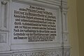 Gedenktafel Dorfkirche Nackel.jpg 2,592 × 1,728; 502 KB
-
 Nackel church.jpg 1,350 × 1,482; 373 KB

