Category:Donaghanie
Jump to navigation
Jump to search
Media in category "Donaghanie"
The following 72 files are in this category, out of 72 total.
-
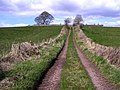
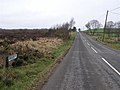 B158, Donaghanie Road - geograph.org.uk - 1209199.jpg 640 × 479; 53 KB
-
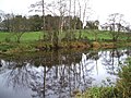
 Camowen River, Donaghanie - geograph.org.uk - 621553.jpg 640 × 281; 42 KB
-
 Camowen River, Donaghanie - geograph.org.uk - 621597.jpg 640 × 272; 46 KB
-
 Corboe Road - geograph.org.uk - 688924.jpg 640 × 479; 112 KB
-
 Country road, Donaghanie - geograph.org.uk - 621586.jpg 640 × 333; 51 KB
-
 Countryside at Donaghanie - geograph.org.uk - 76576.jpg 640 × 479; 102 KB
-
 Cows at Donaghanie - geograph.org.uk - 1518264.jpg 640 × 479; 78 KB
-
 Cows, Donaghanie - geograph.org.uk - 1541626.jpg 640 × 479; 57 KB
-
 Cranmore Road, Donaghanie - geograph.org.uk - 3561871.jpg 640 × 480; 77 KB
-
 Crannogue Road, Donaghanie - geograph.org.uk - 294138.jpg 640 × 479; 80 KB
-
 Crevenagh Road, Donaghanie - geograph.org.uk - 1541655.jpg 640 × 479; 86 KB
-
 Crevenagh Road, Donaghanie - geograph.org.uk - 3561874.jpg 640 × 480; 65 KB
-
 Crossroads at Donaghanie - geograph.org.uk - 641953.jpg 640 × 282; 32 KB
-
 Donaghanie - fishing venue - geograph.org.uk - 621546.jpg 640 × 318; 41 KB
-
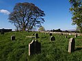
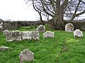 Donaghanie graveyard - geograph.org.uk - 76550.jpg 640 × 479; 177 KB
-
 Donaghanie Orange Hall.jpg 640 × 479; 43 KB
-
 Donaghanie Post Office - geograph.org.uk - 76570.jpg 640 × 479; 101 KB
-
 Donaghanie Townland - geograph.org.uk - 1209145.jpg 640 × 479; 108 KB
-
 Donaghanie Townland - geograph.org.uk - 1209151.jpg 640 × 479; 49 KB
-
 Donaghanie Townland - geograph.org.uk - 1209176.jpg 640 × 479; 89 KB
-
 Donaghanie Townland - geograph.org.uk - 1209191.jpg 640 × 479; 68 KB
-
 Donaghanie Townland - geograph.org.uk - 1209201.jpg 640 × 479; 84 KB
-
 Donaghanie Townland - geograph.org.uk - 1209240.jpg 640 × 479; 42 KB
-
 Donaghanie Townland - geograph.org.uk - 1444628.jpg 640 × 479; 70 KB
-
 Donaghanie Townland - geograph.org.uk - 1444650.jpg 640 × 479; 48 KB
-
 Donaghanie Townland - geograph.org.uk - 1444965.jpg 640 × 479; 69 KB
-
 Donaghanie Townland - geograph.org.uk - 1511045.jpg 640 × 479; 67 KB
-
 Donaghanie Townland - geograph.org.uk - 1511050.jpg 640 × 479; 47 KB
-
 Donaghanie Townland - geograph.org.uk - 1518208.jpg 640 × 479; 59 KB
-
 Donaghanie Townland - geograph.org.uk - 1518210.jpg 640 × 479; 54 KB
-
 Donaghanie Townland - geograph.org.uk - 1518226.jpg 640 × 479; 57 KB
-
 Donaghanie Townland - geograph.org.uk - 1518244.jpg 640 × 479; 73 KB
-
 Donaghanie Townland - geograph.org.uk - 1518258.jpg 640 × 479; 79 KB
-
 Donaghanie Townland - geograph.org.uk - 1541658.jpg 640 × 479; 83 KB
-
 Donaghanie Townland - geograph.org.uk - 1633474.jpg 640 × 479; 61 KB
-
 Donaghanie Townland - geograph.org.uk - 1633479.jpg 640 × 479; 64 KB
-
 Donaghanie Townland - geograph.org.uk - 1633481.jpg 640 × 479; 52 KB
-
 Donaghanie Townland - geograph.org.uk - 621548.jpg 640 × 480; 96 KB
-
 Donaghanie Townland - geograph.org.uk - 621549.jpg 640 × 323; 37 KB
-
 Dryarch Road, Donaghanie - geograph.org.uk - 1444960.jpg 640 × 479; 65 KB
-
 Eskermore Road, Donaghanie - geograph.org.uk - 1388059.jpg 640 × 479; 73 KB
-
 Exit, Donaghanie Graveyard - geograph.org.uk - 1541652.jpg 640 × 479; 83 KB
-
 Farm Buildings at Donaghanie - geograph.org.uk - 621588.jpg 640 × 339; 56 KB
-
 Grove house, Donaghanie - geograph.org.uk - 76549.jpg 640 × 479; 134 KB
-
 Hump back bridge, Donaghanie - geograph.org.uk - 1518234.jpg 640 × 479; 86 KB
-
 Hump back bridge, Donaghanie - geograph.org.uk - 1518237.jpg 640 × 479; 63 KB
-
 Lane, Donaghanie - geograph.org.uk - 1209236.jpg 640 × 479; 48 KB
-
 Lane, Donaghanie - geograph.org.uk - 1541663.jpg 640 × 479; 75 KB
-
 Laneway to Donaghanie graveyard - geograph.org.uk - 76552.jpg 640 × 479; 164 KB
-
 Laneway, Donaghanie Old Graveyard - geograph.org.uk - 764040.jpg 640 × 479; 81 KB
-
 Laneway, Donaghanie Old Graveyard - geograph.org.uk - 764041.jpg 640 × 479; 87 KB
-

-
 Lisboy Road, Donaghanie - geograph.org.uk - 1209195.jpg 640 × 479; 70 KB
-
 Lisboy Road, Donaghanie - geograph.org.uk - 1518239.jpg 640 × 479; 73 KB
-
 Lisboy Road, Donaghanie - geograph.org.uk - 1633473.jpg 640 × 479; 77 KB
-
 Old Railway Bridge, Donaghanie - geograph.org.uk - 621599.jpg 640 × 480; 65 KB
-
 Old Railway Bridge, Donaghanie - geograph.org.uk - 621601.jpg 640 × 480; 68 KB
-
 Plaque, Donaghanie Orange Hall - geograph.org.uk - 1013904.jpg 640 × 382; 44 KB
-
 Railway bridge at Donaghanie - geograph.org.uk - 76573.jpg 640 × 479; 144 KB
-
-
 River Camowen, Donaghanie - geograph.org.uk - 621602.jpg 640 × 480; 51 KB
-
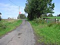
 Road at Donaghanie - geograph.org.uk - 621585.jpg 640 × 480; 80 KB
-
 Scrubland, Donaghanie - geograph.org.uk - 1541666.jpg 640 × 479; 118 KB
-
 Sheep on a hillside, Donaghanie - geograph.org.uk - 1518262.jpg 640 × 479; 68 KB
-
 Stile, Donaghanie - geograph.org.uk - 1444626.jpg 640 × 479; 98 KB
-
-
 The Camowen at Donaghanie - geograph.org.uk - 621551.jpg 640 × 480; 55 KB
-
 The Leap, Donaghanie, Omagh - geograph.org.uk - 621594.jpg 640 × 305; 47 KB
-
 Tyrone flag, Donaghanie - geograph.org.uk - 1518241.jpg 640 × 479; 56 KB
-
 View from Donaghanie Graveyard - geograph.org.uk - 764044.jpg 640 × 479; 63 KB
-
 View from Donaghanie Graveyard - geograph.org.uk - 764046.jpg 640 × 479; 61 KB
-
 Wetlands at Donaghanie - geograph.org.uk - 76562.jpg 640 × 479; 195 KB


