Category:Domplatz 5 (Eichstätt)
Jump to navigation
Jump to search
| Object location | | View all coordinates using: OpenStreetMap |
|---|
 | |||||
| Upload media | |||||
| Instance of | |||||
|---|---|---|---|---|---|
| Location | Eichstätt, Upper Bavaria, Bavaria, Germany | ||||
| Street address |
| ||||
| Heritage designation | |||||
 | |||||
This is the category of the Bavarian Baudenkmal (cultural heritage monument) with the ID D-1-76-123-51 (Wikidata)
|
Deutsch: Domplatz 5 Eichstätt: Ehemaliger Domherrenhof Arzat-Gebsattel, elfachsiger Barockbau mit Mansarddach, um 1715 von Gabriel de Gabrieli erbaut, Stuckfassade um 1770/80; spätmittelalterlicher Seitenflügel mit Wappensteinen, 16. Jahrhundert und 1715.
Media in category "Domplatz 5 (Eichstätt)"
The following 7 files are in this category, out of 7 total.
-
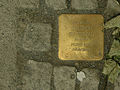
 AIMG 1183 Stolperstein Salomon Guttentag Eichstätt.jpg 1,659 × 1,638; 872 KB
-
 Domplatz 5 Eichstaett-1.jpg 2,529 × 1,881; 689 KB
-
 Domplatz 5 Eichstätt -Stolperstein Guttentag (1).jpg 768 × 1,024; 1.16 MB
-
 Domplatz 5 Eichstätt -Stolperstein Guttentag (2).jpg 1,024 × 768; 1.04 MB
-
 Eichstätt, Domplatz 5-20160816-001.jpg 5,996 × 4,003; 10.65 MB
-
 Radabweiser Eichstätt Domplatz 5–Widmanngasse (1).jpg 1,536 × 2,048; 1.8 MB
-
 Radabweiser Eichstätt Domplatz 5–Widmanngasse (2).jpg 1,536 × 2,048; 1.83 MB

.jpg)
.jpg)

.jpg)
.jpg)