Category:Dogwood Park (Eatonville)
Jump to navigation
Jump to search
Dogwood Park, 41299 Clear Lake Hwy (SR 161), Eatonville, Washington. Located 3 miles (4.8 km) north of Eatonville on Washington Route 161.
Media in category "Dogwood Park (Eatonville)"
The following 22 files are in this category, out of 22 total.
-
 Bench 7081.jpg 4,608 × 3,072; 7.3 MB
-
 Blue Star Hwy 7074.jpg 3,072 × 4,608; 5.97 MB
-
 Centennial 7068.jpg 4,608 × 3,072; 6.84 MB
-
 Columbia Crest 7087.jpg 4,608 × 3,072; 2.9 MB
-
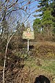
 Dogwood park 7077.jpg 4,608 × 3,072; 6.06 MB
-
 Liberty Cap 7084.jpg 4,608 × 3,072; 2.8 MB
-
 Mt Rainier 7067.jpg 3,072 × 4,608; 5.73 MB
-
 Mtn View 7066.jpg 4,608 × 3,072; 5.02 MB
-
 Mtn View 7069.jpg 4,608 × 3,072; 4.65 MB
-
 Ohop Crest 7071.jpg 4,608 × 3,072; 3.2 MB
-
 Ohop Crest 7085.jpg 4,608 × 3,072; 3.59 MB
-
 Oregon-grape 7078.jpg 3,072 × 4,608; 6.1 MB
-
 Oregon-grape 7079.jpg 3,072 × 4,608; 4.06 MB
-
 Oregon-grape 7080.jpg 4,608 × 3,072; 5.32 MB
-
 Oregon-grape 7082.jpg 3,072 × 4,608; 4.06 MB
-
 Oregon-grape 7083.jpg 3,072 × 4,608; 4.28 MB
-
 Rd markers 7073.jpg 3,072 × 4,608; 4.11 MB
-
 Rebuilt peak 7085 (2).jpg 4,608 × 3,072; 3.54 MB
-
 Sunset Amphitheater 7070.jpg 4,608 × 3,072; 3.21 MB
-
 Sunset Amphitheater 7072.jpg 4,608 × 3,072; 2.93 MB
-
 Sunset Amphitheater 7086.jpg 4,608 × 3,072; 3.06 MB
-
 West slope 7076.jpg 3,072 × 4,608; 4.93 MB


.jpg)


