Category:Dogs of West Yorkshire
Jump to navigation
Jump to search
Subcategories
This category has only the following subcategory.
D
Media in category "Dogs of West Yorkshire"
The following 58 files are in this category, out of 58 total.
-

-
 Afternoon races at Post Hill - geograph.org.uk - 5645171.jpg 1,024 × 768; 214 KB
-
 Bridge over Barnsley Canal.jpg 640 × 480; 151 KB
-
 Canine chums in Ardsley Reservoir - geograph.org.uk - 5816427.jpg 3,839 × 4,936; 3.66 MB
-
 Clay Royd Bridge. - geograph.org.uk - 87056.jpg 640 × 480; 150 KB
-
 Dog by Wilfred's Stone - geograph.org.uk - 5244696.jpg 4,000 × 3,000; 2.41 MB
-
 Dog in Meanwood Beck - geograph.org.uk - 4794122.jpg 640 × 427; 132 KB
-
 Exercise time at Ayranbrau Kennels - geograph.org.uk - 5906100.jpg 1,024 × 768; 233 KB
-
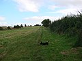
 Field Boundary - geograph.org.uk - 527993.jpg 640 × 480; 150 KB
-
 Footbridge and stile - geograph.org.uk - 532561.jpg 640 × 480; 153 KB
-

-
 Footpath between canal and river Aire at Ferrybridge - geograph.org.uk - 6148029.jpg 3,889 × 2,876; 3.7 MB
-
 Freda's garden Knottingley - geograph.org.uk - 6148022.jpg 3,072 × 4,608; 4.48 MB
-
 Freezing fog and Hoar frost - geograph.org.uk - 6057169.jpg 4,608 × 3,072; 5.95 MB
-
 Fryston Mural - geograph.org.uk - 6723701.jpg 3,216 × 3,125; 1.76 MB
-

-
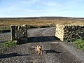 Gateway to Clough Hey Farm. - geograph.org.uk - 269057.jpg 640 × 480; 123 KB
-
 Goole and Knottingley canal and "Freda's Garden" - geograph.org.uk - 6148087.jpg 4,608 × 3,072; 4.3 MB
-
 H Marsden, Bradford Road, Brighouse (8235824094).jpg 2,173 × 1,849; 2.84 MB
-
 I'm sure he went in here ... (5538578250).jpg 2,711 × 1,714; 3.46 MB
-
 Iron Bridge Graffiti - geograph.org.uk - 6703826.jpg 4,288 × 3,216; 1.9 MB
-
 Jackson Bridge - geograph.org.uk - 5973249.jpg 3,715 × 2,570; 2.99 MB
-
 Kings Mill viewed from the canal - geograph.org.uk - 5973254.jpg 4,608 × 3,072; 3.82 MB
-
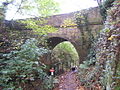
 Long bridle path tunnel under railway lines - geograph.org.uk - 5652316.jpg 4,608 × 3,456; 3.02 MB
-
 Old path from canal, Thackley - geograph.org.uk - 133578.jpg 640 × 480; 96 KB
-
 Park Farm - geograph.org.uk - 587168.jpg 640 × 480; 114 KB
-
 Park Grange Farm - geograph.org.uk - 587163.jpg 640 × 480; 107 KB
-

-
 Peel Park - geograph.org.uk - 2134280.jpg 2,048 × 1,536; 616 KB
-
 Pond - geograph.org.uk - 552757.jpg 640 × 480; 121 KB
-
 Poppies on the path - geograph.org.uk - 561423.jpg 640 × 480; 106 KB
-
 Public footpath . - geograph.org.uk - 535639.jpg 640 × 480; 78 KB
-

-

-
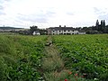
 Public Footpath entering Purston - geograph.org.uk - 585885.jpg 640 × 480; 83 KB
-

-

-

-

-
 Retaining wall for new housing development - geograph.org.uk - 5791211.jpg 4,288 × 3,216; 3.04 MB
-
 Rolo in Woodside Quarry, Ireland Wood, Leeds. W.Yorkshire. (5).jpg 3,880 × 2,608; 3.54 MB
-
 Small Footbridge - geograph.org.uk - 587166.jpg 640 × 480; 143 KB
-
 Sowerby Bridge Footpath 136 approaching Longley, Norland - geograph.org.uk - 2932015.jpg 2,000 × 1,500; 920 KB
-
 Spring has Sprung. - geograph.org.uk - 2931824.jpg 3,876 × 2,568; 2.26 MB
-
 Stile - geograph.org.uk - 552673.jpg 640 × 480; 172 KB
-

-
 Stone Stile - geograph.org.uk - 552770.jpg 640 × 480; 110 KB
-
 Sykes Gate Bottom - geograph.org.uk - 366547.jpg 640 × 480; 121 KB
-
 Tennyson Street, Pudsey, Leeds - geograph.org.uk - 5088625.jpg 1,280 × 853; 609 KB
-
 The Binn Royd Track at Moor End Lane - geograph.org.uk - 4329036.jpg 2,000 × 1,500; 1.02 MB
-
 The northern end of Lower Taythes Lane - geograph.org.uk - 582556.jpg 640 × 480; 101 KB
-
 The river Aire at Ferrybridge - geograph.org.uk - 5670616.jpg 3,749 × 2,751; 1.88 MB
-
-
 Trans-Pennine Trail near Walton. - geograph.org.uk - 54160.jpg 640 × 480; 47 KB
-
 Trotting over the Went Valley - geograph.org.uk - 56335.jpg 479 × 640; 79 KB
-
 Trundles Lane bridge - geograph.org.uk - 563635.jpg 640 × 480; 75 KB
-
 Walking The Dogs In Middleton Park - geograph.org.uk - 5960317.jpg 640 × 450; 100 KB
-
 Weimaraner, Bankhouse, Pudsey - geograph.org.uk - 943368.jpg 450 × 600; 104 KB


.jpg)
.jpg)


.jpg)


