Category:Doelhofkerk
Jump to navigation
Jump to search
| Object location | | View all coordinates using: OpenStreetMap |
|---|
church building in Boarnsterhim, Netherlands  | |||||
| Upload media | |||||
| Instance of | |||||
|---|---|---|---|---|---|
| Dedicated to | |||||
| Location | Aldeboarn, Heerenveen, Friesland, Netherlands | ||||
| Street address |
| ||||
| Located on street |
| ||||
| Heritage designation |
| ||||
| Inception |
| ||||
| official website | |||||
 | |||||
Nederlands: Doelhofkerk (Hervormde kerk), Tsjerkebuorren 2-4, Aldeboarn (Oldeboorn), gem. Heerenveen, Friesland
|
This is a category about rijksmonument number 35950
|
|
This is a category about rijksmonument number 35951
|
| Address |
|
Subcategories
This category has only the following subcategory.
I
Media in category "Doelhofkerk"
The following 31 files are in this category, out of 31 total.
-
 1820181005 torenspits kerk van Aldeboarn.jpg 3,456 × 5,184; 1.85 MB
-
 20181005 Aldeboarn2.jpg 5,184 × 3,456; 4.12 MB
-
 20181005 Aldeboarn3.jpg 5,140 × 3,426; 3.95 MB
-
 20181005 Aldeboarn6.jpg 5,184 × 3,456; 3.04 MB
-
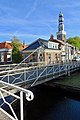 20181005 brug2 Doelhof Aldeboarn.jpg 3,456 × 5,184; 3.24 MB
-
 20181005 Doelhofkerk van Aldeboarn1.jpg 3,456 × 5,184; 3.21 MB
-
 20181005 Doelhofkerk van Aldeboarn2.jpg 5,184 × 3,456; 2.73 MB
-
 20181005 ingang (detail) kerk van Aldeboarn.jpg 2,712 × 2,564; 1.56 MB
-
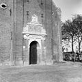
 20181005 ingang kerk van Aldeboarn.jpg 3,456 × 5,184; 4.08 MB
-
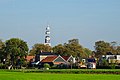
 20181005 Zicht1 op Aldeboarn.jpg 5,184 × 3,456; 3.59 MB
-
 20181005 Zicht2 op Aldeboarn.jpg 4,911 × 3,275; 2.74 MB
-
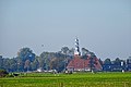 20181005 Zicht3 op Aldeboarn.jpg 5,184 × 3,456; 3.76 MB
-
 2023 Aldeboarn, Doelhôf- of Sint-Pankratiustsjerke (1).jpg 2,604 × 3,214; 2.79 MB
-
 2023 Aldeboarn, Doelhôf- of Sint-Pankratiustsjerke (2).jpg 2,252 × 2,251; 1.9 MB
-
 2023 Aldeboarn, Doelhôf- of Sint-Pankratiustsjerke (3).jpg 2,252 × 2,252; 2.82 MB
-
 2120181005 Aldeboarn5.jpg 5,184 × 3,456; 3.52 MB
-
 Aldeboarn, Doelhôftsjerke.jpg 1,936 × 1,296; 1.21 MB
-
 Beeldhouwwerk 1641 - Oldeboorn - 20172197 - RCE.jpg 1,194 × 1,200; 473 KB
-
 Detail westgevel Anno Domini 1753 (jaartal) - Oldeboorn - 20172201 - RCE.jpg 1,200 × 1,200; 341 KB
-
 Exterieur - Oldeboorn - 20172194 - RCE.jpg 962 × 1,200; 271 KB
-

-
 Exterieur met omgeving - Oldeboorn - 20172198 - RCE.jpg 906 × 1,200; 195 KB
-
 Ingang op de Toren na de restauratie - Oldeboorn - 20172193 - RCE.jpg 1,200 × 1,195; 495 KB
-
 Ingang Torenportaal - Oldeboorn - 20172192 - RCE.jpg 956 × 1,200; 253 KB
-
 Ingangspartij westgevel - Oldeboorn - 20172199 - RCE.jpg 1,197 × 1,200; 474 KB
-
 Kerk vanuit het noord-westen - Oldeboorn - 20172190 - RCE.jpg 915 × 1,200; 175 KB
-
 Kerk vanuit het noord-westen - Oldeboorn - 20172191 - RCE.jpg 899 × 1,200; 206 KB
-
 Oldeboorn 04.JPG 2,560 × 1,920; 818 KB
-
 Oldeboorn met Andringastate en kerk.jpg 425 × 324; 35 KB
-
 Oldeborn, kerk foto3 2007-10-14 15.43.JPG 2,304 × 3,072; 2.7 MB
-
 Overzicht noordwestgevel met kerktoren - Oldeboorn - 20345802 - RCE.jpg 936 × 1,200; 217 KB


_kerk_van_Aldeboarn.jpg)


.jpg)
.jpg)
.jpg)


_-_Oldeboorn_-_20172201_-_RCE.jpg)


