Category:Dobratsch
Jump to navigation
Jump to search

Slovenščina: Dobrač
Français : Dobratsch
Esperanto: Villacher Alpe
mountain in the Gailtal Alps in Carinthia  | |||||
| Upload media | |||||
| Instance of | |||||
|---|---|---|---|---|---|
| Location | Villach-Land District, Carinthia, Austria | ||||
| Significant event |
| ||||
| Mountain range | |||||
| Topographic isolation |
| ||||
| Elevation above sea level |
| ||||
 | |||||
Subcategories
This category has the following 16 subcategories, out of 16 total.
B
D
- Deutsche Kapelle (Dobratsch) (27 F)
- Dobratsch-Gipfelhaus (9 F)
G
- Grünnock (3 F)
R
S
- Sender Dobratsch (15 F)
T
- Tscheltschnigkogel (18 F)
V
W
- Warmbad-Judendorf (4 F)
- Windische Kapelle (20 F)
Media in category "Dobratsch"
The following 200 files are in this category, out of 281 total.
(previous page) (next page)-
De-Dobratsch.ogg 1.9 s; 19 KB
-
 20111004 25 Kopie (8996723544).jpg 4,928 × 3,264; 8.75 MB
-
 2014-06-26 Ossiacher See - Unwetter -hu- 1916.jpg 5,282 × 3,521; 10.52 MB
-
 2014-10-22 09-48-48 Italy Friuli-Venezia Giulia Ugovizza.jpg 4,039 × 2,848; 6.12 MB
-
 2021-04-16 Feistritz an der Gail Blick auf den Ort1.jpg 5,456 × 3,632; 7.76 MB
-
 2021-04-16 Feistritz an der Gail St Magdalena02.jpg 5,175 × 3,531; 14.06 MB
-
 2021-04-16 Feistritz an der Gail St Martin Friedhof1.jpg 5,314 × 3,537; 12.93 MB
-
 2021-04-16 Feistritz an der Gail St Martin Kriegerdenkmal3.jpg 3,490 × 5,243; 12.24 MB
-
 2021-04-17 Feistritz an der Gail Modellflugplatz6.jpg 5,456 × 3,632; 9.2 MB
-
 2021-04-17 Feistritz an der Gail Modellflugplatz8.jpg 3,313 × 2,198; 5.58 MB
-
 Aichingerhütte an der Villachalpenstraße - panoramio.jpg 3,264 × 2,448; 2.89 MB
-
 Alpendohlen Naturpark Dobratsch.jpg 4,912 × 2,704; 3.47 MB
-
 Alpendohlen.jpg 2,945 × 1,506; 1.25 MB
-
 Alpenlahner Bad Bleiberg.jpg 13,982 × 3,852; 38.22 MB
-
 Alpine Motorschlitten, Modell Lynx, Kärnten, Österreich.jpg 1,500 × 940; 687 KB
-
 An Idea Of The Morning (187971303).jpeg 2,048 × 904; 260 KB
-
 Anstieg auf den Dobratsch von Ost (BildID 15496990).jpg 1,680 × 1,215; 1.22 MB
-
 Arenablick Finkenstein, Waldrast, Dobratsch, Kärnten 02.jpg 1,500 × 1,000; 780 KB
-
 Arnoldstein Dobratsch Sued-Ansicht 05102016 4706.jpg 7,360 × 4,912; 22.11 MB
-
 Arnoldstein Dobratsch Sued-Ansicht 05102016 4707.jpg 7,220 × 4,819; 18.08 MB
-
 Arnoldstein Dobratsch-Blick von Agoritschach 20072012 011.jpg 4,288 × 2,848; 1.77 MB
-
 Arnoldstein Radendorf Landschaft mit Haflinger und Dobratsch 25052020 9083.jpg 7,360 × 4,912; 19.9 MB
-
 Arnoldstein Radendorf Siebenbrünn Pferde an Kastanienbaum 25052020 9080.jpg 7,360 × 4,912; 20.32 MB
-
 Arnoldstein Radendorf Wallfahrtskirche Maria Siebenbruenn mit Dobratsch 23052016 2048.jpg 7,360 × 4,912; 22.23 MB
-
 Arnoldstein Radendorf Wallfahrtskirche Maria Siebenbrünn 23052016 2045.jpg 7,360 × 4,912; 20.63 MB
-
 Arnoldstein Ruine des Benediktinerklosters und Dobratsch S-Ansicht 05102016 4723.jpg 7,360 × 4,912; 28.84 MB
-
 Arnoldstein Thoerl Dobratsch Sued-Ansicht 05102016 4776.jpg 7,360 × 4,912; 22.24 MB
-
 Arnoldstein Tschau Blick zum Dobratsch 20052022 9291.jpg 4,928 × 3,280; 5.36 MB
-
 Arnoldstein Tschau Brennholzstapel Landschaft Dobratsch 20052022 2607.jpg 7,360 × 4,912; 19.37 MB
-
 Arnoldstein Bahnhofsbereich mit Gleisanlagen 11082012 228.jpg 4,288 × 2,848; 1.9 MB
-
 Arnoldstein Friedhofskapelle und Dobratsch 01082012 445.jpg 4,288 × 2,848; 1,007 KB
-
 Arnoldstein Hoischhuegel spaetantike Hoehensiedlung 01082012 333.jpg 4,288 × 2,848; 2.09 MB
-
 Arnoldstein Polizeiinspektion, Villlach Land, Kärnten.jpg 1,500 × 888; 837 KB
-
 Arnoldstein, Blick zum Dobratsch Funkturm.jpg 1,701 × 2,551; 853 KB
-
 Arnoldstein, Blick zum Dobratsch.jpg 2,551 × 1,701; 1.05 MB
-
 Aurikel, Naturpark Dobratsch (2166 m ü.A) Kärnten.jpg 4,032 × 2,574; 4.52 MB
-
 Aussicht vom Magdalensberg 1.jpg 9,917 × 7,438; 32.5 MB
-
 Bad Bleiberg, Kärnten mit Blick zum Dobratsch.jpg 1,500 × 997; 938 KB
-
 Bad Bleiberg, Kärnten, ORF Materialseilbahn auf den Dobratsch.jpg 1,391 × 682; 431 KB
-
 Bad Bleiberg, Nötsch - Gipfelareal des Dobratsch.JPG 5,200 × 2,925; 7.94 MB
-
 Bad Bleiberg, ORF Materialseilbahn auf den Dobratsch, Kärnten.jpg 1,500 × 997; 990 KB
-
 BadBleiberg07 Dobratsch.jpg 5,424 × 3,611; 7.97 MB
-
 Baško jezero 02.JPG 3,648 × 2,736; 2.73 MB
-
 Bergdohlen im Naturpark Dobratsch.jpg 2,421 × 1,301; 1.14 MB
-
 Bergfried Burgruine Khünburg-Aussicht Ost.jpg 4,150 × 3,113; 6.74 MB
-
 Bild 1Baumpilze Bild 2 Smaragdeidechse.jpg 1,952 × 3,264; 1.56 MB
-
 Bild 1Baumpilze Bild 3 Smaragdeidechse.jpg 1,952 × 3,264; 1.16 MB
-
 Bleiberg AK 1908 gegen den Dobratsch.jpg 567 × 362; 72 KB
-
 Bleiberg am Dobratsch. (15-6.1917.) (BildID 15799076).jpg 1,680 × 1,187; 1.45 MB
-

-
 Blick nach Finkenstein vom Dobratsch, Kärnten 01.jpg 1,500 × 911; 1.32 MB
-

-
-
-

-

-
 Blick von Kreuth Bauernschaft zum Dobratsch, Kärnten.jpg 5,000 × 3,084; 8.25 MB
-
 Blitz in Kärnten.jpeg 5,472 × 3,648; 1.31 MB
-
 Blumenwiese Naturpark Dobratsch.jpg 3,089 × 2,048; 3.99 MB
-
 Burgberg-Straßfried, Landschaftsschutzgebiet in Arnoldstein, Kärnten.jpg 5,000 × 3,333; 14.35 MB
-
 Cima Achomitza-Schönwipfel to north viewin Dobratsch - panoramio.jpg 2,048 × 1,534; 861 KB
-
 Coccau 01.JPG 2,592 × 1,944; 795 KB
-
 Coccau, village in Tarvisio, Italy.jpg 953 × 760; 511 KB
-
 Dobrasch Naturpark Kärnten.jpg 4,912 × 2,768; 4.27 MB
-
 Dobratsch (2166 m ) Südwand Abbruchgebiet - Rote Wand - Gailtaler Alpen, Kärnten.jpg 1,500 × 997; 1.04 MB
-
 Dobratsch (49191869253).jpg 4,032 × 3,024; 3.61 MB
-
 Dobratsch (49192367491).jpg 3,620 × 2,715; 2.17 MB
-
 Dobratsch (49192368251).jpg 4,032 × 3,024; 2.82 MB
-
 Dobratsch 2008 0814.JPG 2,592 × 1,944; 742 KB
-
 Dobratsch abendstimmung.JPG 4,288 × 3,216; 2.94 MB
-
 Dobratsch Funkturm.jpg 3,089 × 2,048; 3.45 MB
-
 Dobratsch Gipfel 2004.JPG 2,272 × 1,704; 1,020 KB
-
 Dobratsch Gipfel Panorama.jpg 12,816 × 3,874; 31.63 MB
-
 Dobratsch Gipfelwache (BildID 15494403).jpg 1,216 × 1,680; 1.13 MB
-
 Dobratsch Grünnock.jpg 5,456 × 3,632; 5.79 MB
-
 Dobratsch I. Naturpark Kärntens, Österreich.jpg 1,453 × 928; 696 KB
-
 Dobratsch Karawanken Julische Alpen 20051217.jpg 1,000 × 665; 147 KB
-
 Dobratsch Naturpark Kärnten, Österreich.jpg 1,500 × 673; 426 KB
-
 Dobratsch Naturpark Villach, Kärnten.jpg 4,912 × 3,153; 7.43 MB
-
 Dobratsch Naturpark, Gailtaler Alpen, Kärnten.jpg 4,693 × 2,831; 3.54 MB
-
 Dobratsch Naturpark, Kärnten, Verhaltensregeln.jpg 1,401 × 969; 465 KB
-
 Dobratsch Naturpark, Kärnten.jpg 1,242 × 760; 509 KB
-
 Dobratsch Naturzone, Kärnten.jpg 1,981 × 1,404; 949 KB
-

-
 Dobratsch Rundwanderweg Schild.jpg 3,024 × 3,441; 3.08 MB
-
 Dobratsch Suedseite 1.jpg 1,278 × 771; 253 KB
-
 Dobratsch Südabsturz (BildID 15494396).jpg 1,680 × 1,176; 1.32 MB
-
 Dobratsch Südwand mit Sendemast auf 2115 m Seehöhe in den Gailtaler Alpen.jpg 4,912 × 3,071; 3.5 MB
-
 Dobratsch und 2 Taeler 1.jpg 1,278 × 771; 216 KB
-
 Dobratsch Villacher Alpe, Europaschutzgebiet, Kärnten.jpg 1,500 × 1,000; 918 KB
-
 Dobratsch von St Stefan i Gailtal.jpg 4,608 × 3,456; 3.35 MB
-
 Dobratsch-Blick auf Klagenfurter Becken 25112009 07.jpg 4,288 × 2,848; 6.99 MB
-
 Dobratsch-Blick auf Razor 25112009 77.jpg 2,848 × 4,288; 6.28 MB
-
 Dobratsch-Gipfel im Herbst.jpg 2,048 × 1,360; 2.01 MB
-
 Dobratsch.jpg 2,008 × 1,377; 649 KB
-
 Dobratsch01 Sender.jpg 3,601 × 5,409; 5.6 MB
-
 Dobratschgipfel, Gailtaler Alpen, Kärnten.jpg 4,591 × 2,063; 2.6 MB
-
 DobratschJaegersteig.JPG 2,048 × 1,536; 599 KB
-
 DobratschSueden.JPG 2,048 × 1,536; 683 KB
-
 DobratschWinter.JPG 3,872 × 2,592; 4.11 MB
-
 Dobrač 01.JPG 3,648 × 2,736; 4.01 MB
-
 Dobrač 02.JPG 3,648 × 2,736; 4.06 MB
-
 Dobrač 03.JPG 3,648 × 2,736; 3.18 MB
-
 Dobrač 04.JPG 3,648 × 2,736; 3.48 MB
-
 Dobrač 05.JPG 3,648 × 2,736; 4.66 MB
-
 Dobrač 06.JPG 3,648 × 2,736; 4.5 MB
-
 Dobrač 07.JPG 2,736 × 3,648; 4.42 MB
-
 Dobrač 08.JPG 2,736 × 3,648; 4.39 MB
-
 Dobrač 09.JPG 3,648 × 2,736; 4.13 MB
-
 Dobrač 12.JPG 3,648 × 2,736; 3.95 MB
-
 Dobrač 19.JPG 3,648 × 2,736; 3.13 MB
-
 Dobrač 20.JPG 3,648 × 2,736; 4.83 MB
-
 DSCF8889 (49191761473).jpg 6,240 × 4,160; 3.78 MB
-
 DSCF8899 (49191765203).jpg 6,240 × 4,160; 3.1 MB
-
 DSCF8902 (49192460322).jpg 6,240 × 4,160; 4.37 MB
-
 DSCF8908 (49191769143).jpg 6,240 × 4,160; 4.37 MB
-
 DSCF8912 (49192462472).jpg 6,240 × 4,160; 4.99 MB
-
 DSCF8914 (49192266931).jpg 6,240 × 4,160; 3.79 MB
-
 DSCF8919 (49192465837).jpg 6,240 × 4,160; 4.94 MB
-
 Ehemalige Harpfe Schumi, Vorderberg 12, Gailtal, Kärnten.jpg 1,500 × 737; 558 KB
-
 Emil Barbarini Blick auf den Dobratsch.jpg 5,538 × 3,433; 3.71 MB
-
 Europäische Hornviper, Dobratsch (Villach), Kärnten 01.jpg 5,000 × 3,333; 10.52 MB
-
 Europäische Hornviper, Dobratsch (Villach), Kärnten.jpg 5,000 × 3,333; 9.59 MB
-
 Feistritz an der Gail Quarzkonglomerat und Dobratsch 16052017 8575.jpg 7,360 × 4,912; 26.75 MB
-
 Feistritz an der Gail, Modellflugplatz in Kärnten.jpg 1,500 × 943; 766 KB
-
 Feldkirchen Klachl und Ossiacher See Ost-Ansicht 23052019 6970.jpg 4,928 × 3,280; 8.63 MB
-
 Feldraiostation DOBRATSCH - ROSSKOFELSPITZE. (BildID 15480013).jpg 1,245 × 1,680; 1.05 MB
-
 Feldraiostation DOBRATSCH - ROSSKOFELSPITZE. (BildID 15480020).jpg 1,212 × 1,680; 1,014 KB
-

-

-
 Frühlingsblume, Dobratsch (2166 m ü.A.), Kärnten.jpg 1,500 × 935; 692 KB
-
 Full Moon (198212983).jpeg 2,048 × 1,356; 226 KB
-
 Gailtal Schuett Unterlauf der Gail 20052007 02.jpg 3,872 × 2,592; 1.74 MB
-
 Gentianella pilosa cf. (7123924179).jpg 1,280 × 853; 333 KB
-
 Getreidefeld im Gailtal mit Blick Richtung Villach, Dobratsch (2166 m ü.M).jpg 1,500 × 997; 2.12 MB
-
 Gladiolenwiese Oberschütt, Villach, Kärnten 06.jpg 930 × 1,374; 703 KB
-
 Gladiolenwiese Oberschütt, Villach, Kärnten 08.jpg 1,500 × 1,000; 1 MB
-
 Gladiolenwiese Oberschütt, Villach, Kärnten 15.jpg 1,500 × 953; 923 KB
-
 Goritschacher Almhütte 1945 erbaut.jpg 3,648 × 2,736; 2.04 MB
-
 Görtschach 12.JPG 2,592 × 1,944; 2.17 MB
-
 Hasberger Marterl, Förker Laasriegel, Marktgemeinde Nötsch, Kärnten.jpg 1,007 × 867; 566 KB
-
 HeinzlV.jpg 6,000 × 4,000; 6.04 MB
-
 Hemmapilgerweg St Oswald.jpg 1,536 × 2,048; 630 KB
-
 Hermagor Dellach Gailtal-Blick zum Dobratsch W-Ansicht 08062017 5206.jpg 4,928 × 3,280; 11.51 MB
-
 Hermagor Latschach Blick nach Osten zum Dobratsch 08062017 9170.jpg 7,360 × 4,912; 15.35 MB
-
 Hills in Austria.jpg 4,000 × 2,667; 2.22 MB
-
 Hohenthurn Blick zum Dobratsch Sued-Ansicht 16052017 8452.jpg 7,360 × 4,912; 27.15 MB
-
 Hohenthurn Blick zum Dobratsch Sued-Ansicht 16052017 8453.jpg 4,912 × 7,360; 26.27 MB
-
 Hohenthurn Goeriach Friedhof Ost-Portal SW-Ansicht und Dobratsch 16052017 8509.jpg 7,360 × 4,912; 17.18 MB
-
 Hohenthurn Goeriach Kriegerdenkmal 16052017 8484.jpg 7,360 × 4,912; 26.25 MB
-
 Hohenthurn Goeriach Pfarrkirche Mariae Namen SSW-Ansicht 16052017 8539.jpg 7,360 × 4,912; 24.59 MB
-
 Hohenthurn Goeriach Pfarrkirche Mariae Namen SW-Ansicht 16052017 8471.jpg 7,146 × 4,840; 20.7 MB
-
 Hohenthurn Goeriach Pfarrkirche Mariae Namen und Friedhof 16052017 8533.jpg 7,360 × 4,912; 25.25 MB
-
 Hohenthurn mit Dobratsch 20052007 03.jpg 3,872 × 2,592; 1.76 MB
-
 Hohenthurn, Bezirk Villach Land, Kärnten.jpg 5,000 × 3,333; 11.22 MB
-
 Hubertuskapelle in Bleiberg Kreuth, Kärnten.jpg 4,755 × 2,954; 5.15 MB
-
 Höhenloipe Rosstratte.jpg 2,592 × 1,728; 819 KB
-
 Höhlen im Naturpark Dobratsch (2166 m), Kärnten.jpg 1,500 × 955; 1,011 KB
-
 Illitschalm, Gemeinde Finkenstein, Bezirk Villach Land, Kärnten.jpg 4,795 × 2,602; 6.36 MB
-
 Insberg Blick Richtung Unteres Drautal Villach, Kärnten.jpg 1,500 × 997; 1.14 MB
-
 Jägersteig - Naturpark Dobratsch - Villach, Kärnten.jpg 4,912 × 3,264; 7.7 MB
-
 Jägersteig im Naturpark Dobratsch.jpg 4,912 × 3,264; 8.06 MB
-
 Jägersteig Naturpark Dobratsch, Villach, Kärnten.jpg 4,266 × 3,175; 6.05 MB
-
 Karawanken u.Triglavgruppe v.Rosskofel +1795 (Dobratsch) (BildID 15494382).jpg 1,680 × 1,198; 1.12 MB
-
 Kath. Pfarrkirche hl. Martin und Friedhof mit Blick zur Südflanke des Dobratsch.jpg 5,000 × 3,087; 7.44 MB
-
 Magdalensberg Blick gen Westen Muraunberg Sankt Veit an der Glan Gauerstall 15042022 2495.jpg 7,360 × 4,912; 14.89 MB
-
 Magdalensberg Blick gen Westen Zechnerkogel 15042022 2458.jpg 7,360 × 4,912; 11.53 MB
-
 Ulrichsberg und Dobratsch vom Magdalensberg gesehen 21012020 7360.jpg 4,928 × 3,280; 6.48 MB
-
 Knappenkreuz Dobratsch (2166 m ü.A.) Kärnten.jpg 2,155 × 3,040; 1.33 MB
-
 Kornfeld Gailtal, Kärnten.jpg 1,500 × 895; 954 KB
-
 Ladislav Benesch - Dobrač s Podkorenskega sedla.jpg 4,160 × 2,067; 316 KB
-
 Last Moment Of A Day (202837721).jpeg 2,048 × 938; 626 KB
-
 Marktgemeinde Arnoldstein, Südseite des Dobratsch (2166 m ü.A.), Kärnten.jpg 1,500 × 912; 788 KB
-
 Markus Pernhart - Bleiberg.jpg 6,948 × 4,896; 17.43 MB
-
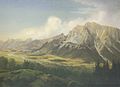
 Markus Pernhart - Dobratsch - 1858.jpeg 3,492 × 2,274; 3.06 MB
-
 Markus Pernhart - Dobratsch - 1858.jpg 7,002 × 2,868; 7.68 MB
-
 Markus Pernhart - Dobratsch - 1859.jpg 6,972 × 2,340; 6.89 MB
-
 Markus Pernhart - Dobratsch gegen Südosten.jpg 6,948 × 5,028; 19.54 MB
-
 Markus Pernhart - Gailtal gegen Nordwesten.jpg 6,948 × 5,016; 18.11 MB
-
 Markus Pernhart - Roschitza-Panorama.jpg 7,014 × 5,082; 12.73 MB
-
 Markus Pernhart - Villacher Becken.jpg 6,984 × 4,026; 17.13 MB
-
 Milka-feeling - panoramio.jpg 2,592 × 1,944; 1.64 MB
-
 Millstätter See von Nordost.jpg 1,776 × 1,055; 411 KB
-
 Mirnock vom Dobratsch aus.jpg 2,048 × 1,536; 704 KB
-
 Nachtpanorama vom Villacher Becken.jpg 2,592 × 1,728; 1.08 MB
-
 Naturpark Dobratsch, Almgasthof "Hundsmarhof" im Winter 2018.jpg 2,016 × 1,512; 1.07 MB
-
 Naturpark Dobratsch, Almgasthof "Hundsmarhof", Villach, Kärnten, Österreich.jpg 1,818 × 1,211; 686 KB
-
 Naturpark Dobratsch, Nähe Storfhöhe, Kärnten.jpg 1,500 × 1,000; 1.39 MB
-
 Naturpark Dobratsch, Villacher Alpe - Infotafel - Kärnten, Österreich.jpg 1,500 × 1,265; 1.85 MB
-
 Naturpark Dobratsch.jpg 1,600 × 1,067; 421 KB
-
 Noetsch Hauptplatz 2008 0814.JPG 2,592 × 1,944; 721 KB
-
 Noetsch mit Dobratsch 20052007 01.jpg 3,872 × 2,592; 1.7 MB
-
 Noetsch Saak altes Haus Kulturdenkmal 2008 0814.jpg 2,592 × 1,944; 802 KB
-
 Noetsch Saak Bauernhaus 2008 0814.JPG 2,592 × 1,944; 904 KB
-
 Noetsch Saak Hauptstrasse 2008 0814.JPG 2,592 × 1,944; 932 KB
-
 Noetsch Saak Kirche mit Dobratsch 2008 0814.jpg 2,592 × 1,944; 680 KB
-
 Noetsch Wasserleonburg 2008 01.JPG 1,600 × 1,200; 374 KB
-
 Nötsch Saak Pfarrkirche hl. Kanzian SW-Ansicht 20052007 01.jpg 3,872 × 2,592; 1.01 MB
-
 Nötsch Sankt Georgen 29 Aufbahrungshalle 04072023 4075.jpg 7,360 × 4,912; 18.85 MB
-
 Nötsch Sankt Georgen Pfarrkirche hl. Georg Friedhof und N-Wand 04072023 4080.jpg 7,360 × 4,912; 17.02 MB
.jpg)


.jpeg)
.jpg)


_K%C3%A4rnten.jpg)


_(BildID_15799076).jpg)
_(BildID_15800569).jpg)

_(BildID_15496913).jpg)
_(BildID_15496920).jpg)
_(BildID_15496927).jpg)
_(BildID_15496934).jpg)
.jpg)


_S%C3%BCdwand_Abbruchgebiet_-_Rote_Wand_-_Gailtaler_Alpen,_K%C3%A4rnten.jpg)
.jpg)
.jpg)
.jpg)


.jpg)


.jpg)


.jpg)
.jpg)
.jpg)
.jpg)
.jpg)
.jpg)
.jpg)


,_K%C3%A4rnten_01.jpg)
,_K%C3%A4rnten.jpg)


.jpg)
.jpg)
.jpg)
.jpg)
,_K%C3%A4rnten.jpg)
.jpeg)

.jpg)
.jpg)


,_K%C3%A4rnten.jpg)


_(BildID_15494382).jpg)


_K%C3%A4rnten.jpg)


.jpeg)
,_K%C3%A4rnten.jpg)


