Category:Disused railway stations in Stirling council area
Jump to navigation
Jump to search
Subcategories
This category has the following 8 subcategories, out of 8 total.
A
- Aberfoyle railway station (3 F)
B
- Balfron Station (5 F)
- Buchlyvie railway station (2 F)
C
- Callander railway station (4 F)
D
- Dumgoyne railway station (2 F)
K
L
- Lochearnhead railway station (2 F)
Media in category "Disused railway stations in Stirling council area"
The following 12 files are in this category, out of 12 total.
-
 Balquhidder Station - geograph.org.uk - 1749724.jpg 640 × 354; 98 KB
-
 Blanefield Station 1831254 92e15256.jpg 640 × 378; 107 KB
-
 Bridge of Allan railway station (site), Stirling, 2014 (geograph 4111638).jpg 1,024 × 768; 242 KB
-
 Caledonian Railway, Glen Ogle. - geograph.org.uk - 110607.jpg 640 × 448; 89 KB
-
 Causewayhead station site geograph-3103470-by-Ben-Brooksbank.jpg 2,108 × 1,447; 2.74 MB
-
 Doune station site geograph-3418249-by-Ben-Brooksbank.jpg 2,351 × 1,448; 5.13 MB
-
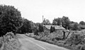
 Drymen - geograph-2107431-by-Richard-Webb.jpg 640 × 480; 96 KB
-
 Former railway station, Glen Dochart - geograph.org.uk - 3704211.jpg 4,608 × 3,456; 4.75 MB
-
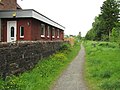
 Gargunnock station site geograph-3556843-by-Ben-Brooksbank.jpg 2,388 × 1,492; 3.31 MB
-
 Gartness station geograph-3557849-by-Ben-Brooksbank.jpg 2,355 × 1,289; 2.73 MB
-
 Killin - geograph-5365001-by-Thomas-Nugent.jpg 640 × 480; 158 KB
-
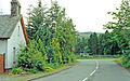
 West Highland Way near Killearn (geograph 5386747).jpg 1,024 × 683; 541 KB


,_Stirling,_2014_(geograph_4111638).jpg)


.jpg)