Category:Disused railway stations in Devon
Jump to navigation
Jump to search
Wikimedia category | |||||
| Upload media | |||||
| Instance of | |||||
|---|---|---|---|---|---|
| Category combines topics | |||||
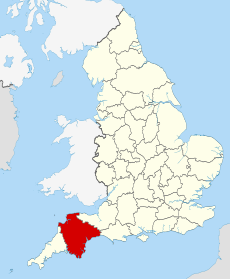
| Devon | |||||
ceremonial county of England | |||||
| Spoken text audio | |||||
| Instance of | |||||
| Location |
| ||||
| Capital | |||||
| Population |
| ||||
| Area |
| ||||
| Different from | |||||
| Said to be the same as | Devon (historic county of England, ceremonial county of England, 1844) | ||||
 | |||||
Subcategories
This category has the following 78 subcategories, out of 78 total.
A
- Ashbury railway station (3 F)
- Avonwick railway station (4 F)
B
- Bovey railway station (14 F)
- Brent railway station (14 F)
- Brentor railway station (5 F)
C
- Christow railway station (9 F)
- Colyton railway station (34 F)
- Cornwood railway station (11 F)
D
- Dartmouth railway station (33 F)
E
- Exminster railway station (18 F)
F
- Filleigh railway station (3 F)
- Fremington railway station (15 F)
G
H
- Hemyock railway station (5 F)
I
K
L
- Lydford railway station (5 F)
M
- Morebath railway station (3 F)
N
P
- Petrockstow railway station (11 F)
S
- Sidmouth railway station (7 F)
T
- Tiverton railway station (4 F)
W
- Westward Ho! railway station (10 F)
Y
Media in category "Disused railway stations in Devon"
The following 37 files are in this category, out of 37 total.
-
Ashwater former station geograph-3240610-by-Ben-Brooksbank.jpg 2,346 × 1,383; 3.14 MB
-
Bampton Station - geograph.org.uk - 1749992.jpg 640 × 351; 120 KB
-
Beeching's Way, Thorverton - geograph.org.uk - 1125623.jpg 640 × 480; 65 KB
-
Billacombe Station site of 1798157 31316a48.jpg 640 × 931; 222 KB
-
Bittaford Platform site of 1809911 ee1dbc14.jpg 640 × 346; 93 KB
-
Brampford Speke Halt site 1973005 c2c2a3f8.jpg 1,496 × 1,030; 728 KB
-
Brixham railway station 1910213 26d7e678.jpg 640 × 347; 103 KB
-
Brixton Road railway station 1910592.jpg 640 × 386; 153 KB
-
Broadwoodwidger, Tower Hill - geograph.org.uk - 448029.jpg 640 × 427; 210 KB
-
Budleigh Salterton Station 1973565 42c1301d.jpg 640 × 387; 147 KB
-
Chelfham Station & Viaduct Lynton & Barnstaple Railway (geograph 1667118).jpg 1,024 × 768; 311 KB
-
Chudleigh Knighton Halt railway station - 1970.jpg 858 × 658; 96 KB
-
Coryton (GWR) former station geograph-3114477-by-Ben-Brooksbank.jpg 2,037 × 1,444; 3.02 MB
-
Dunsbear Halt railway station - geograph.org.uk - 5798768.jpg 4,288 × 2,848; 2.47 MB
-
Dunsland Cross station site geograph-3425618-by-Ben-Brooksbank.jpg 2,352 × 1,279; 3.73 MB
-
East Budleigh former station, geograph-3440704-by-Ben-Brooksbank.jpg 2,356 × 1,396; 3.04 MB
-
Elburton Cross station site geograph-3454050-by-Ben-Brooksbank.jpg 2,145 × 1,408; 2.43 MB
-
GWR Stables (geograph 5487786).jpg 2,778 × 2,084; 3.93 MB
-
Hatherleigh Railway Station.jpg 340 × 204; 13 KB
-
Hole station site geograph-3682478-by-Ben-Brooksbank.jpg 2,396 × 1,542; 3.19 MB
-
L&Bbrattonstation2004.jpg 768 × 432; 200 KB
-
Lifton station (postcard).jpg 1,588 × 980; 218 KB
-
Littleham geograph-3752083-by-Ben-Brooksbank.jpg 2,346 × 1,377; 3.18 MB
-
Lynton & Barnstaple Railway- Parracombe halt (geograph 4047228).jpg 1,600 × 1,091; 515 KB
-
Mount Pleasant Road Halt site 2009.jpg 1,024 × 768; 353 KB
-
No trains here now - geograph.org.uk - 1492814.jpg 640 × 427; 63 KB
-
Plympton station Devon.jpg 1,024 × 636; 308 KB
-
Seaton (2021-08-02) 13.jpg 5,568 × 3,712; 15.9 MB
-
Site (estimated) of Ide station, 2000 (geograph 5434509).jpg 2,319 × 1,347; 2.67 MB
-
Swimbridge railway station Oct 1969.jpg 1,744 × 1,632; 213 KB
-
The Old Station - geograph.org.uk - 1521347.jpg 640 × 480; 73 KB
-
Trusham Railway Station - geograph.org.uk - 1472830.jpg 640 × 480; 153 KB
-
Tunnel at Lucas Terrace Plymouth - geograph.org.uk - 998466.jpg 640 × 449; 85 KB
-
West Exe Halt railway station (site), Devon (geograph 5454860).jpg 1,600 × 1,200; 343 KB
-
Whitstone and Bridgerule station - geograph.org.uk - 727855.jpg 640 × 426; 69 KB


