<nowiki>Category:Disused railway stations in Bedfordshire; categoría de Wikimedia; kategori Wikimedia; Wikimedia category; د ويکيمېډيا وېشنيزه; Vikimedya kategorisi; ویکیمیڈیا زمرہ; kategória projektov Wikimedia; категорія проєкту Вікімедіа; 维基媒体分类; Wikimedia-Kategorie; Викимедиина категорија; Wikimedia-Kategorie; विकिपीडिया:श्रेणी; page de catégorie d'un projet Wikimedia; kategorija na Wikimediji; विकिपीडिया वर्ग; категорија на Викимедији; Wikimedia-Kategorie; Wikimedia-kategori; kategori Wikimédia; تصنيف ويكيميديا; pajenn rummata eus Wikimedia; Wikimedia:ကဏ္ဍခွဲခြင်း; 維基媒體分類; Wikimedia категориясы; categoría de Wikimedia; Wikimedia-Kategorie; Викимедиа категорияһы; tudalen categori Wikimedia; kategori e Wikimedias; ردهٔ ویکیمدیا; 维基媒体项目分类; Wikimedia-kategori; ვიკიპედია:კატეგორიზაცია; ウィキメディアのカテゴリ; categoria Wikimedia; تصنيف بتاع ويكيميديا; විකිමීඩියා ප්රභේද පිටුව; categoria Vicimediorum; विकिमीडिया श्रेणी; Wikimedia-luokka; Wikimedia category; gurühi Vikimedia; катэгорыя ў праекце Вікімэдыя; Викимедиа проектындагы төркем; catigurìa di nu pruggettu Wikimedia; หน้าหมวดหมู่วิกิมีเดีย; Wikimedia:Kategorija; Wikimedia-Kategorie; উইকিমিডিয়া থাক; Уикимедия категория; categorie în cadrul unui proiect Wikimedia; categurìa 'e nu pruggette Wikimedia; Wikimedia-kategori; kawan Wikimèdia; гурӯҳи Викимедиа; 위키미디어 분류; Wikimedia-bólkur; kategorio en Vikimedio; kategori Wikimedia; Wikimedia:Ronnaghys; উইকিমিডিয়া বিষয়শ্রেণী; kategori Wikimedia; 维基媒体分类; kategorija w projektach Wikimedije; thể loại Wikimedia; Wikimedia projekta kategorija; kategoria ti Wikimedia; categoria de um projeto da Wikimedia; 维基媒体分类; категорияд Ангилал; Wikimedia-kategori; kategori Wikimedia; پۆلی ویکیمیدیا; Wikimedia category; Vikimédia ñemohenda; Wikimédia-kategória; વિકિપીડિયા શ્રેણી; Wikimediako kategoria; категория в проекте Викимедиа; Wikimedia-Kategorie; Kategoriya ning Wikimedia; Wikimedia-kategorie; Wîkîmediya:Kategorî; विकिमिडिया श्रेणी; Wikimedia-Kategorie; 维基媒体项目分类; קטגוריה בוויקיפדיה; Викимедиа проектындагы төркем; विकिमिडिया श्रेणी; Wikimedia kategooria; Wikimedia-categorie; Wikimedia-kategoriija; гурӯҳ дар лоиҳаи Викимедиа; categoría de Wikimedia; 維基媒體分類; Wikimedia category; categoria di un progetto Wikimedia; kategoria w projekcie Wikimedia; Wikimedia:Klassys; Wikimedia-kategory; 維基媒體分類; 維基媒體分類; Վիքիմեդիայի նախագծի կատեգորիա; categoria de Wikimedia; kategorya ng Wikimedia; ẹ̀ka Wikimedia; 維基媒體專案分類; categoria de um projeto da Wikimedia; kategorie na projektech Wikimedia; kategorija na Wikimediji; tumbung Wikimedia; Wikimedia-Kategorie; kategorija Wikimedie; Wikimedia proyektındağı törkem; катэгорыя ў праекце Вікімедыя; Wikimedia-kategorie; kategori Wikimedia; jamii ya Wikimedia; വിക്കിമീഡിയ വർഗ്ഗം; Wikimedia-categorie; kategori Wikimedia; Viciméid catagóir; زمرو:وڪيپيڊيا زمرا بندي; Vikipidiya:Shopni; categoría de Wikimedia; விக்கிமீடியப் பகுப்பு; κατηγορία εγχειρημάτων Wikimedia; Wikimedia-categorie</nowiki>
Subcategories
This category has the following 14 subcategories, out of 14 total.


 A1 underpass (geograph 2813803).jpg 3,872 × 2,592; 3.57 MB
 Crawley railway Halt (site) (geograph 3386198).jpg 1,024 × 768; 204 KB
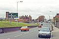 Dunstable North station site geograph-3426156-by-Ben-Brooksbank.jpg 2,395 × 1,572; 5.3 MB
 Fields and railway - geograph.org.uk - 1054524.jpg 640 × 475; 74 KB
 Kempston & Elstow railway station (site) (geograph 3386034).jpg 1,024 × 768; 163 KB
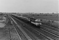 Langford (1983).jpg 1,508 × 1,024; 183 KB
 Luton Hoo railway station (1980s).JPG 1,840 × 1,232; 853 KB
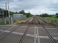 Wootton Broadmead railway station (site) (geograph 3386098).jpg 1,024 × 768; 156 KB
.jpg)
_(geograph_3386198).jpg)


_(geograph_3386034).jpg)
.jpg)
.JPG)
_(geograph_3386098).jpg)