Category:Disused railway lines in Greater Manchester
Jump to navigation
Jump to search
Wikimedia category | |||||
| Upload media | |||||
| Instance of | |||||
|---|---|---|---|---|---|
| |||||
Subcategories
This category has the following 6 subcategories, out of 6 total.
Media in category "Disused railway lines in Greater Manchester"
The following 39 files are in this category, out of 39 total.
-
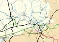 Around Manchester railway map 1921.svg 1,398 × 986; 279 KB
-
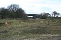
 Bickershaw Junction - geograph.org.uk - 1739407.jpg 2,496 × 1,664; 2.03 MB
-
 Bickershaw Junction - geograph.org.uk - 1739412.jpg 2,496 × 1,664; 2.53 MB
-
 Bickershaw Junction - geograph.org.uk - 1739737.jpg 2,496 × 1,664; 2.35 MB
-
 Bickershaw Junction - geograph.org.uk - 1739806.jpg 2,496 × 1,664; 2.39 MB
-

-

-
 Disused level crossing on Trafford Park Road - geograph.org.uk - 4477141.jpg 1,280 × 843; 400 KB
-
 Disused level crossing on Trafford Park Road - geograph.org.uk - 4477144.jpg 1,280 × 853; 449 KB
-
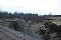
 Disused Railway Tracks at Lower Ince - geograph.org.uk - 5721727.jpg 1,024 × 770; 490 KB
-

-
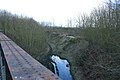
 Disused Railway, Clayton Vale - geograph.org.uk - 1835480.jpg 2,816 × 2,112; 2.04 MB
-
 East from Bickershaw Junction - geograph.org.uk - 1739681.jpg 2,496 × 1,664; 1.75 MB
-
 Former rail bridge, George's Rd, Stockport.jpg 3,264 × 2,448; 2.95 MB
-
 Godley to Apethorn Railway Track - geograph.org.uk - 1279187.jpg 640 × 567; 181 KB
-
 Godley Turntable - geograph.org.uk - 1005818.jpg 640 × 480; 145 KB
-

-
 Knarr Lane Bridge over The Delph Donkey - geograph.org.uk - 1164502.jpg 640 × 480; 113 KB
-
 Knott Fold Bridge - geograph.org.uk - 1279148.jpg 640 × 564; 151 KB
-
 Knott Fold Bridge - geograph.org.uk - 1279150.jpg 640 × 521; 141 KB
-
 LNWR route to Manchester - geograph.org.uk - 1739758.jpg 2,496 × 1,664; 2.34 MB
-
 LNWR route to Wigan - geograph.org.uk - 1739752.jpg 2,496 × 1,664; 2.24 MB
-
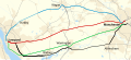 Map of rail routes between Liverpool and Manchester in 1960.svg 702 × 318; 1.33 MB
-
 No Through Route - geograph.org.uk - 1380974.jpg 640 × 480; 262 KB
-
 Oil Trains No More - geograph.org.uk - 1230945.jpg 640 × 480; 233 KB
-
-
 Railway wars - geograph.org.uk - 914843.jpg 640 × 426; 120 KB
-

-

-
 Strangeways East Junction - geograph.org.uk - 1739765.jpg 2,496 × 1,664; 1.64 MB
-

-
 Tracks ahead - geograph.org.uk - 827990.jpg 640 × 462; 67 KB
-
 Trans-Pennine Trail - geograph.org.uk - 1230992.jpg 480 × 640; 238 KB
-
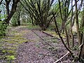
 Trans-Pennine Trail, Looking East - geograph.org.uk - 1337673.jpg 640 × 480; 194 KB
-

-
 Whelley Loop Line - De Trafford Junction - geograph.org.uk - 1739395.jpg 2,496 × 1,664; 2.05 MB
-
 Whelley Loop Line - geograph.org.uk - 1706634.jpg 427 × 640; 123 KB
-
 Whelley Loop Line - geograph.org.uk - 1706660.jpg 427 × 640; 125 KB
-
 Whelley Loop Line 2 - geograph.org.uk - 1572051.jpg 640 × 427; 112 KB


