Category:District maps of Taipei
Jump to navigation
Jump to search
中文(臺灣):臺北市各區地圖
Subcategories
This category has the following 13 subcategories, out of 13 total.
B
D
N
S
W
X
Z
Media in category "District maps of Taipei"
The following 23 files are in this category, out of 23 total.
-
 1983年台北市古亭區里界圖.png 1,652 × 1,004; 122 KB
-
 1983年台北市建成區里界圖.png 431 × 563; 26 KB
-
 1983年台北市景美區里界圖.png 888 × 564; 64 KB
-
 1983年台北市木柵區里界圖.png 792 × 560; 48 KB
-
 1983年龍山區里界圖.png 664 × 567; 51 KB
-
 BlankTaipeiMap.png 347 × 458; 1.21 MB
-
 District maps of Taipei (1946-1968).png 323 × 192; 16 KB
-
 District maps of Taipei (1968~1990) Blank 01.png 490 × 599; 43 KB
-
 District maps of Taipei (1968~1990).png 510 × 558; 55 KB
-
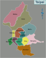
 Districts of Taipei with Names.PNG 350 × 461; 30 KB
-
 Districts of Taipei-Taiwan.png 346 × 457; 1.21 MB
-
 Map of Taipei districts.png 795 × 1,000; 143 KB
-
 Map of TaipeiCity blank.svg 413 × 550; 23 KB
-
 Taipei district map.png 858 × 1,101; 26 KB
-
 Taipei Districts for JUN-11(12)-2021-1A.jpg 858 × 1,101; 184 KB
-
 Taipei Districts for jun-11-2021-1A.jpg 858 × 1,101; 185 KB
-
 Taipei Districts for-2021-6-14-1A.jpg 858 × 1,101; 196 KB
-
 Taipei Districts for-2021-6-25-1A.jpg 858 × 1,101; 206 KB
-
 Taipei Districts.PNG 858 × 1,101; 94 KB
-
 城中區行政區劃.png 1,032 × 553; 52 KB
-
 延平區行政區劃.png 384 × 576; 25 KB
-
 雙園區里界圖.png 783 × 1,110; 81 KB
-
 龍山區行政區劃.png 664 × 567; 46 KB


.png)
.png)


-2021-1A.jpg)


_Blank_01.png)