Category:District Maps of Selangor
Jump to navigation
Jump to search
Media in category "District Maps of Selangor"
The following 26 files are in this category, out of 26 total.
-
 Daerah Gombak Highlighted in the State of Selangor, Malaysia.svg 409 × 440; 28 KB
-
 Map of Gombak District, Selangor.svg 1,120 × 684; 1.49 MB
-

-
 District of Hulu Langat, Selangor.png 161 × 268; 55 KB
-
 Map of Hulu Langat District, Selangor.svg 499 × 773; 1.21 MB
-

-
 Map of Hulu Selangor District, Selangor.svg 776 × 806; 1.12 MB
-
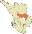
 Daerah Klang Highlighted in the State of Selangor, Malaysia.svg 409 × 440; 320 KB
-
 Klang District Selangor Municipalities Klang Highlighted.svg 978 × 532; 42 KB
-
 Map of Klang District, Selangor.svg 728 × 666; 1.46 MB
-
 Mukims of Klang District, Selangor.png 729 × 565; 9 KB
-

-
 Map of Kuala Langat District, Selangor.svg 717 × 596; 7.64 MB
-

-
 Map of Kuala Selangor District, Selangor.svg 637 × 764; 8.43 MB
-
 Daerah Petaling Highlighted in the State of Selangor, Malaysia.svg 409 × 440; 25 KB
-
 District of Petaling, Selangor.png 194 × 163; 44 KB
-
 Map of Petaling District, Selangor.svg 1,066 × 834; 4.02 MB
-

-

-

-

-
 Map of Sabak Bernam District, Selangor.svg 1,036 × 735; 682 KB
-
 Selangor districts numbered.svg 409 × 440; 40 KB
-
 Daerah Sepang Highlighted in the State of Selangor, Malaysia.svg 409 × 440; 26 KB
-
 Map of Sepang District, Selangor.svg 462 × 768; 1.2 MB


