Category:Distance indicators in Pakistan
Jump to navigation
Jump to search
Subcategories
This category has the following 2 subcategories, out of 2 total.
M
Media in category "Distance indicators in Pakistan"
The following 28 files are in this category, out of 28 total.
-
 0 Point towards Moola.jpg 4,000 × 3,000; 3.84 MB
-
 2007 08 21 China Pakistan Karakoram Highway Khunjerab Pass IMG 7336.jpg 1,024 × 643; 399 KB
-
 2007 08 21 China Pakistan Karakoram Highway Khunjerab Pass IMG 7354.jpg 1,024 × 643; 391 KB
-
 2007 08 24 Pakistan -Karakoram Highway Gilgit IMG 8402.jpg 1,024 × 683; 406 KB
-
 2007 08 25 Pakistan Karakoram Highway IMG 8582.jpg 1,024 × 683; 439 KB
-
 A loaded donkey in teru ghizer district.jpg 3,264 × 2,240; 3.61 MB
-
 A road-sign on way to Khunjerab.jpg 1,024 × 768; 237 KB
-
 Ancient Bazira Barikot Swat Kp Pakistan (2).jpg 1,600 × 1,200; 648 KB
-
 Army Check Post Meny.jpg 1,500 × 1,919; 498 KB
-
 Astore versus Gilgit.jpg 5,312 × 2,988; 8.11 MB
-
 Astride road Skardu-Shigar. A board explaining the attractions in Shigar Valley.jpg 1,967 × 2,390; 1.22 MB
-
 Beauty and Nature of Pakistan 38.jpg 2,560 × 1,536; 1.34 MB
-
 Drive in Clouds 5 (3211898549).jpg 1,280 × 1,024; 147 KB
-
 Flickr - boellstiftung - Wegweiser Lahore.jpg 3,456 × 2,592; 2.47 MB
-
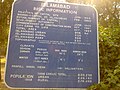 Islamabad info board.jpg 1,600 × 1,200; 277 KB
-
 Khunjerab Pass Road.jpg 5,989 × 3,983; 5.42 MB
-
 Landmark Domel.JPG 2,304 × 1,728; 1.72 MB
-
 LOHARBANDA KAGHAN VALLEY PAKISTAN.jpg 3,648 × 2,736; 1.31 MB
-
 Malik Liaqat Ali5.JPG 2,848 × 2,136; 1.48 MB
-
 Milestone & Map at Babusar Top.jpg 4,608 × 3,072; 6.24 MB
-
 Milestone near Wagah Border.JPG 1,904 × 2,527; 1.43 MB
-

-
 Quetta to Moola Bike Tour.jpg 4,000 × 3,000; 3.32 MB
-
 Road (N-15) in Khyber Pakhtunkhwa.jpg 800 × 600; 261 KB
-
 Road to Chakothi.jpg 2,592 × 1,944; 1.4 MB
-
 Skardu Turnoff from KKH - panoramio.jpg 1,600 × 1,200; 1.02 MB
-
 The Location Pointer.JPG 2,304 × 3,456; 934 KB
-
 Tomb of Shihab.JPG 2,048 × 1,536; 652 KB


.jpg)


.jpg)


_in_Khyber_Pakhtunkhwa.jpg)


