Category:Disley
Jump to navigation
Jump to search
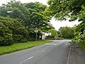
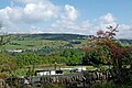
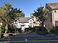
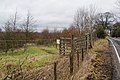
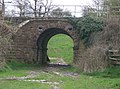
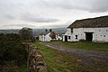
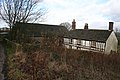
English: Disley is a village and civil parish in the unitary authority of Cheshire East and the ceremonial county of Cheshire, England. It is located on the very edge of the Peak District, in the Goyt Valley, very close to the county boundary with Derbyshire at New Mills, and south of Stockport, Greater Manchester. To the north of the village, the River Goyt and the Peak Forest Canal, which opened in 1800, passes along the edge of the village. Today it is a dormitory village retaining a semi-rural character.
Nederlands: Disley is een plaats in het bestuurlijke gebied Macclesfield, in het Engelse graafschap Cheshire. De plaats telt 4301 inwoners.
civil parish in Cheshire East, England  | |||||
| Upload media | |||||
| Instance of | |||||
|---|---|---|---|---|---|
| Location | Cheshire East, Cheshire, North West England, England | ||||
| Different from | |||||
 | |||||
Subcategories
This category has the following 8 subcategories, out of 8 total.
B
- Bollinhurst Reservoir (3 F)
D
- Disley Methodist Church (4 F)
- Disley railway station (7 F)
- Disley Tunnel (3 F)
- Disley War Memorial (6 F)
M
- St Mary's Church, Disley (8 F)
P
- Pubs in Disley (22 F)
Media in category "Disley"
The following 200 files are in this category, out of 239 total.
(previous page) (next page)-
 "Come in Duck Number 11 - your time is up" - geograph.org.uk - 4650953.jpg 4,608 × 3,456; 3.9 MB
-
 11 Jackson's Edge Road, Disley.JPG 1,200 × 900; 238 KB
-
 17 Buxton Old Road, Disley.JPG 1,200 × 900; 236 KB
-
 1898 Milestone - geograph.org.uk - 5602311.jpg 865 × 2,091; 1.12 MB
-
 32 Buxton Old Road, Disley.JPG 1,200 × 900; 309 KB
-
 37 Buxton Old Road, Disley.JPG 1,200 × 900; 337 KB
-
 A choice of footpaths with a distant view of Manchester - geograph.org.uk - 2741687.jpg 2,592 × 1,944; 1.62 MB
-
 Above Redmoor Farm looking towards New Mills - geograph.org.uk - 4670820.jpg 3,072 × 1,728; 2.12 MB
-
 Across the Goyt Valley near New Mills, Derbyshire - geograph.org.uk - 6257438.jpg 1,440 × 960; 1.55 MB
-
 Across the Goyt Valley near New Mills, Derbyshire - geograph.org.uk - 6257533.jpg 1,600 × 900; 1.72 MB
-
 Across the Goyt Valley north of Danebank in Cheshire - geograph.org.uk - 6258086.jpg 1,280 × 960; 1.49 MB
-
 Airshafts, Disley Tunnel - geograph.org.uk - 2748479.jpg 1,200 × 800; 195 KB
-
 Albert House - Buxton Road - geograph.org.uk - 5360563.jpg 1,600 × 1,200; 481 KB
-
 An old car or two - geograph.org.uk - 2275777.jpg 3,648 × 2,736; 5.64 MB
-
 An unusual garden - geograph.org.uk - 4670840.jpg 3,072 × 1,728; 1.85 MB
-
 Approaching Disley - geograph.org.uk - 4673798.jpg 800 × 533; 108 KB
-
 Barn at the junction of Green Lane and Long Lane - geograph.org.uk - 2741685.jpg 2,592 × 1,944; 1.62 MB
-

-
 Barney Storey's Golden Postbox in Disley - geograph.org.uk - 3145730.jpg 640 × 853; 963 KB
-
 Bentside Farm - geograph.org.uk - 2824960.jpg 3,872 × 2,592; 3.46 MB
-
 Bollinhurst Bridge - geograph.org.uk - 1134770.jpg 640 × 480; 178 KB
-
 Brines Farmhouse, Disley.JPG 1,200 × 900; 238 KB
-
 Brookside Farm - geograph.org.uk - 4273.jpg 640 × 476; 272 KB
-
 Buxton Old Road - geograph.org.uk - 2548762.jpg 640 × 427; 100 KB
-
 Buxton Old Road - geograph.org.uk - 3994979.jpg 640 × 480; 106 KB
-
 Buxton Old Road - geograph.org.uk - 3995045.jpg 640 × 480; 67 KB
-
 Buxton Old Road - geograph.org.uk - 3995053.jpg 640 × 480; 79 KB
-
 Buxton Road filling station - geograph.org.uk - 2573687.jpg 640 × 480; 71 KB
-
 Buxton Road West - geograph.org.uk - 2573703.jpg 640 × 480; 90 KB
-
 Cheshire pasture and woodland north-east of Disley - geograph.org.uk - 6258133.jpg 1,080 × 1,440; 1.69 MB
-
 Cheshire pasture north-east of Disley - geograph.org.uk - 6258121.jpg 1,440 × 960; 1.35 MB
-
 Cheshire pasture north-east of Disley - geograph.org.uk - 6258128.jpg 1,440 × 1,080; 1.59 MB
-
 Cliff, a farmstead on Whaley Moor - geograph.org.uk - 2274831.jpg 3,648 × 2,736; 5.18 MB
-
 Cock Knoll Farm - geograph.org.uk - 4650951.jpg 3,730 × 3,232; 2.65 MB
-
 Cockhead - geograph.org.uk - 4650992.jpg 4,608 × 3,456; 4.32 MB
-
 Country Lane near Disley - geograph.org.uk - 4673788.jpg 800 × 533; 140 KB
-
 Covered reservoir, Disley - geograph.org.uk - 2748498.jpg 800 × 1,200; 199 KB
-
 Cows feeding by Whaley Lane - geograph.org.uk - 2816891.jpg 3,872 × 2,592; 4.94 MB
-
 Derbyshire, Please Watch Your Speed - geograph.org.uk - 3144156.jpg 640 × 480; 588 KB
-
 Derelict Barn in Mather Clough - geograph.org.uk - 4650923.jpg 4,608 × 3,456; 3.6 MB
-
 Diglee - geograph.org.uk - 2667009.jpg 640 × 427; 73 KB
-
 Disley - geograph.org.uk - 2471559.jpg 640 × 471; 108 KB
-
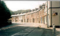 Disley - The Crescent.jpg 640 × 384; 69 KB
-
 Disley Baptist Church - geograph.org.uk - 2824994.jpg 3,872 × 2,592; 3.73 MB
-
 Disley Baptist Church - geograph.org.uk - 3145709.jpg 640 × 480; 407 KB
-
 Disley Fountain - geograph.org.uk - 5602113.jpg 1,280 × 1,726; 1.47 MB
-
 Disley Fountain - geograph.org.uk - 5602262.jpg 1,280 × 1,838; 1.36 MB
-
 Disley from the Brook Bottom road - geograph.org.uk - 4297298.jpg 1,800 × 1,350; 262 KB
-
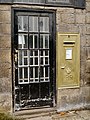
 Disley gold pillar box 16-02-2013.JPG 2,592 × 3,872; 6.11 MB
-
 Disley gold postbox 11-09-2012.JPG 2,592 × 3,872; 5.87 MB
-
 Disley Hall - geograph.org.uk - 436624.jpg 480 × 360; 41 KB
-
 Disley in 2005.jpg 640 × 480; 150 KB
-
 Disley PO & Van 11-09-2012.JPG 3,872 × 2,592; 4.5 MB
-
 Disley PO 11-09-2012.JPG 2,592 × 3,872; 5.31 MB
-
 Disley PO 16-02-2013.JPG 2,592 × 3,872; 5.09 MB
-
 Disley Rural District, Cheshire (1970).svg 1,410 × 1,018; 385 KB
-
 Disley, Co-operative Food - geograph.org.uk - 4293910.jpg 1,024 × 768; 126 KB
-
 Disley, Fountain Square - geograph.org.uk - 4293925.jpg 1,024 × 768; 138 KB
-
 Disley, railway bridge - geograph.org.uk - 4293972.jpg 1,024 × 768; 221 KB
-
 Disley, railway lines - geograph.org.uk - 4293904.jpg 1,024 × 768; 192 KB
-
 Disley, stile - geograph.org.uk - 4293958.jpg 1,024 × 756; 213 KB
-
 Disley, street furniture - geograph.org.uk - 4293935.jpg 1,024 × 768; 159 KB
-
 Disley, toilet - geograph.org.uk - 4293941.jpg 1,024 × 764; 145 KB
-
 Dissop Head - geograph.org.uk - 3799063.jpg 3,888 × 2,157; 1.45 MB
-
 Dryhurst Lodge, Disley.JPG 1,200 × 900; 346 KB
-
 Entrance to Lyme Park - geograph.org.uk - 3994964.jpg 640 × 480; 90 KB
-
 Entrance to Redmoor Farm - geograph.org.uk - 3988883.jpg 3,821 × 2,409; 1.98 MB
-
 Entrance to Sports Centre - geograph.org.uk - 2535831.jpg 3,648 × 2,736; 5.98 MB
-
 Extension of Parish Hall, Disley.JPG 900 × 1,200; 256 KB
-
 Farm at Bollinhurst - geograph.org.uk - 88112.jpg 640 × 480; 153 KB
-
-
 Farmland north-east of Danebank in Cheshire - geograph.org.uk - 6257660.jpg 1,440 × 960; 1.36 MB
-
 Field by the railway line - geograph.org.uk - 4265518.jpg 461 × 640; 81 KB
-
 Fishing pond near Dissop Head - geograph.org.uk - 2823568.jpg 3,872 × 2,592; 4.84 MB
-
 Flooded field in the Goyt Valley - geograph.org.uk - 2825002.jpg 3,872 × 2,592; 4.19 MB
-
 Fog on the Black Hill - geograph.org.uk - 6023334.jpg 5,762 × 3,939; 3.51 MB
-
 Footpath at Disley Golf Course - geograph.org.uk - 2142771.jpg 640 × 480; 169 KB
-
 Footpath near Cock Knoll Farm - geograph.org.uk - 4650955.jpg 3,653 × 2,954; 2.43 MB
-
 Footpath towards Danebank - geograph.org.uk - 2168107.jpg 640 × 480; 149 KB
-
 Footpath towards Seven Springs - geograph.org.uk - 2142791.jpg 640 × 480; 142 KB
-
 Footpath up Black Hill on Whaley Moor - geograph.org.uk - 2096170.jpg 640 × 480; 167 KB
-
 Fountain inscription - geograph.org.uk - 5602274.jpg 1,280 × 1,342; 1.38 MB
-
 Fountain Square - geograph.org.uk - 5600990.jpg 1,280 × 960; 874 KB
-
 Fountain Square Disley - geograph.org.uk - 4754282.jpg 1,024 × 768; 132 KB
-
 Fountain, Disley.jpg 800 × 1,200; 190 KB
-
 Foxholes, Disley.JPG 1,200 × 900; 238 KB
-
 Friend's Meeting House, Disley.jpg 1,200 × 800; 199 KB
-
 Gate piers to Lyme Park in Red Lane, Disley.jpg 4,000 × 3,000; 5.94 MB
-
 Geese near Moorside Grange Hotel - geograph.org.uk - 2823570.jpg 3,872 × 2,592; 4.67 MB
-
 Gold large wall box @ Disley PO 11-09-2012.JPG 2,592 × 3,872; 5.3 MB
-
 Gold Postbox (SK12 371) - geograph.org.uk - 5602875.jpg 1,280 × 1,527; 1.51 MB
-
 Grazing and woodland - geograph.org.uk - 3994953.jpg 480 × 640; 111 KB
-
 Grazing north of Buxton Old Road - geograph.org.uk - 3995049.jpg 640 × 480; 60 KB
-
 Grazing off Buxton Old Road - geograph.org.uk - 3995055.jpg 640 × 480; 53 KB
-
 Grazing, Higher Disley - geograph.org.uk - 3994985.jpg 640 × 480; 81 KB
-
 Green Lane - geograph.org.uk - 2823590.jpg 3,872 × 2,592; 5.45 MB
-
 Green Lane, Higher Disley - geograph.org.uk - 4670843.jpg 3,072 × 1,728; 1.6 MB
-

-

-
 Gritstone Trail, alternative route, ruined barn - geograph.org.uk - 2133533.jpg 1,024 × 681; 230 KB
-
 Hagg Bank Farm, Disley.JPG 800 × 1,200; 198 KB
-
 Hague Bridge 2.JPG 1,800 × 1,200; 460 KB
-
 Hague Bridge.jpg 3,648 × 2,736; 5.78 MB
-
 Hairpin bend in the Disley to Hague Bar road - geograph.org.uk - 3474673.jpg 4,320 × 3,240; 4.74 MB
-
 High Peak from Chantry Road Disley.jpg 4,032 × 1,674; 1.67 MB
-
 High Peak School - geograph.org.uk - 4670772.jpg 2,764 × 1,448; 1.24 MB
-
 High Peak School - geograph.org.uk - 4673759.jpg 800 × 533; 102 KB
-
 Hill View House - Dissop Head - geograph.org.uk - 4650940.jpg 4,608 × 3,456; 4.32 MB
-
 Hill View House - geograph.org.uk - 4673765.jpg 800 × 524; 119 KB
-
 Hillview House - geograph.org.uk - 4670795.jpg 3,072 × 1,728; 1.94 MB
-

-
 House at Woodend - geograph.org.uk - 3144201.jpg 640 × 480; 530 KB
-
 If only all path diversions were as polite - geograph.org.uk - 2275759.jpg 3,648 × 2,736; 5.57 MB
-
 In the (very, if you ask me) rough - geograph.org.uk - 2275731.jpg 3,648 × 2,736; 5.88 MB
-
 Jacksons Edge road Disley - geograph.org.uk - 4754283.jpg 1,024 × 648; 143 KB
-
 Junction of Old Buxton Road and Market Street, Disley - geograph.org.uk - 3080494.jpg 4,000 × 2,500; 1.72 MB
-
 K6 Telephone kiosk, Disley.JPG 900 × 1,200; 326 KB
-
 Lane Ends Farm, Higher Disley.JPG 1,200 × 900; 211 KB
-
 Lane Head Farmhouse.JPG 1,200 × 900; 162 KB
-
 Library Gardens - geograph.org.uk - 5602829.jpg 1,280 × 960; 998 KB
-
 Light Alders Lane - geograph.org.uk - 3994958.jpg 640 × 480; 121 KB
-
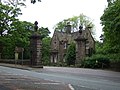
 Lodge at the entrance to Lyme Park - geograph.org.uk - 2401818.jpg 640 × 463; 104 KB
-
 Lodge by the Red Lane entrance to Lyme Park - geograph.org.uk - 2741689.jpg 2,592 × 1,944; 1.26 MB
-
 Lodge, Lyme Park.jpg 4,000 × 3,000; 3.21 MB
-
 Long Lane - geograph.org.uk - 2823621.jpg 3,872 × 2,592; 4.65 MB
-
 Longside Reservoir - geograph.org.uk - 2816885.jpg 3,872 × 2,592; 4.53 MB
-
 Lower Greenshall, Disley.JPG 1,200 × 900; 285 KB
-
 Lyme Gate Cottage, Disley.jpg 4,000 × 3,000; 6.33 MB
-

-
 Lyme Park - geograph.org.uk - 3488750.jpg 4,592 × 3,056; 7.82 MB
-
 Lyme Park, view northeast from the Cage - geograph.org.uk - 2237801.jpg 1,024 × 681; 94 KB
-
 Marker "William Wood, Eyam, Derbyshire, here murdered" - geograph.org.uk - 1589477.jpg 1,014 × 1,601; 212 KB
-
 Market Street junction - geograph.org.uk - 2573693.jpg 640 × 480; 79 KB
-
 Meeting of paths - geograph.org.uk - 2823582.jpg 3,872 × 2,592; 5.87 MB
-
 Memorial to William Wood, murdered on this spot - geograph.org.uk - 2730982.jpg 1,024 × 768; 258 KB
-
 Milestone adjacent to The Fountain, Disley.JPG 900 × 1,200; 217 KB
-
 Milestone at Disley - geograph.org.uk - 5602180.jpg 1,280 × 1,949; 1.73 MB
-
 Moore's Buildings, Disley.JPG 900 × 1,200; 293 KB
-
 Moored narrowboats north of Danebank in Cheshire - geograph.org.uk - 6258063.jpg 960 × 1,280; 1.36 MB
-
 Moorside Grange Hotel - geograph.org.uk - 4101112.jpg 3,736 × 2,491; 1.41 MB
-
 Moorside Grange Hotel - geograph.org.uk - 4703446.jpg 3,888 × 1,968; 1.48 MB
-
 Moorside Grange, hotel and spa - geograph.org.uk - 2275724.jpg 3,648 × 2,736; 4.52 MB
-
 Moorwood Farm - geograph.org.uk - 2242071.jpg 2,500 × 1,847; 2.89 MB
-
 Moorwood Farm - geograph.org.uk - 2816672.jpg 3,872 × 2,592; 5.16 MB
-
 Moorwood reservoir - geograph.org.uk - 2242080.jpg 2,500 × 1,184; 1.75 MB
-
 Muddy footpath near the end of Green Lane - geograph.org.uk - 2823584.jpg 3,872 × 2,592; 6.79 MB
-
 Murder stone (775980587).jpg 1,024 × 683; 243 KB
-
 Muslin Row, Higher Disley.JPG 1,200 × 900; 203 KB
-
 New house under construction - geograph.org.uk - 2823536.jpg 3,872 × 2,592; 5.1 MB
-
 North Lodge - Lyme Park - geograph.org.uk - 4650999.jpg 4,608 × 3,456; 4.32 MB
-
 Nos 12, 14 and 16, Buxton Old Road, Disley.JPG 4,000 × 3,000; 1.37 MB
-
 Old bath - geograph.org.uk - 2548763.jpg 427 × 640; 130 KB
-

-
 Old stone barn at Lane Ends Farm - geograph.org.uk - 4670835.jpg 3,072 × 1,728; 1.06 MB
-
 On Buxton Road West (A6) - geograph.org.uk - 3994966.jpg 640 × 480; 95 KB
-
 On the Gritstone Trail - geograph.org.uk - 4670813.jpg 3,072 × 1,728; 1.97 MB
-
 On the Gritstone Trail - geograph.org.uk - 4673796.jpg 800 × 533; 133 KB
-
 Panorama over Furness Vale - geograph.org.uk - 5816876.jpg 12,000 × 2,355; 6.65 MB
-
 Pasture and housing west of Newtown, Cheshire - geograph.org.uk - 4309503.jpg 1,280 × 795; 578 KB
-
 Pasture and housing west of Newtown, Cheshire - geograph.org.uk - 4309654.jpg 1,024 × 681; 432 KB
-
 Path on the side of Whaley Moor - geograph.org.uk - 2817702.jpg 3,872 × 2,592; 4.47 MB
-
 Path through the Millennium Wood - geograph.org.uk - 2823575.jpg 3,872 × 2,592; 6.01 MB
-
 Paths and bridleway south of Disley - geograph.org.uk - 2275753.jpg 3,648 × 2,736; 5.79 MB
-

-
-
 RBS Bank, Disley - geograph.org.uk - 5600527.jpg 1,280 × 1,083; 1.15 MB
-
 Real and imitation swans - geograph.org.uk - 4673762.jpg 800 × 533; 132 KB
-
 Red Moor Farm.jpg 3,456 × 2,304; 2.86 MB
-
 Redmoor Farm - geograph.org.uk - 2816850.jpg 3,872 × 2,592; 4.48 MB
-
 Redmoor Farm - geograph.org.uk - 3557721.jpg 1,024 × 768; 727 KB
-
 Redmoor Farm - geograph.org.uk - 4670827.jpg 3,072 × 1,728; 1.76 MB
-
 Redmoor Farm - geograph.org.uk - 4673802.jpg 800 × 533; 119 KB
-
 Redmoor Farm near Disley, Cheshire - geograph.org.uk - 5232542.jpg 5,184 × 2,920; 1.5 MB
-
 Reservoir works, seen from Lyme Park - geograph.org.uk - 2135327.jpg 1,024 × 681; 161 KB
-
 Right of way to Cockhead - geograph.org.uk - 2231834.jpg 800 × 600; 145 KB
-
 River Goyt - geograph.org.uk - 3144164.jpg 640 × 481; 710 KB
-
 River Goyt, Woodend - geograph.org.uk - 3144166.jpg 640 × 481; 655 KB
-
 Ryles Wood - geograph.org.uk - 266885.jpg 640 × 480; 181 KB
-
 Sarah Storey's Gold Postbox, Disley - geograph.org.uk - 3145726.jpg 640 × 640; 928 KB
-
 Schoolhouse Surgery, Disley.JPG 1,200 × 900; 208 KB
-
 Sheep grazing - geograph.org.uk - 4265530.jpg 520 × 640; 83 KB
-
 Sheep grazing at Bentside Farm - geograph.org.uk - 4673791.jpg 800 × 533; 137 KB
-
 Sheep within a field - geograph.org.uk - 2666986.jpg 640 × 427; 110 KB
-
 Shops on Fountain Square, Disley - geograph.org.uk - 3994973.jpg 640 × 480; 66 KB
-
 Stanley Hall - geograph.org.uk - 2748490.jpg 1,200 × 800; 200 KB
-
 Stanley Hall and adjoining barn.jpg 3,456 × 2,304; 4.35 MB
-
 Stanley Hall Disley post renovation 2016 - geograph.org.uk - 5967756.jpg 1,600 × 1,200; 428 KB
-
 Stanley Hall Disley post renovation 2016 - geograph.org.uk - 5967757.jpg 1,600 × 1,200; 363 KB
-
 Stanley Hall Disley post renovation 2016 - geograph.org.uk - 5967760.jpg 1,600 × 900; 376 KB
-
 Stanley Hall, Disley.jpg 3,648 × 2,736; 6.2 MB
-
 Start of the Gritstone Trail at Disley - geograph.org.uk - 281269.jpg 640 × 480; 189 KB
-
 Stile on a path near Bolder Hall - geograph.org.uk - 2275737.jpg 3,648 × 2,736; 5.1 MB
-
 Stone Barn, Lane Ends Farm - geograph.org.uk - 3995048.jpg 640 × 480; 67 KB
-
 Stone wall and bank - geograph.org.uk - 3995052.jpg 480 × 640; 86 KB
-
 Surprise for birdwatchers at Dissop Head Farm - geograph.org.uk - 3496705.jpg 2,048 × 1,536; 551 KB
-
 The Chantry House, Disley.JPG 1,200 × 900; 359 KB
-
 The Cottage at Disley Hall Farm.JPG 1,200 × 900; 206 KB
-
 The Crescent, Disley - geograph.org.uk - 2824980.jpg 3,872 × 2,592; 4.54 MB
-
 The Fountain, Disley.JPG 900 × 1,200; 242 KB
-
 The Grey Cottage, Disley.JPG 1,200 × 900; 306 KB


.svg)


_-_geograph.org.uk_-_5602875.jpg)


_rough_-_geograph.org.uk_-_2275731.jpg)


.jpg)


_-_geograph.org.uk_-_3994966.jpg)


