Category:Dirt roads in Aberdeen
Jump to navigation
Jump to search
Council areas (municipalities) of Scotland: Aberdeen · Aberdeenshire · Angus · Argyll and Bute · Clackmannanshire · Dumfries and Galloway · East Ayrshire · East Dunbartonshire · East Lothian · East Renfrewshire · Edinburgh · Falkirk · Fife · Glasgow · Highland · Inverclyde · Midlothian · Moray · North Ayrshire · North Lanarkshire · Outer Hebrides · Orkney Islands · Perth and Kinross · Renfrewshire · Scottish Borders · Shetland Islands · South Ayrshire · South Lanarkshire · Stirling · West Dunbartonshire · West Lothian

Media in category "Dirt roads in Aberdeen"
The following 7 files are in this category, out of 7 total.
-
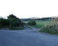 Access to Benthoul - geograph.org.uk - 586372.jpg 640 × 508; 76 KB
-
 Farm track east towards West Lasts - geograph.org.uk - 607017.jpg 480 × 640; 92 KB
-
 Farm track going west from West Lasts - geograph.org.uk - 607011.jpg 640 × 480; 81 KB
-
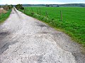
 Road to East Cairnton - geograph.org.uk - 575435.jpg 640 × 480; 122 KB
-
 Track to Leuchar Farm - geograph.org.uk - 662128.jpg 633 × 475; 124 KB
-
 Track to Meikle Eddieston - geograph.org.uk - 585574.jpg 640 × 480; 65 KB
-
 Track to Meikle Eddieston - geograph.org.uk - 586148.jpg 640 × 458; 51 KB


