Category:Dippal Burn
Jump to navigation
Jump to search
river in East Ayrshire, Scotland, UK; its confluence with Slot Burn forms Greenock Water | |||||
| Upload media | |||||
| Instance of | |||||
|---|---|---|---|---|---|
| Location | East Ayrshire, Scotland | ||||
| Connects with |
| ||||
| Elevation above sea level |
| ||||
| Mouth of the watercourse |
| ||||
 | |||||
Media in category "Dippal Burn"
The following 14 files are in this category, out of 14 total.
-
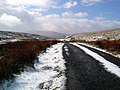 After the snow - geograph.org.uk - 735810.jpg 640 × 480; 83 KB
-
 Bothy above the Dippal Burn - geograph.org.uk - 735718.jpg 640 × 480; 79 KB
-
 Dippal bothy - geograph.org.uk - 735723.jpg 640 × 480; 67 KB
-
 Dippal Burn - geograph.org.uk - 137438.jpg 640 × 480; 80 KB
-
 Dippal Burn - geograph.org.uk - 137439.jpg 640 × 480; 75 KB
-
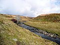
 Looking down the Dippal Burn - geograph.org.uk - 735704.jpg 640 × 480; 102 KB
-
 Looking down the Dippal Burn - geograph.org.uk - 735726.jpg 640 × 480; 76 KB
-
 Pool by the track up the Dippal Burn - geograph.org.uk - 735710.jpg 640 × 480; 75 KB
-

-

-
 Small bridge over the Dippal Burn - geograph.org.uk - 735742.jpg 640 × 480; 91 KB
-
 Small bridge over the Dippal Burn - geograph.org.uk - 735839.jpg 640 × 480; 100 KB
-
 The Dippal Burn - geograph.org.uk - 735733.jpg 640 × 480; 83 KB
-
 View along the Dippal Burn and track - geograph.org.uk - 735826.jpg 640 × 480; 100 KB


