Category:Dietfurt SG
Jump to navigation
Jump to search
| Object location | | View all coordinates using: OpenStreetMap |
|---|
village of Switzerland | |||||
| Upload media | |||||
| Instance of | |||||
|---|---|---|---|---|---|
| Location | |||||
| Elevation above sea level |
| ||||
 | |||||
Subcategories
This category has the following 3 subcategories, out of 3 total.
D
- Dietfurt railway station (4 F)
K
- Kengelbach (1 F)
Media in category "Dietfurt SG"
The following 20 files are in this category, out of 20 total.
-
 ETH-BIB-Bütschwil-LBS H1-009799.tif 6,259 × 4,352; 78.13 MB
-

-

-
 ETH-BIB-Dietfurt v. S. aus 200 m-Inlandflüge-LBS MH01-002554.tif 6,391 × 4,522; 82.82 MB
-
 ETH-BIB-Dietfurt, Bütschwil, Soorze v. S. aus 100 m-Inlandflüge-LBS MH01-002556.tif 6,435 × 4,663; 86 MB
-

-
 ETH-BIB-Dietfurt, Schönenberger AG, Weberei-Inlandflüge-LBS MH03-1194.tif 6,650 × 4,637; 88.23 MB
-
 ETH-BIB-Dietfurt, Weberei Toggenburg, ehemals Appretur-Inlandflüge-LBS MH03-1668.tif 6,096 × 4,230; 73.9 MB
-
 ETH-BIB-Dietfurt-LBS H1-009243.tif 6,435 × 4,426; 81.63 MB
-
 ETH-BIB-Dietfurt-LBS H1-012717.tif 6,727 × 4,655; 89.7 MB
-
 ETH-BIB-Dietfurt-LBS H1-018613.tif 6,754 × 4,688; 90.73 MB
-
 ETH-BIB-Dietfurt-LBS H1-021421.tif 6,097 × 4,255; 74.27 MB
-
 ETH-BIB-Dietfurt-LBS H1-027885.tif 6,682 × 4,664; 89.21 MB
-
 ETH-BIB-Dietfurt-LBS H1-027899.tif 6,625 × 4,699; 89.11 MB
-
 Landstrasse Brücke über die Thur, Dietfurt SG 20190726-jag9889.jpg 4,608 × 3,456; 10.66 MB
-
 Sonnenb.jpg 1,280 × 853; 260 KB
-
 Umfahrung Brütschwil Brücke bei Michelau über die Thur, Dietfurt SG 20190726-jag9889.jpg 4,608 × 3,456; 13.16 MB
-
 Umfahrung Brütschwil Brücke über die Thur, Dietfurt SG 20190726-jag9889.jpg 4,608 × 3,456; 11.22 MB
-
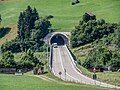
 Umfahrungsstrasse Bütschwil Neudietfurt.jpg 5,184 × 3,456; 9.47 MB
-
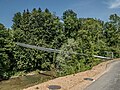 Wasserleitungsbrücke über die Thur, Dietfurt SG 20190726-jag9889.jpg 4,608 × 3,456; 12.37 MB


