Category:Diagrams of fluvial geomorphology
Jump to navigation
Jump to search
Subcategories
This category has the following 8 subcategories, out of 8 total.
Media in category "Diagrams of fluvial geomorphology"
The following 26 files are in this category, out of 26 total.
-

-
 Aggradation.png 1,700 × 1,700; 69 KB
-
 Aggradation.svg 600 × 600; 509 KB
-
 Alluvial plain general.PNG 720 × 960; 223 KB
-
 Breg.jpg 939 × 1,279; 162 KB
-
 BurbankRiverModel.jpg 3,508 × 2,480; 1.28 MB
-
 Delta sezione longitudinale.png 905 × 623; 14 KB
-
 FFM Kalbach (Nidda) Einzugsgebiet-Grafiken FoP.de.jpg 1,647 × 1,143; 933 KB
-
 FleuveJaune-01.png 10,883 × 4,741; 652 KB
-
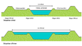
 Floodplain and River Depositional Environment.jpg 2,736 × 1,824; 1.14 MB
-
 Flussordnung (Shreve).JPG 329 × 198; 10 KB
-
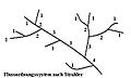 Flussordnung (Strahler).JPG 329 × 198; 9 KB
-
 Flussordnung (Strahler).svg 310 × 198; 8 KB
-
 Fluvial erosion directions.svg 1,502 × 1,010; 17 KB
-
 Geomorphology of Old River.jpg 959 × 847; 153 KB
-
 Hydrogeomorphic.jpg 925 × 456; 118 KB
-
 Lits d'un fleuve.png 825 × 388; 6 KB
-
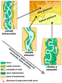
 PEAT&COAL IN FLUVIAL ENV(MEANDER).png 1,280 × 720; 293 KB
-
 PSM V02 D683 Terraced river valley.jpg 1,508 × 472; 55 KB
-
 PSM V02 D684 Pebbles in stream bed.jpg 1,287 × 169; 23 KB
-
 Rivierbedding fr.png 1,324 × 755; 294 KB
-
 Shreve-stream-order.png 1,346 × 614; 37 KB
-
 Strahler-tree.gif 299 × 262; 4 KB
-
 Verhang.GIF 745 × 378; 18 KB
-
 Victoria Falls National Park marker.jpg 2,988 × 5,312; 2.76 MB
-
 Wasserfall schaubild.svg 487 × 214; 38 KB
.jpg)


_Einzugsgebiet-Grafiken_FoP.de.jpg)


.JPG)
.JPG)
.svg)


.png)


