Category:Diagrams of Mount Everest
Jump to navigation
Jump to search
Subcategories
This category has only the following subcategory.
H
- Mount Everest height comparisons (27 F)
Media in category "Diagrams of Mount Everest"
The following 13 files are in this category, out of 13 total.
-
 1963 American Everest expedition.svg 771 × 883; 8.21 MB
-

-
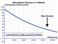 Altitude and air pressure & Everest.jpg 1,764 × 1,344; 524 KB
-
 Everest-3D-Map-No-Type.jpg 5,000 × 3,750; 4.08 MB
-
 Everest-3D-Map-Type-EN.jpg 5,000 × 3,750; 4.28 MB
-
 Everest-3D-Map-Type-ES.jpg 5,000 × 3,750; 4.29 MB
-
 Everest-Nordwand.jpg 626 × 555; 32 KB
-
 EverestAscents.svg 1,300 × 975; 11 KB
-
 Mount Everest, pre-1975 climbing routes on Southwest Face.svg 1,538 × 2,380; 72 KB
-
 Mount Everest, pre-1976 climbing routes on Southwest Face.svg 1,538 × 2,380; 84 KB
-
 Mount Everest,1975 climbing route on Southwest Face.svg 1,538 × 2,380; 67 KB
-
 Mount Everest,1975 climbing route on Southwest Face.svg-az.png 387 × 599; 77 KB
-
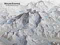 Panoramakarte Mount Everest.jpg 5,000 × 3,750; 6.39 MB


.jpg)