Category:Dewlish
Jump to navigation
Jump to search
English: Dewlish is a village in Dorset, England, seven miles north east of Dorchester in the Dorset Area of Outstanding Natural Beauty (AONB). The village has a population of 254 (2001).
village and civil parish in Dorset, United Kingdom  | |||||
| Upload media | |||||
| Instance of | |||||
|---|---|---|---|---|---|
| Location | Dorset, South West England, England | ||||
| Said to be the same as | Dewlish (Wikimedia duplicated page, civil parish) | ||||
 | |||||
Subcategories
This category has the following 3 subcategories, out of 3 total.
A
D
- Dewlish Park (4 F)
- Dewlish War Memorial (3 F)
Media in category "Dewlish"
The following 92 files are in this category, out of 92 total.
-
 A354 towards Dorchester - geograph.org.uk - 5964540.jpg 1,024 × 684; 199 KB
-
 Badger sett - geograph.org.uk - 2433293.jpg 640 × 480; 146 KB
-
 Badger Setts on Lord's Down - geograph.org.uk - 423895.jpg 640 × 480; 182 KB
-
 Barn at Chebbard Farm - geograph.org.uk - 2433740.jpg 640 × 480; 102 KB
-
 Beacon for Queen's Diamond Jubilee - geograph.org.uk - 2966567.jpg 640 × 480; 70 KB
-
 Bridle Path - geograph.org.uk - 2433330.jpg 640 × 480; 96 KB
-
 Bridle Path near Chebbards Farm - geograph.org.uk - 1320773.jpg 640 × 480; 142 KB
-
 Bridleway near Dewlish - geograph.org.uk - 1013367.jpg 480 × 640; 126 KB
-
 Bridleway, Park Hill - geograph.org.uk - 1013376.jpg 640 × 480; 163 KB
-
 Caterpillars - geograph.org.uk - 2433765.jpg 640 × 455; 112 KB
-
 Chebbard Farm - geograph.org.uk - 4990258.jpg 1,600 × 1,065; 708 KB
-
 Cheselbourne West Down - geograph.org.uk - 2433288.jpg 640 × 480; 85 KB
-
 Churchyard, Dewlish - geograph.org.uk - 1013181.jpg 640 × 480; 133 KB
-
 Communication Mast, Whitelands Down - geograph.org.uk - 2966571.jpg 640 × 480; 47 KB
-
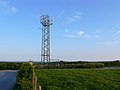 Communications Mast, Dewlish - geograph.org.uk - 1320760.jpg 640 × 480; 49 KB
-
 Cottages near Dewlish - geograph.org.uk - 113298.jpg 640 × 480; 184 KB
-
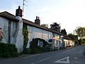 Cottages, Dewlish - geograph.org.uk - 1320759.jpg 640 × 485; 69 KB
-
 Country Lane near Chebbards Farm - geograph.org.uk - 1320775.jpg 640 × 466; 86 KB
-
 Countryside near Dewlish - geograph.org.uk - 1320774.jpg 640 × 414; 68 KB
-
 Countryside near Dewlish - geograph.org.uk - 1530617.jpg 640 × 480; 93 KB
-
 Countryside near Dewlish - geograph.org.uk - 2158109.jpg 640 × 480; 90 KB
-
 Countryside near Dewlish - geograph.org.uk - 2158134.jpg 640 × 480; 110 KB
-
 Crawthorne Farm - geograph.org.uk - 491062.jpg 640 × 480; 93 KB
-
 Crawthorne House - geograph.org.uk - 491066.jpg 640 × 480; 87 KB
-
 Crossroads in Dewlish - geograph.org.uk - 113414.jpg 640 × 480; 89 KB
-
 Devil's Brook - geograph.org.uk - 491050.jpg 640 × 480; 125 KB
-
 Devil's Brook Valley - geograph.org.uk - 113448.jpg 640 × 480; 110 KB
-
 Dewlish Church and surrounds - geograph.org.uk - 5428227.jpg 640 × 480; 84 KB
-
 Dewlish House parkland - geograph.org.uk - 2941888.jpg 640 × 480; 137 KB
-
 Dewlish Mill Ford - geograph.org.uk - 4546826.jpg 1,084 × 725; 349 KB
-
 Dewlish Park - geograph.org.uk - 2158125.jpg 640 × 480; 146 KB
-
 Dewlish Village Hall - geograph.org.uk - 113316.jpg 640 × 480; 123 KB
-
 Dewlish Village Hall - geograph.org.uk - 3368251.jpg 1,024 × 768; 161 KB
-
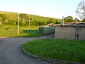 Dewlish Water Treatment Works - geograph.org.uk - 1320524.jpg 640 × 480; 69 KB
-
 Dewlish, brook - geograph.org.uk - 3368147.jpg 768 × 1,024; 269 KB
-
 Dewlish, buildings of Chebbard Farm - geograph.org.uk - 1374665.jpg 640 × 480; 60 KB
-

-
 Dewlish, Manor Farm - geograph.org.uk - 3368297.jpg 1,024 × 768; 214 KB
-
 Dewlish, mast - geograph.org.uk - 3368162.jpg 761 × 1,024; 132 KB
-
 Dewlish, Methodist chapel - geograph.org.uk - 3368485.jpg 1,024 × 768; 161 KB
-

-

-

-
 Dewlish, postbox No. DT2 83 - geograph.org.uk - 1343301.jpg 640 × 480; 72 KB
-
 Dewlish, roadbridge - geograph.org.uk - 3368152.jpg 768 × 1,024; 171 KB
-
 Dewlish, stile - geograph.org.uk - 3368471.jpg 1,024 × 768; 208 KB
-
 Dewlish, thatched cottages - geograph.org.uk - 3368233.jpg 1,024 × 768; 152 KB
-
 Dewlish, war memorial - geograph.org.uk - 3368241.jpg 1,024 × 767; 186 KB
-
 Earth mounds near Dewlish - geograph.org.uk - 113433.jpg 640 × 480; 130 KB
-
 Entrance to Dewlish - geograph.org.uk - 2910888.jpg 640 × 480; 116 KB
-
 Farm track and hedge near Dewlish - geograph.org.uk - 663260.jpg 640 × 480; 76 KB
-
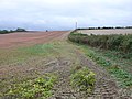
 Farmland near Dewlish - geograph.org.uk - 663295.jpg 640 × 480; 75 KB
-
 Fields north of Chebbard Farm - geograph.org.uk - 2162612.jpg 640 × 480; 115 KB
-
 Footpath near Dewlish - geograph.org.uk - 1013236.jpg 640 × 480; 149 KB
-
 Footpath near Dewlish - geograph.org.uk - 1013831.jpg 640 × 480; 105 KB
-
 Ford at Dewlish Mill - geograph.org.uk - 113446.jpg 640 × 480; 159 KB
-
 House in Dewlish - geograph.org.uk - 113411.jpg 640 × 480; 120 KB
-
 Jock's Hill - geograph.org.uk - 2941866.jpg 640 × 480; 131 KB
-
 Lower Farm House - geograph.org.uk - 491039.jpg 640 × 480; 118 KB
-
 Mill House, Dewlish - geograph.org.uk - 113330.jpg 640 × 480; 114 KB
-
 Muddy gateway near Dewlish - geograph.org.uk - 1038232.jpg 640 × 480; 96 KB
-
 Old Houses, in Dewlish - geograph.org.uk - 2318323.jpg 800 × 600; 208 KB
-
 Old Parsonage Farmhouse - Dewlish (2) - geograph.org.uk - 626967.jpg 640 × 436; 195 KB
-
 Old Parsonage Farmhouse - Dewlish - geograph.org.uk - 626966.jpg 640 × 447; 189 KB
-
 Parsonage Farm near Dewlish - geograph.org.uk - 1013826.jpg 640 × 454; 64 KB
-
 Parsonage Farm, Dewlish - geograph.org.uk - 113306.jpg 640 × 480; 123 KB
-
 Puddletown Down - geograph.org.uk - 2433251.jpg 640 × 480; 106 KB
-
 Riders on Park Hill - geograph.org.uk - 1013370.jpg 640 × 480; 157 KB
-
 Roadkill- fox cub. - geograph.org.uk - 2433755.jpg 640 × 431; 136 KB
-
 Rush hour in Dewlish - geograph.org.uk - 3124132.jpg 640 × 480; 82 KB
-
 Stile near Dewlish - geograph.org.uk - 1013225.jpg 640 × 480; 149 KB
-
 The Devils Brook near Dewlish - geograph.org.uk - 1013166.jpg 640 × 480; 110 KB
-
 The Fields of Crawthorne Farm - geograph.org.uk - 491069.jpg 640 × 480; 94 KB
-
 The most pointless notice ever - geograph.org.uk - 3193201.jpg 640 × 480; 45 KB
-
 The Oak at Dewlish - geograph.org.uk - 2910903.jpg 640 × 480; 106 KB
-
 The Oak at Dewlish - geograph.org.uk - 3368226.jpg 1,024 × 755; 139 KB
-
 The Puddletown to Cheselbourne road - geograph.org.uk - 733405.jpg 640 × 480; 129 KB
-
 Track across Cheselbourne Down - geograph.org.uk - 2433310.jpg 640 × 480; 91 KB
-
 Transmitter near Dewlish - geograph.org.uk - 1033658.jpg 480 × 640; 42 KB
-
 View across the Devils brook Dewlish - geograph.org.uk - 1320758.jpg 640 × 480; 70 KB
-
 Village Hall - Dewlish - geograph.org.uk - 626973.jpg 640 × 427; 180 KB
-
 Village Hall, Dewlish - geograph.org.uk - 1013205.jpg 640 × 480; 89 KB
-
 War Memorial , Dewlish - geograph.org.uk - 2158116.jpg 640 × 480; 92 KB
-
 Warren Hill at Chebbard Farm - geograph.org.uk - 4990256.jpg 1,600 × 1,065; 602 KB
-
 Weather vane, Dewlish - geograph.org.uk - 1013209.jpg 640 × 587; 58 KB
-
 Whitelands House - geograph.org.uk - 533853.jpg 640 × 480; 113 KB
-
 Devil's Brook - geograph.org.uk - 113336.jpg 640 × 480; 166 KB
-
 Devil's Brook Valley - geograph.org.uk - 113366.jpg 640 × 480; 84 KB
-
 Footbridge over Devil's Brook - geograph.org.uk - 113393.jpg 640 × 480; 186 KB
-
 Park Hill - geograph.org.uk - 113437.jpg 640 × 480; 192 KB
-
 Towards Bulbarrow - geograph.org.uk - 113348.jpg 640 × 480; 84 KB
-
 Woodsdown - geograph.org.uk - 113355.jpg 640 × 480; 117 KB


_-_geograph.org.uk_-_626967.jpg)


