Category:Devil's Dyke, Hertfordshire
Jump to navigation
Jump to search
prehistoric defensive ditch .jpg) | |||||
| Upload media | |||||
| Instance of | |||||
|---|---|---|---|---|---|
| Part of |
| ||||
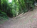
| Location | Wheathampstead, St Albans, Hertfordshire, East of England, England | ||||
| Heritage designation | |||||
 | |||||
Media in category "Devil's Dyke, Hertfordshire"
The following 7 files are in this category, out of 7 total.
-
 Devil's Dyke Hertfordshire (1).jpg 768 × 576; 114 KB
-
 Devil's Dyke Hertfordshire (2).jpg 768 × 576; 133 KB
-
 Devil's Dyke Hertfordshire sign.jpg 504 × 541; 64 KB
-
 Devil's Dyke, Hertfordshire 1 2020-07-20.jpg 3,024 × 4,032; 8.11 MB
-
 Devil's Dyke, Hertfordshire 2 2020-07-20.jpg 3,024 × 4,032; 8.1 MB
-
 Devils Dyke, Wheathamstead - geograph.org.uk - 799.jpg 640 × 480; 210 KB
-
 Entrance to Devil's Dyke - geograph.org.uk - 1457918.jpg 640 × 480; 103 KB
.jpg)


