Category:Details of old maps of Germany
Jump to navigation
Jump to search
Subcategories
This category has the following 9 subcategories, out of 9 total.
B
- Parts of old maps of Brandenburg (86 F)
- Parts of old maps of Bremen (32 F)
C
- Parts of old maps of Cologne (38 F)
D
H
- Parts of old maps of Hamburg (102 F)
S
Media in category "Details of old maps of Germany"
The following 200 files are in this category, out of 459 total.
(previous page) (next page)-
 Brabanter Straße (Waldseemueller).jpg 755 × 273; 101 KB
-
 Philipp Apian - Bairische Landtafeln von 1568 - Tafel 09 Eichstätt Ingolstadt.jpg 3,584 × 2,909; 2.87 MB
-
 Philipp Apian - Bairische Landtafeln von 1568 - Tafel 10 Ingolstadt Kehlheim.jpg 3,386 × 2,520; 2.5 MB
-
 Frauentor Weimar 1569.png 752 × 525; 650 KB
-
 S. Iacobs Thor Weimar.png 664 × 436; 460 KB
-
 Udenheim-Philippsburg 1590 2.jpg 409 × 240; 62 KB
-
 Warnsath EmmiusKarte von 1595.PNG 496 × 358; 236 KB
-
 Stadtgebiet Duisburg 1590er (Karte von Moers).jpg 837 × 1,798; 394 KB
-
 Apiankarte Ausschnitt Traunstein.png 1,382 × 872; 1.94 MB
-
 Map of Bavaria-Franconia South East 1600.jpg 800 × 600; 170 KB
-
 Amt Tremsbüttel (1652).jpg 600 × 450; 117 KB
-
 M. Merian SW Ausschnitt Zeughaus.png 331 × 256; 113 KB
-
 Riss Eisenzeche Heidersdorf.jpg 1,404 × 746; 380 KB
-
 Potsdam Suchodoletz 1683.jpg 1,616 × 1,376; 762 KB
-
 Cent Bachgaw 1695.jpg 2,146 × 1,351; 1.74 MB
-
 Grand Duche de Berg (cropped) Hellebroich.jpg 724 × 563; 78 KB
-
-
 Karte Nannenhohn 1715.jpg 836 × 584; 277 KB
-
 Stralsund Grünhufe 1715 Ausschnitt 10.jpg 2,393 × 1,213; 776 KB
-
 Stralsund Grünhufe 1715 Ausschnitt 20.jpg 755 × 640; 148 KB
-
 Mühlhausen, Free Imperial City in Thuringia.jpg 2,816 × 2,112; 1.8 MB
-
 Vetter Karte Neuendettelsau.jpg 1,391 × 1,442; 857 KB
-
 EssenWerdenStyrum 1761.jpg 1,378 × 1,219; 1,000 KB
-
 Karte Tente wag.jpg 192 × 186; 43 KB
-
 The Free Imperial City of Rothenburg's territory.jpg 960 × 1,280; 410 KB
-
 Meimersdorfer Moor Vahrendorf.jpeg 1,000 × 500; 660 KB
-
 Vahrendorf’schen Karte von Sulsdorf Schleswig-Holstein.jpg 900 × 1,600; 185 KB
-
 Vahrendorf’schen Karte von Kembs Dazendorf Schleswig-Holstein.jpg 900 × 1,600; 229 KB
-
 Ausschnitt Tranchot 1801 Broichen.png 798 × 499; 1.02 MB
-
 Reutlingen, Esslingen, Weil Imperial Cities.JPG 1,232 × 1,050; 476 KB
-
 Fürstentum Aschaffenburg 1807.jpg 636 × 466; 222 KB
-
 Trk72 Köln-Detail.jpg 2,502 × 3,503; 7.62 MB
-
-
 Gelleshof Topograhische Aufnahme.png 555 × 453; 553 KB
-
 1811k Aller.JPG 1,180 × 1,032; 300 KB
-
 Karte Diedersorf.png 1,006 × 570; 1.14 MB
-
 Karte Prädetz bei Burg.png 825 × 504; 892 KB
-
 Karte Räckendorf 1893.png 1,026 × 539; 1.4 MB
-
 Karte von Nieplitz.png 706 × 512; 699 KB
-
 Karte Oberschlesiens 1818.jpg 1,677 × 1,856; 1.38 MB
-
 Ortsplan Weihenzell (1824).jpg 1,230 × 916; 379 KB
-
 Fundgrube Roter Hirsch.jpg 1,337 × 1,201; 406 KB
-
 Ortsplan Altendettelsau.jpg 682 × 508; 149 KB
-
 Ziemia tarnogórska.jpg 960 × 912; 266 KB
-
 Burgstall Hochberg.PNG 650 × 398; 559 KB
-
 Burgstall Traunstein.PNG 590 × 381; 512 KB
-
 Ausschnitt Stadtplan Schweinfurt von 1833.png 592 × 333; 402 KB
-
 Karte Amt Miltenberg 1836.png 997 × 545; 1.03 MB
-
 Map of Dresden 1837, section showing Neustadt.jpg 3,088 × 2,056; 2.87 MB
-
 Schloßberg (Pantelitz) 1839.jpg 557 × 384; 155 KB
-

-
 Ibbenbüren-Land.jpg 3,257 × 3,405; 4.77 MB
-
 Lengerich-Land.jpg 2,940 × 2,515; 2.9 MB
-
 Westerkappeln-Land.jpg 1,901 × 2,917; 2.35 MB
-
 Bochum Dahlhausen Linden 1843.png 884 × 676; 1.56 MB
-
 Frankenforst.jpg 824 × 884; 498 KB
-
 Linn Karte Preussische Landesaufnahme 1844.jpg 479 × 206; 31 KB
-
 Berlin 1847 Detail.jpg 1,545 × 1,466; 1.14 MB
-
 Lagekarte Biebermühle Weismain.jpg 174 × 116; 30 KB
-
 Mittleres Mortelbachtal.jpg 1,199 × 1,030; 267 KB
-
 1851 Creglingen (Creglingen) - Bebauung Siedlungskern.jpg 350 × 350; 136 KB
-
 Karte Polzuhn.png 703 × 292; 408 KB
-
 Mainleite bei Schweinfurt. BayernAtlas Historische Karte.png 971 × 852; 1.76 MB
-
 Katasterplan Schweinfurt von 1868, Ausschnitt Maininseln.png 713 × 358; 587 KB
-
 SW Katasterplan 1868 Stadtbahnhof.png 454 × 438; 439 KB
-
 Ausschnitt aus dem Stadtplan um 1874.jpg 1,431 × 850; 830 KB
-
 Unteres Blaufarbenwerk Breitenbach 1875.jpg 887 × 594; 87 KB
-
 Dazendorf (Gremersdorf) 1877.jpg 2,215 × 2,889; 1.5 MB
-
 Karte Von Halstenbek 1877.png 706 × 450; 551 KB
-
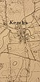 Kembs (Gremersdorf) 1877.jpg 1,960 × 4,032; 807 KB
-
 Westerwälder Braunkohlerevier.PNG 808 × 606; 1.13 MB
-
 Mecklenburg+Vorpommern1880.gif 945 × 656; 466 KB
-
 Tribsees Sülz Andree1880.tif 654 × 474; 911 KB
-
 Reichsstadt Ulm 1789.png 668 × 386; 787 KB
-
 Spruner-Menke Handatlas 1880 Karte 33 (Ausschnitt Helmegau).jpg 2,060 × 1,431; 1.49 MB
-
 Spruner-Menke Handatlas 1880 Karte 33 (Eic).jpg 2,451 × 2,170; 2.6 MB
-
 Spruner-Menke Handatlas 1880 Karte 33 (Leinegau).jpg 1,319 × 1,614; 1.07 MB
-
 Spruner-Menke Handatlas 1880 Karte 33 (Liesgau).jpg 1,472 × 1,642; 1.16 MB
-
 Spruner-Menke Handatlas 1880 Karte 33 (Ohmfeld).jpg 367 × 302; 145 KB
-
 Spruner-Menke Handatlas 1880 Karte 34 (Eic).jpg 2,106 × 1,575; 1.72 MB
-
 Spruner-Menke Handatlas 1880 Karte 34 (Thuringia).jpg 4,485 × 3,158; 6.65 MB
-
 1881 Assamstadt - Bebauung (cropped).jpg 400 × 400; 119 KB
-
 1881 Igersheim - Bebauung.jpg 300 × 300; 77 KB
-
 1884 Schwabhausen (Boxberg) - Bebauung Siedlungskern.jpg 488 × 468; 47 KB
-

-
 Astfala.jpg 309 × 196; 32 KB
-
 1889 Oberschüpf - Bebauung Siedlungskern.jpg 732 × 486; 80 KB
-
 Ostpreussen 1890.jpg 1,915 × 2,470; 2.47 MB
-
 Stielers handatlas 1891 10 Ausschnitt 2011 01 01 Ho.jpg 424 × 587; 90 KB
-
 1895-Voigt&Haeffner-Falkstraße-2-ausschnitt-markierung.png 1,180 × 1,125; 3.91 MB
-
 TroskaLubuskie.png 652 × 486; 483 KB
-
 SW Skizze Reichsburg Zürch.png 1,814 × 993; 4.16 MB
-
 Lechtalheiden Karte 1904.jpg 532 × 1,608; 499 KB
-
 Heilstätte Carolagrün in einer Landkarte aus dem Anfang des 20. Jahrhunderts.jpg 2,991 × 2,226; 3.44 MB
-
 Katasterplan Schweinfurt Ausschnitt westlich der Maxbrücke.png 789 × 468; 676 KB
-
 GK25 NeueNr.2130 Luebeck 1915 FID-GEO (cropped).jpg 6,034 × 4,327; 8.98 MB
-
 Kursbuchkarte Raum Schweinfurt.png 476 × 293; 175 KB
-
 ND Latschenhochmoor südwestlich Weibhausen Amtsblatt.jpg 796 × 1,148; 443 KB
-
 ND Latschenhochmoor und Streuwiese südöstlich Preising Amtsblatt.jpg 837 × 1,161; 394 KB
-
 ND Übergangs- und Niedermoor nordwestlich Abstreit Amtsblatt.jpg 805 × 1,153; 405 KB
-
 ND Eiche nordwestlich Höpperding Amtsblatt.jpg 805 × 1,157; 297 KB
-
 5103Eschweiler1910Kopie.jpg 2,953 × 3,098; 4.26 MB
-
 Aachen-Kornelimünster 1702.png 1,882 × 1,834; 6.2 MB
-
 Abtei Reichsstadt Buchau - Hase 1742.png 1,736 × 1,080; 3.01 MB
-

-
 Alt Uetersen.jpg 896 × 749; 582 KB
-

-

-
 Baden - Burgfriedensplan vor 1696.jpg 357 × 284; 114 KB
-
 Bay. Urkataster Markt SW Geometrie.png 1,501 × 794; 2.52 MB
-

-

-

-

-
 Buchau, on the Federsee.jpg 1,053 × 665; 237 KB
-
 Burgauer Landtafel 1613 Ausschnitt Glöttweng Landensberg.jpg 866 × 697; 174 KB
-
 Canton Eschweiler2.jpg 560 × 366; 73 KB
-
 Chrósćicy – karta wokoło 1800.png 1,326 × 598; 1.15 MB
-

-
 Donauwörth, from a 1740 map.jpg 2,816 × 2,112; 2.04 MB
-
 Dorff und Closter Graffschafft 1653.jpg 547 × 423; 210 KB
-
 Dortmund Territorium 1681.jpg 1,226 × 888; 774 KB
-
 Ehemalige Hsnr. Kettersbach.jpg 2,936 × 2,336; 1.05 MB
-
 Eibenstock Carlsfeld Bergrevier Bildkarte von 1520 1.jpg 1,761 × 1,675; 418 KB
-
 Eibenstock Carlsfeld Bergrevier Bildkarte von 1520 10.jpg 4,000 × 3,000; 3.58 MB
-
 Eibenstock Carlsfeld Bergrevier Bildkarte von 1520 11.jpg 4,000 × 3,000; 3.55 MB
-
 Eibenstock Carlsfeld Bergrevier Bildkarte von 1520 12.jpg 4,000 × 3,000; 3.69 MB
-
 Eibenstock Carlsfeld Bergrevier Bildkarte von 1520 13.jpg 4,000 × 3,000; 3.28 MB
-
 Eibenstock Carlsfeld Bergrevier Bildkarte von 1520 14.jpg 4,000 × 3,000; 3.42 MB
-
 Eibenstock Carlsfeld Bergrevier Bildkarte von 1520 2.jpg 2,919 × 2,858; 1.06 MB
-
 Eibenstock Carlsfeld Bergrevier Bildkarte von 1520 3.jpg 4,000 × 3,000; 3.24 MB
-
 Eibenstock Carlsfeld Bergrevier Bildkarte von 1520 4.jpg 3,000 × 4,000; 3.14 MB
-
 Eibenstock Carlsfeld Bergrevier Bildkarte von 1520 5.jpg 4,000 × 3,000; 3.42 MB
-
 Eibenstock Carlsfeld Bergrevier Bildkarte von 1520 6.jpg 4,000 × 3,000; 3.35 MB
-
 Eibenstock Carlsfeld Bergrevier Bildkarte von 1520 7.jpg 4,000 × 3,000; 3.62 MB
-
 Eibenstock Carlsfeld Bergrevier Bildkarte von 1520 8.jpg 4,000 × 3,000; 3.12 MB
-
 Eibenstock Carlsfeld Bergrevier Bildkarte von 1520 9.jpg 4,000 × 3,000; 3.35 MB
-
-

-

-

-
 Forsthaus beim Ochsenkopfe.jpg 1,043 × 459; 117 KB
-
-
-

-

-

-

-
-

-

-

-
-

-

-

-

-

-

-

-

-
-

-
 Fotothek df rp-c 0600053 Radibor. Oberreit, Sect. Bautzen, 1844-46.jpg 800 × 512; 246 KB
-

-

-

-

-

-
-
 Fotothek df rp-c 0620037 Puschwitz. Oberreit, Sect. Bautzen, 1844-46.jpg 800 × 511; 261 KB
-

-
 Fotothek df rp-c 0630003 Rammenau. Oberreit, Sect. Bautzen, 1844-46.jpg 800 × 511; 262 KB
-

-

-

-

-

-

-

-
-

-

-
 Fotothek df rp-c 0670015 Obergurig. Oberreit, Sect. Stolpen, 1821-22.jpg 800 × 514; 269 KB
-
-

-
 Fotothek df rp-c 0670023 Kirschau. Oberreit, Sect. Stolpen, 1821-22.jpg 800 × 512; 266 KB
-
 Fotothek df rp-c 0670027 Schirgiswalde. Oberreit, Sect. Stolpen, 1821-22.jpg 1,472 × 909; 1,017 KB
-

-

-

-

-
-
 Fotothek df rp-c 0680019 Löbau. Oberreit, Sect. Zittau, 1844-46.jpg 800 × 512; 275 KB
-

-

-
 Fotothek df rp-c 0690048 Zittau. Oberreit, Sect. Zittau, 1844-46.jpg 800 × 515; 266 KB
-

-

-


.jpg)


.jpg)


_Hellebroich.jpg)
_(1696)-detail.jpg)


.jpg)


.jpg)


_1839.jpg)


_-_Bebauung_Siedlungskern.jpg)


_1877.jpg)

_1877.jpg)


.jpg)
.jpg)
.jpg)
.jpg)
.jpg)
.jpg)
.jpg)
.jpg)

_-_Bebauung_Siedlungskern.jpg)
_Gemarkung_Schwabhausen_(Boxberg).jpg)


.jpg)


.jpg)


_von_1791_(Ausschnitt).jpg)


_aus_dem_Jahr_1876_Ausschnitt.jpg)


.jpg)


.jpg)