Category:Details of old maps of Australia
Jump to navigation
Jump to search
Media in category "Details of old maps of Australia"
The following 19 files are in this category, out of 19 total.
-
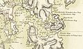
 Tasmania (1715).png 804 × 587; 889 KB
-
 Thomas Scott's map of Norfolk Bay and Frederick Henry Bay, 1824.jpg 858 × 516; 260 KB
-
 Map of Cornwall County, Tasmania 1886.png 477 × 281; 316 KB
-
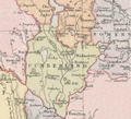 Map of Cumberland County (Tasmania) 1886.png 511 × 464; 389 KB
-
 Map of Lincoln County (Tasmanian) 1886.png 344 × 407; 318 KB
-
 Map of Pembroke County (Tasmania) 1886.png 514 × 467; 444 KB
-
 Westmoreland County (Tasmania) 1886.png 347 × 323; 280 KB
-
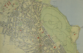
 Davenport County Queensland 1890.png 1,320 × 624; 1.72 MB
-
 Portland County Queensland 1890.png 725 × 491; 630 KB
-
 Rodney County Queensland.png 710 × 611; 857 KB
-

-
-
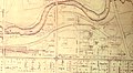
 Academy of Music, Adelaide map.png 846 × 580; 821 KB
-
 Hobart aerial survey 1954 map05 sullivans cove.png 487 × 382; 419 KB
-
 Hobart aerial survey 1954 map05.png 719 × 948; 1.57 MB
-
 Hobart aerial survey 1954 map10-11.png 1,420 × 908; 2.75 MB
-
 Hobart aerial survey 1954 map14-15.png 1,411 × 923; 2.69 MB
-
 Hobart aerial survey 1954 map2-3.png 1,368 × 885; 2.32 MB
-
 Hobart aerial survey 1954 map8-9.png 1,426 × 918; 2.9 MB
.png)


_1886.png)
_1886.png)
_1886.png)
_1886.png)


_north_of_North_Terrace_including_Jubilee_Exhibition_grounds_and_railway_line.jpg)


