Category:Details of bird's eye view maps of Massachusetts
Jump to navigation
Jump to search
Media in category "Details of bird's eye view maps of Massachusetts"
The following 63 files are in this category, out of 63 total.
-
 1850 FinancialDistrict BirdsEyeView Boston byJohnBachmann.png 966 × 566; 1.25 MB
-
 1850 BeaconHill BirdsEyeView Boston byJohnBachmann.png 814 × 671; 969 KB
-
 1850 KneelandSt area BirdsEyeView Boston byJohnBachmann.png 966 × 567; 1.27 MB
-
 1850 MasonicTemple BirdsEyeView Boston byJohnBachmann.png 654 × 541; 825 KB
-
 1850 NorthEnd BirdsEyeView Boston byJohnBachmann.png 967 × 562; 1.25 MB
-
 1850 ParkSquare BirdsEyeView Boston byJohnBachmann.png 813 × 715; 1,013 KB
-
 1850 PublicGarden BirdsEyeView Boston byJohnBachmann.png 969 × 573; 944 KB
-
 1850 Wharves BirdsEyeView Boston byJohnBachmann.png 965 × 565; 889 KB
-
 1850 FederalStChurch BirdsEyeView Boston byJohnBachmann.png 717 × 706; 1.14 MB
-
-
 Fall River station on 1877 bird's eye map.jpg 605 × 446; 73 KB
-
 Fall River Wharf on 1877 bird's eye map.jpg 1,315 × 1,062; 307 KB
-
 Ferry Street station on 1877 bird's eye map.jpg 785 × 587; 119 KB
-
 Natick station and engine house 1877.JPG 699 × 390; 87 KB
-
 Watuppa station on 1877 bird's eye map.jpg 483 × 378; 43 KB
-
 Middleborough Yard on 1881 bird's eye view map.jpg 1,868 × 1,178; 555 KB
-
 Norwood station on 1882 bird's eye map.jpg 620 × 465; 79 KB
-
 NY&NE shops and Norwood Central station on 1882 bird's eye map.jpg 1,360 × 799; 346 KB
-
 Plymouth station on 1882 bird's-eye view map.jpg 1,223 × 885; 262 KB
-
 Highlandville station on 1887 bird's eye view map.jpg 471 × 366; 54 KB
-
 Needham station on 1887 bird's eye view map.jpg 869 × 471; 105 KB
-
 Middleborough station on 1889 bird's eye view map.jpg 1,204 × 713; 242 KB
-
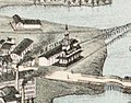
 Haverhill Bridge and station on 1893 bird's eye view map.jpg 1,630 × 1,211; 459 KB
-
 Haverhill station on 1893 bird's eye view map.jpg 1,241 × 838; 285 KB
-

-
 1899 BeaconHill Boston map byAEDowns BPL.png 964 × 440; 888 KB
-
 1899 BostonCommon map byAEDowns BPL.png 965 × 569; 1.27 MB
-
 1899 BroadSt Boston map byAEDowns BPL.png 808 × 714; 1.34 MB
-
 1899 FinancialDistrict Boston map byAEDowns BPL.png 1,015 × 473; 934 KB
-
 1899 HowardSt Boston map byAEDowns BPL.png 807 × 711; 1.35 MB
-
 1899 IndiaWharf LongWharf Boston map byAEDowns BPL.png 1,013 × 469; 1,016 KB
-
 1899 NorthEnd Boston map byAEDowns BPL.png 958 × 566; 1.17 MB
-
 1899 WestEnd Boston map byAEDowns BPL 11180.png 1,058 × 739; 1.81 MB
-
 1899 WestEnd Boston map byAEDowns BPL.png 1,008 × 471; 925 KB
-
 Beverly station on 1879 bird's eye view map.jpg 501 × 349; 60 KB
-
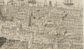
 Boston Bird's-eye View from the North -- Haymarket detail -- 1877.jpg 1,018 × 1,037; 1.29 MB
-
 Canton Center station on 1918 bird's eye view map.jpg 328 × 231; 25 KB
-
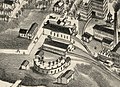
 Canton Junction station on 1918 bird's eye view map.jpg 855 × 557; 149 KB
-
 Central Street station on 1876 bird's eye view map.jpg 809 × 473; 141 KB
-
 Haverhill station on 1876 bird's eye view map.jpg 623 × 461; 69 KB
-

-

-

-

-
 Hyde Park (B&P) station on 1879 bird's eye view map.jpg 489 × 331; 39 KB
-
 Hyde Park (NY&NE) station on 1879 bird's eye view map.jpg 350 × 272; 25 KB
-
 Hyde Park (NY&NE) station on 1890 bird's eye view map.jpg 577 × 445; 67 KB
-
 Hyde Park station on 1890 bird's eye view map.jpg 787 × 565; 117 KB
-
 Readville stations on 1879 bird's eye view map.jpg 674 × 454; 80 KB
-
 Mattapan station and yard on 1890 bird's eye view map.jpg 1,071 × 781; 244 KB
-
 Mattapan station on 1890 bird's eye view map.jpg 463 × 346; 51 KB
-
 Middleborough freight house on 1889 bird's eye view map.jpg 775 × 530; 113 KB
-
 Newton Lower Falls Branch terminal from 1880 bird's eye view map.jpg 2,322 × 1,366; 719 KB
-
 North Attleboro station on 1878 bird's eye view map.jpg 650 × 497; 89 KB
-
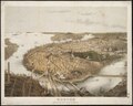
 Park Square on 1870 bird's eye map.jpg 2,690 × 1,661; 938 KB
-

-
 Readville stations on 1893 bird's eye view map.jpg 722 × 456; 94 KB
-
 Springdale station on 1918 bird's eye view map.jpg 300 × 200; 17 KB
-

-
 Taunton station and roundhouse on 1875 bird's eye view map.jpg 1,168 × 780; 237 KB
-

-

-
 Walpole Union Station on 1882 birds-eye map.jpg 736 × 576; 146 KB


_station_on_1879_bird%27s_eye_view_map.jpg)
_station_on_1879_bird%27s_eye_view_map.jpg)
_station_on_1890_bird%27s_eye_view_map.jpg)


