Category:Details of Second Military Mapping Survey of Austrian Empire
Jump to navigation
Jump to search
Media in category "Details of Second Military Mapping Survey of Austrian Empire"
The following 18 files are in this category, out of 18 total.
-
 Balassagyarmat térkép (második katonai felmérés).jpg 1,280 × 768; 286 KB
-
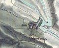
 Brabenčák - 2. vojenské mapování.jpg 716 × 407; 99 KB
-
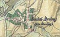 Budai Ábrány térképe.jpg 779 × 483; 600 KB
-
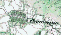 Csomonya 2.katonai terkepezes.gif 383 × 221; 71 KB
-
 Czigánd 1806 - 1869.jpg 1,021 × 641; 241 KB
-
 Franziszeische Landesaufnahme 11.png 724 × 656; 1.11 MB
-
 Kálló – II. katonai felmérés térképe (1806-1869).jpg 800 × 654; 402 KB
-
 Monorierdő II. katonai felmérés 1806–1869.jpg 936 × 598; 177 KB
-

-
 Salgótarján és környéke a második katonai felmérés idején.jpg 2,270 × 3,793; 1.47 MB
-
 Schloss und Stadt Ebenfurth bei Wiener Neustadt.jpg 551 × 403; 152 KB
-
 Seregélyes-második-katonai-felmérés-térképe.jpg 863 × 706; 286 KB
-

-

-
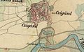
 Szent György Ábrány térképe.jpg 827 × 636; 844 KB
-
 Szentendre térkép 2.jpg 2,653 × 1,957; 4.8 MB
-
 Tubož mapa 1843.jpg 969 × 694; 354 KB
-
 Буньковичі (1779–1783).png 1,040 × 520; 1.12 MB
.jpg)


.jpg)


.jpg)
.jpg)


.png)