Category:Details of Ferraris maps of Belgium
Jump to navigation
Jump to search
Media in category "Details of Ferraris maps of Belgium"
The following 200 files are in this category, out of 241 total.
(previous page) (next page)-
 189 - Mastricht - Maastricht (2) - Copy.jpg 4,972 × 4,044; 7.26 MB
-
 76 - Bruxelles - Brussel Bruxelles-fixed.jpg 21,466 × 14,450; 174.27 MB
-
 Aalst, Belgium ; Ferraris Map.jpg 652 × 564; 55 KB
-
 Abbaye de Florival Ferraris.jpg 3,577 × 2,645; 4.31 MB
-
 Abbaye de Solières - Carte de Ferraris.jpg 723 × 641; 191 KB
-
 Aiseau1777.jpg 1,757 × 1,200; 2.88 MB
-
 Antoing et le tertre du Trou de Billemont - Carte de Ferraris.jpg 750 × 633; 236 KB
-
 Antwerpse Heriweg Damme.png 3,046 × 758; 5.89 MB
-
 Anvaing 1770.png 1,280 × 800; 1.81 MB
-
 Arlon, Belgium, Ferraris, 1775.jpg 1,680 × 1,050; 289 KB
-
 Assenede, Belgium, Ferrariskaart, 1775.jpg 1,680 × 1,050; 304 KB
-
 Ath, Belgium, Ferraris Map, 1775.jpg 1,680 × 1,050; 325 KB
-

-
 Beisloven Egmontkasteel 1777.jpg 5,297 × 3,401; 5.6 MB
-
 Beke, Waarschoot, Ferraris map.jpg 1,612 × 1,078; 705 KB
-
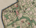 Belgique-Reckem.png 981 × 761; 1.78 MB
-
 Bellebargiebos Ferraris 02.jpg 5,472 × 3,648; 21.92 MB
-
 Bellebargiebos Ferraris.jpg 3,577 × 4,791; 7.2 MB
-
 Blankenberge, Belgium, Ferraris , 1775.jpg 1,680 × 1,050; 326 KB
-
 Blauw Kasteel Lange Munte Ferraris.jpg 5,472 × 3,648; 21.02 MB
-
 Boembekemolen - België.jpg 811 × 675; 280 KB
-
 Boembekemolen 1777.jpg 5,472 × 3,648; 18.28 MB
-
 Bois d'Houtaing, Bois d'Assoumont, Bois du Carmois Bois à Choques Ferraris.jpg 5,472 × 3,648; 16.15 MB
-
 Bois d'Hubermont Bois de Leuze Bois d'Antoing Ferraris.jpg 3,648 × 5,472; 20.34 MB
-
 Bois d'Hubermont Bois de Lezuze Bois d'Antoing Bois Lefèbvre Bois d'Hergies Ferraris.jpg 5,472 × 3,648; 15.66 MB
-
 Bois de La Louvière Livierenbos Hayesbos Ferraris.jpg 5,472 × 3,648; 21.17 MB
-
 Bois Lefèbvre Ferraris.jpg 5,472 × 3,648; 15.28 MB
-
 Bonne-Espérance Ferraris.png 861 × 599; 945 KB
-
 Bos Ferraris 01.jpg 3,648 × 5,472; 18.48 MB
-
 Bos Nieuwenhove Ferraris.jpg 5,472 × 3,648; 15.8 MB
-
 Bos t'Ename Ferraris 01.jpg 5,472 × 3,648; 18.86 MB
-
 Bos t'Ename Ferraris 02.jpg 3,648 × 5,472; 17.92 MB
-
 Bos van Houthulst Ferraris.jpg 5,297 × 3,481; 5.32 MB
-
 Bouvelobos Ferraris.jpg 5,472 × 3,648; 22.96 MB
-
 Brakelbos Ferraris.jpg 5,472 × 3,648; 19.85 MB
-
 Brakelbos Pottelbergbos Ferraris.jpg 5,472 × 3,648; 19.49 MB
-
 Kanaal Brugge-Oostende, Ferraris.jpg 1,684 × 958; 376 KB
-
 Buggenhoutbos Ferraris 01.jpg 2,193 × 3,577; 3.4 MB
-
 Buggenhoutbos Ferraris 02.jpg 2,585 × 4,353; 4.94 MB
-
 Bulskampveld, Ferraris, 1777.jpg 1,274 × 674; 206 KB
-
 Burg-Reuland Belgium Ferraris 1777.png 1,237 × 598; 1.33 MB
-
 Carte de Theux, montage à partir de quatre planches de la carte de Ferraris.jpg 2,772 × 2,079; 1.42 MB
-
 Carte Ferraris 1777 Château Grandvoir.tif 583 × 481; 849 KB
-
 Carte Ferraris Chateau Motte.jpg 1,717 × 1,262; 1.26 MB
-
 Carte Ferraris de Godinne.jpg 485 × 358; 62 KB
-
 Cense Rosieaux et tumulus de Hanret - Carte de Ferraris.jpg 750 × 642; 175 KB
-
 Charleroi - Broucheterre et Faubourg - Ferraris map (1770-1778).jpg 1,522 × 1,200; 1.95 MB
-
 Charleroi - Ferraris map (1770-1778) - digue.jpg 800 × 800; 1.04 MB
-
 Charleroi - Ferraris map (1770-1778).jpg 930 × 1,170; 1.13 MB
-
 Charleroi - ville basse - Ferraris map (1770-1778).jpg 1,087 × 797; 969 KB
-
 Charleroi-Dampremy - Ferraris - 01.jpg 6,300 × 4,878; 24.1 MB
-
 Château de Jehay - Carte de Ferraris.jpg 1,034 × 717; 308 KB
-
 Clermont-sur-Berwinne1777(Ferraris212).jpg 1,200 × 675; 156 KB
-
 Cotthembos.jpg 5,472 × 3,648; 15.39 MB
-
 Damme, Belgium ; Ferraris Map.jpg 652 × 564; 50 KB
-
 Deinze, Belgium ; Ferraris map.jpg 760 × 648; 73 KB
-
 Dendermonde, Belgium ; Ferraris Map.jpg 652 × 564; 57 KB
-
 Dhuy - Les 6 Frères - Carte de Ferraris.jpg 860 × 596; 223 KB
-
 Diksmuide, Belgium, map, Ferraris, 1776.jpg 760 × 648; 63 KB
-
 Dinant, Belgium, Ferraris, 1775.jpg 1,680 × 1,050; 279 KB
-
 Doel, Lillo, Schelde, Ferraris, 1775.jpg 1,680 × 1,050; 345 KB
-
 Domein de Ghellinck - de Ferraris.jpg 793 × 673; 258 KB
-
 Doormansbos Ferraris.jpg 5,009 × 3,385; 5.15 MB
-
 Drongen, Ghent, Belgium, ferrariskaart.jpg 1,680 × 1,050; 320 KB
-
 Drongengoedhoeve, ferraris-kaart.jpg 1,280 × 1,024; 289 KB
-
 Eeklo, Belgium ; Ferraris Map.jpg 652 × 564; 64 KB
-
 Elene 01.jpg 5,472 × 3,648; 18.04 MB
-
 Enghien , Belgium, Ferraris Map, 1775.jpg 1,680 × 1,050; 362 KB
-
 Erwetegem.jpg 5,472 × 3,648; 16.99 MB
-
 Ettingebos Ferraris.jpg 5,472 × 3,648; 17.37 MB
-
 Evere-Ferraris.png 1,202 × 1,310; 3.08 MB
-
 Evergem Ferraris.TIF 733 × 606; 1.45 MB
-
 Ferraris kasteel de Ghellinck.jpg 785 × 699; 220 KB
-
 Ferraris Leval Blegny.jpg 1,417 × 1,811; 512 KB
-
 Ferraris Lokeren Kaart.png 4,824 × 3,072; 26.05 MB
-
 Ferraris map, De Pinte.jpg 646 × 479; 51 KB
-
 Ferraris map, Tournai.jpg 597 × 533; 41 KB
-
 Ferraris-Karte.jpg 1,633 × 1,309; 1.93 MB
-
 Ferraris-Leuven.png 5,473 × 5,052; 47.61 MB
-
 Ferrarisbaasrode.jpg 596 × 480; 57 KB
-
 Ferrariskaart - 370729 - onroerenderfgoed.jpg 1,381 × 4,181; 6.29 MB
-
 Ferrariskaart Oudegem.jpg 952 × 976; 526 KB
-
 Forest - Abbaye de Forest - Carte de Ferraris.jpg 662 × 721; 262 KB
-
 Galgebossen Ferraris.jpg 5,472 × 3,648; 23.79 MB
-
 Gavere - Ferraris.jpg 687 × 605; 150 KB
-
 Geraardsbergen , Belgium, Ferraris Map, 1775.jpg 1,680 × 1,050; 371 KB
-
 Godarville - Carte Ferraris - 1777.png 831 × 516; 825 KB
-
 Godveerdegem.jpg 5,472 × 3,648; 17.55 MB
-
 Groenhove Ferraris.jpg 5,472 × 3,648; 16.4 MB
-
 Grotenberge.jpg 5,472 × 3,648; 16.05 MB
-
 Gruuthusekasteel op ferrariskaart.JPG 841 × 526; 98 KB
-
 Guigoven Wintershoven en Vlierhoven.png 1,790 × 1,284; 4.19 MB
-
 Hasselt, Belgium ; Ferraris Map.jpg 652 × 564; 53 KB
-
 Heirweg Kortrijk-Gent, Ferrariskaart.jpg 1,680 × 1,050; 315 KB
-
 Herentals Ferraris map 18th century.png 702 × 769; 1.08 MB
-
 Het Leen Ferraris.jpg 5,472 × 3,648; 22.42 MB
-
 Het Leen-Lembeekse Bossen, Belgium, Ferraris, 1775.jpg 1,680 × 1,050; 555 KB
-
 Heynsdaelebos Ferraris.jpg 5,472 × 3,648; 17.88 MB
-
 Hof van Oranje Ferraris.jpg 5,472 × 3,648; 18.07 MB
-
 Honegem Ferraris.jpg 5,472 × 3,648; 18.5 MB
-
 Hooggoed Ferraris.jpg 5,472 × 3,648; 17.59 MB
-
 Huivelde in 1777.png 1,775 × 734; 1.9 MB
-
 Huwynsbossen Ferraris.jpg 5,472 × 3,648; 20.69 MB
-
 Ieper, Belgium ; Ferraris Map.jpg 652 × 564; 57 KB
-
 In Den Vos.jpg 2,953 × 2,215; 1,005 KB
-
 Jumet - Ferraris - château de Diarbois.jpg 722 × 722; 567 KB
-
 Kalkense Meersen Ferraris.jpg 5,472 × 3,648; 17.29 MB
-
 Kalkense meersen, ferraris, 1775.jpg 1,680 × 1,050; 385 KB
-
 Kanaal Gent-Brugge , Belgium, Ferraris Map, 1775.jpg 1,680 × 1,050; 540 KB
-
 Kaprijke, Belgium ; Ferraris map.jpg 710 × 564; 63 KB
-
 Kasteel Oombergen uit Ferraris.jpg 819 × 773; 317 KB
-
 Kasteel Ten Bieze Ferraris.jpg 5,472 × 3,648; 20.96 MB
-
 Kasteel van Leeuwergem.jpg 3,648 × 5,472; 16.73 MB
-
 Kasteel van Lilare.jpg 5,472 × 3,648; 20.6 MB
-
 Kerkbrugge-Langerbrugge, Ghent, Belgium op de Ferrariskaart, 1775.jpg 1,680 × 1,050; 367 KB
-
 Kloosterbos, Ferraris, 1777.jpg 1,280 × 1,024; 358 KB
-
 Kluisbos Ferraris.jpg 5,472 × 3,648; 22.81 MB
-
 Kluizenbos Ferraris 01.jpg 3,648 × 5,472; 18.83 MB
-
 Kluizenbos Ferraris 02.jpg 5,472 × 3,648; 17.1 MB
-
 Koppenbergbos Ferraris.jpg 3,648 × 5,472; 18.34 MB
-
 Kortrijk, Belgium ; Ferraris Map.jpg 652 × 564; 58 KB
-
 Kravaalbos Ferraris.jpg 5,472 × 3,648; 20.71 MB
-
 La Tombe - Tumulus de Givry.jpg 623 × 502; 112 KB
-
 Le village de Chapelle-Lez-Herlaimont en 1770.png 878 × 710; 1.05 MB
-
 Leeuwergem.jpg 5,472 × 3,648; 21.17 MB
-
 Leuven, Belgium ; Ferraris Map.jpg 652 × 564; 54 KB
-
 Lier, Belgium ; Ferraris Map.jpg 652 × 564; 59 KB
-
 Lieve, Damme-Moerkerke, Belgium, Ferraris.jpg 1,680 × 1,050; 423 KB
-
 Map liege 3.jpg 4,222 × 3,330; 5.14 MB
-
 Lodelinsart - Bonnaire - Ferraris.png 620 × 620; 1 MB
-
 Lodelinsart - Ferraris.jpg 1,664 × 945; 1.75 MB
-
 Lommersum Ferraris 1777.jpg 6,513 × 4,691; 7.94 MB
-
 Lompret(B)1777(Ferraris85).jpg 1,200 × 675; 156 KB
-
 Madegemveld, Ferraris, 1777.jpg 1,284 × 1,028; 284 KB
-
 Makegemse bossen Ferraris 01.jpg 5,440 × 2,976; 5.7 MB
-
 Marchienne-au-Pont - Ferraris.jpg 1,080 × 1,080; 1.09 MB
-
 Mechelen, Belgium ; Ferraris Map.jpg 652 × 564; 171 KB
-
 Meerdaalwoud en Heverleebos, Ferrariskaart, Belgium, 1775.jpg 2,471 × 1,522; 701 KB
-
 Meetjeslandse kreken, Belgium, Ferrariskaart.png 1,680 × 1,050; 3.23 MB
-
 Moervaart, Mendonk, Belgium op de Ferrariskaart, 1775.jpg 1,680 × 1,050; 387 KB
-
 Monceau-sur-Sambre - château - Ferraris.jpg 1,080 × 1,080; 961 KB
-
 Munkbos Ferraris.jpg 3,648 × 5,472; 16.11 MB
-
 Munkebossen Ferraris.jpg 5,472 × 3,648; 21.52 MB
-
 Muziekbos Ferraris.jpg 5,472 × 3,648; 19.05 MB
-
 Muziekbos Sint-Pietersbos Ferraris.jpg 5,472 × 3,648; 17.84 MB
-
 Namur, Belgium, Ferraris, 1775.jpg 1,680 × 1,050; 352 KB
-
 Navagne ferraris.jpg 928 × 678; 110 KB
-
 Nazareth, Belgium, Ferrariskaart.jpg 1,680 × 1,050; 405 KB
-
 Neder.over.heembeek.14.10.11.009.jpg 1,920 × 1,200; 1.43 MB
-
 Nerenbos Makegemse bossen Ferraris.jpg 5,472 × 3,648; 21.14 MB
-
 Nieuwpoort, Belgium ; Ferraris Map.jpg 652 × 564; 49 KB
-
 Oignies - prieuré - Ferraris map (1771-1778) - 01.jpg 1,300 × 892; 1.15 MB
-
 Olne-ferraris.jpg 1,673 × 1,537; 5.72 MB
-
 Onze-Lieve-Vrouw-van-Deinsbekekapel.jpg 1,577 × 525; 384 KB
-
 Ooidonk castle, Belgium ; Ferraris Map.jpg 652 × 564; 49 KB
-
 Oombergen.jpg 5,472 × 3,648; 16.57 MB
-
 Ostend, Belgium ; Ferraris Map.jpg 652 × 564; 41 KB
-
 Oud-Moregembossen Ferraris.jpg 5,472 × 3,648; 18.13 MB
-
 Oudenaarde, Belgium ; Ferraris Map.jpg 652 × 564; 55 KB
-
 Oudenaarde, Belgium, map by Ferraris.jpg 851 × 1,028; 301 KB
-
 Ouren Belgium Ferraris 1777.png 598 × 520; 606 KB
-
 Papinglo, ferraris-kaart.jpg 1,680 × 1,050; 389 KB
-
 Parkbos.jpg 5,472 × 3,648; 18.06 MB
-
 Poperinge, Belgium ; Ferraris Map.jpg 652 × 564; 57 KB
-
 Prieuré d'Herlaymon en 1770.png 960 × 594; 881 KB
-
 Puyenbroeck, belgium on ferraris map.jpg 2,247 × 1,996; 724 KB
-
 Raspaillebos Ferraris.jpg 3,648 × 5,472; 16.04 MB
-
 Ronse, Belgium, Ferraris.jpg 1,680 × 1,050; 326 KB
-
 RONSE.JPG 875 × 492; 113 KB
-
 Roux - Ferraris - les "Basses-Haies".jpg 1,349 × 1,064; 1.53 MB
-
 Rue de meudon.1777.jpg 1,920 × 1,200; 1.43 MB
-
 Rupelmonde Ferraris.jpg 596 × 550; 71 KB
-
 Saint Pierre - Sint-Pieters-Kapelle - Ferraris map.png 701 × 449; 654 KB
-
 Schelde bij Merelbeke, Belgium, Ferraris, 1777.jpg 1,120 × 988; 325 KB
-
 Serskampse bossen Ferraris 01.jpg 5,472 × 3,648; 18.03 MB
-
 Sint-Denijs en Afsnee, Belgium, Ferraris 1775.jpg 1,680 × 1,050; 391 KB
-
 Sint-Goriks-Oudenhove 1777.jpg 5,081 × 3,537; 5.93 MB
-
 Sint-Maria-Oudenhove.jpg 5,472 × 3,648; 17.78 MB
-
 Sint-Niklaas, Belgium, Ferrariskaart, 1775.jpg 1,680 × 1,050; 370 KB
-
 Sint-Vincentiuskapel Ferraris.jpg 5,472 × 3,648; 15.67 MB
-
 Spijkerbos Ferraris.jpg 3,648 × 5,472; 15.57 MB
-
 Steenbergse bossen.jpg 3,648 × 5,472; 16.94 MB
-
 Stokkem op de Ferraris kaart (1771-75) KBR 27-8-2016 15-02-18.JPG 4,020 × 3,196; 8.76 MB
-
 Strijpen 1777.jpg 5,472 × 3,648; 18.47 MB
-
 Stropersbos Ferraris.jpg 5,472 × 3,648; 19.38 MB
-
 Ternath et Opalfene sur la carte de Ferraris.JPG 883 × 619; 111 KB
-
 Thimister-Clermont by Ferraris.png 1,031 × 760; 2.23 MB
-
 Tielt, Belgium, Ferraris, 1775.jpg 1,680 × 1,050; 332 KB
-
 Tombe d'Avene - Tumulus d'Avennes - Carte de Ferraris.jpg 843 × 598; 217 KB
-
 Tombe d'Avernas - Tumulus d'Avernas - Carte de Ferraris.jpg 751 × 642; 205 KB
-
 Tombe d'Hottomont - Tumulus d'Hottomont.jpg 860 × 598; 213 KB
-
 Tombe de Betz - Tumulus de Betz - Carte de Ferraris.jpg 861 × 582; 217 KB
-
 Tombe de Glimes - Tumulus de Glimes.jpg 660 × 720; 220 KB
-
 Tombe de Herbais - Tumulus de Piétrain - Carte de Ferraris.jpg 857 × 593; 226 KB
-
 Tombe de l'Empereur - Carte de Ferraris.jpg 857 × 592; 228 KB
-
 Tombe de Marcinelle - Tumulus de Marcinelle.jpg 850 × 593; 241 KB
-
 Tombe de Middelwinden - Tumulus de Middelwinden - Carte de Ferraris.jpg 798 × 865; 298 KB
-
 Tombe de Tilly - Tumulus de Tilly.jpg 861 × 596; 227 KB
-
 Tombe de Vissoulle - Tumulus de Vissoul - Carte de Ferraris.jpg 783 × 871; 243 KB
-
 Tombe de Waesmont - Tumulus de Waesmont - Carte de Ferraris.jpg 860 × 593; 209 KB
_-_Copy.jpg)


.jpg)
_-_digue.jpg)
.jpg)
.jpg)


.jpg)


1777(Ferraris85).jpg)


_-_01.jpg)


_KBR_27-8-2016_15-02-18.JPG)


