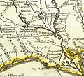
Category:Details of Carte de la Louisiane by Guillaume Delisle (1718)
Jump to navigation
Jump to search
Media in category "Details of Carte de la Louisiane by Guillaume Delisle (1718)"
The following 14 files are in this category, out of 14 total.
-
Adaie.jpg 654 × 598; 156 KB
-
Arkansas1717.png 923 × 603; 1.13 MB
-
Carte d'Amerique.png 2,954 × 2,360; 9.88 MB
-
Comanche 1718.jpg 931 × 873; 868 KB
-
Illinois 1718.jpg 589 × 737; 232 KB
-
Iowa 1718.jpg 1,560 × 1,039; 488 KB
-
Michigan 1718.jpg 1,006 × 625; 374 KB
-
Mississippi river map 1702.jpg 300 × 250; 10 KB
-
Nebraska 1718.jpg 634 × 497; 147 KB
-
Ontario 1718.jpg 1,201 × 593; 449 KB
-
Rio grande in 1718.jpg 818 × 2,256; 791 KB
-
Rivière de Cataracoui ou des Iroquois.jpg 643 × 435; 99 KB
-
Texas 1718.jpg 1,282 × 1,059; 722 KB
-
Wisconsin in 1718.jpg 640 × 480; 184 KB


