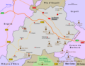
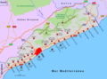
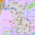
Category:Detailed maps of comarques of Catalonia
Jump to navigation
Jump to search
Media in category "Detailed maps of comarques of Catalonia"
The following 41 files are in this category, out of 41 total.
-
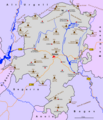
 Map Alt Camp.png 970 × 780; 232 KB
-
 Alt Empordà.png 1,347 × 924; 257 KB
-
 Alt Penedès.png 1,124 × 962; 308 KB
-
 Map Alt Urgell.png 1,051 × 1,436; 396 KB
-
 Alta Ribagorça.png 624 × 825; 171 KB
-
 Mapa de Comarca Anoia.png 950 × 982; 232 KB
-
 Map Bages.png 1,227 × 1,003; 310 KB
-
 Map Baix Camp.png 939 × 989; 299 KB
-
 Baix Ebre.png 1,219 × 821; 228 KB
-
 Baix Empordà.png 702 × 975; 132 KB
-
 Map Baix Llobregat.png 854 × 1,234; 323 KB
-
 Map Baix Penedès.png 1,116 × 1,200; 168 KB
-
 Mapa Cerdanya.png 1,209 × 840; 240 KB
-
 Map Barcelonès.png 790 × 765; 134 KB
-
 Map Berguedà.png 843 × 899; 151 KB
-
 Mapa Conca de Barberá.png 1,082 × 741; 185 KB
-
 Map Garraf.png 1,220 × 715; 172 KB
-
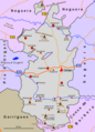
 Map Garrigues.png 980 × 760; 147 KB
-
 Map Garrotxa.png 1,090 × 1,050; 134 KB
-
 Map Gironés.png 758 × 824; 132 KB
-
 Map Maresme.png 1,163 × 862; 191 KB
-
 Map Montsiá.png 1,259 × 743; 230 KB
-
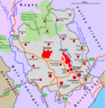
 Map Noguera.png 1,150 × 852; 290 KB
-
 Map Osona.png 958 × 850; 262 KB
-
 Map Pallars Jussá.png 783 × 1,047; 243 KB
-
 Map Pallars Sobirà.png 825 × 993; 240 KB
-
 Map Pla d’Urgell.png 1,310 × 863; 141 KB
-
 Map Pla de l’Estany.png 1,082 × 869; 103 KB
-
 Map Priorat.png 802 × 882; 201 KB
-
 Map Ribera d’Ebre.png 778 × 792; 189 KB
-
 Map Ripollés.png 1,111 × 805; 275 KB
-
 Map Segarra.png 783 × 884; 201 KB
-
 Mapa Segrià.png 660 × 874; 191 KB
-
 Map Selva.png 1,108 × 956; 285 KB
-
 Map Solsonès.png 903 × 1,053; 228 KB
-
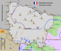
 Map Tarragonès.png 1,414 × 923; 189 KB
-
 Map Terra Alta.png 811 × 992; 221 KB
-
 Map Urgell.png 657 × 910; 165 KB
-
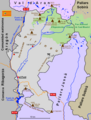
 Map Val d’Aran.png 1,062 × 894; 225 KB
-
 Map Vallès Occidental.png 773 × 792; 220 KB
-
 Map Vallès Oriental.png 1,124 × 845; 288 KB


