Category:Desert landscapes of California
Jump to navigation
Jump to search
Media in category "Desert landscapes of California"
The following 85 files are in this category, out of 85 total.
-
 29 Palms Military Base practice area, Landers, California.jpg 4,152 × 2,310; 10.33 MB
-
 Anza Borrego-Palo Verde Site walkup Pal canyon.jpg 5,184 × 3,888; 18.82 MB
-
 California desert east of Blythe California, seen from interstate 10.jpg 4,477 × 2,985; 5.26 MB
-
 California Desert Landscape 01.JPG 4,512 × 3,000; 6.9 MB
-
 California Desert Landscape 02.JPG 4,512 × 3,000; 6.52 MB
-
 California Desert Landscape 03.JPG 4,512 × 3,000; 4.12 MB
-
 California Desert Landscape 04.JPG 4,512 × 3,000; 4.06 MB
-
 California Desert Landscape 05.JPG 4,512 × 3,000; 5.6 MB
-
 California Desert Landscape 06.JPG 4,512 × 3,000; 7.05 MB
-
 California Desert Landscape 07.JPG 4,512 × 3,000; 6.17 MB
-
 California Desert Landscape 08.JPG 4,512 × 3,000; 6.46 MB
-
 California Desert Landscape 09.JPG 4,512 × 3,000; 6.31 MB
-
 California Desert Landscape 10.JPG 4,512 × 3,000; 8.18 MB
-
 California Desert Landscape 11.JPG 4,512 × 3,000; 6.1 MB
-
 California Desert Landscape 12.JPG 4,512 × 3,000; 8.05 MB
-
 California Desert Landscape 13.JPG 4,512 × 3,000; 8.05 MB
-
 California Desert Landscape 14.JPG 4,512 × 3,000; 7.89 MB
-
 California Desert Landscape 15.JPG 4,512 × 3,000; 6.6 MB
-
 California Desert Landscape 16.JPG 4,512 × 3,000; 8.04 MB
-
 California Desert Landscape 17.JPG 4,512 × 3,000; 8.14 MB
-
 California Desert Landscape 18.JPG 4,512 × 3,000; 5.5 MB
-
 California Desert Landscape 19.JPG 4,512 × 3,000; 4.83 MB
-
 California Desert Landscape 20.JPG 4,512 × 3,000; 4.49 MB
-
 California Desert Landscape 21.JPG 4,512 × 3,000; 4.82 MB
-
 California Desert Landscape 22.JPG 4,512 × 3,000; 5.44 MB
-
 California Desert Landscape 23.JPG 4,512 × 3,000; 5.18 MB
-
 California Desert Landscape 24.JPG 4,512 × 3,000; 5.59 MB
-
 California Desert Landscape 25.JPG 4,512 × 3,000; 6.56 MB
-
 California Desert Landscape 26.JPG 4,512 × 3,000; 5.42 MB
-
 California Desert Landscape 27.JPG 4,512 × 3,000; 4.95 MB
-
 California Desert Landscape 28.JPG 4,512 × 3,000; 7.77 MB
-
 California Desert Landscape 29.JPG 4,512 × 3,000; 7.87 MB
-
 California Desert Landscape 30.JPG 4,512 × 3,000; 8.44 MB
-
 California Desert Landscape 31.JPG 4,512 × 3,000; 4.65 MB
-
 California Desert Landscape 32.JPG 4,512 × 3,000; 6.36 MB
-
 California Desert Landscape 33.JPG 4,512 × 3,000; 6.03 MB
-
 California Desert Landscape 34.JPG 4,512 × 3,000; 7.98 MB
-
 California Desert Landscape 35.JPG 4,512 × 3,000; 8.29 MB
-
 California Desert Landscape 36.JPG 4,512 × 3,000; 5.94 MB
-
 California Desert Landscape 37.JPG 4,512 × 3,000; 6.69 MB
-
 California Desert Landscape 38.JPG 4,512 × 3,000; 6.77 MB
-
 California Desert Landscape 39.JPG 4,512 × 3,000; 6.16 MB
-
 California Desert Landscape 40.JPG 4,512 × 3,000; 6.28 MB
-
 California Desert Landscape 41.JPG 4,512 × 3,000; 4.81 MB
-
 California Desert Landscape 42.JPG 4,512 × 3,000; 5.5 MB
-
 California Desert Landscape 43.JPG 4,512 × 3,000; 5.12 MB
-
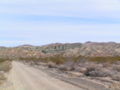
 California Desert off of I10.jpg 4,559 × 3,039; 2.9 MB
-
 Desert Formation.jpg 5,184 × 3,888; 20.61 MB
-
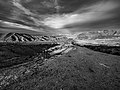
 Desert in black and white.jpg 4,608 × 3,456; 9.38 MB
-
 Desert landscape.jpg 5,184 × 3,888; 16.7 MB
-
 Desert vegetation in Southern California LCCN2013633381.tif 4,096 × 6,144; 144.04 MB
-
 Father Crowley Overlook U.S. Route 190 3.jpg 8,064 × 6,048; 77.28 MB
-
 Father Crowley Overlook U.S. Route 190 7.jpg 8,064 × 6,048; 60.95 MB
-
 Hart Mine - panoramio.jpg 1,600 × 1,067; 1.49 MB
-
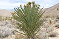
 JoshuaTree 20140905.jpg 3,264 × 2,448; 1.9 MB
-
 JoshuaTree 20150911.jpg 3,088 × 2,659; 1.98 MB
-
 JTCA 1 20140905.jpg 3,264 × 2,167; 7.83 MB
-
 JTCA 2 20140905.jpg 3,259 × 2,332; 8.75 MB
-
 JTCA 20140905.jpg 3,264 × 2,448; 8 MB
-
 JTCA RetreatCtr1 20140905.jpg 3,264 × 2,448; 7.98 MB
-
 Landscape-nature-sky-desert (24244426371).jpg 3,264 × 2,448; 2.1 MB
-
 Looking South into The South Nopah Range WA.jpg 6,000 × 3,376; 18.05 MB
-
 Looking West from Salt Creek Hills Oasis.jpg 8,064 × 6,048; 65.55 MB
-
 Morongo Canyon-2.jpg 4,032 × 2,826; 12.07 MB
-
 Overlooking Canyon Sin Nombre during sunset.jpg 8,160 × 3,902; 22.45 MB
-
 Overlooking Canyon Sin Nombre from S-2 hiway.jpg 10,368 × 7,776; 28.97 MB
-
 Rainbow Basin 0044.JPG 2,272 × 1,704; 686 KB
-
 Scenic image of the desert in California LCCN2013633378.tif 6,144 × 4,096; 144.03 MB
-
 Sundown at Eastland Ranch.JPG 4,288 × 2,848; 7.18 MB
-
 The California desert, majestic, challenging, and very vulnerable (1978) (20325804289).jpg 3,603 × 1,955; 1.06 MB
-
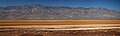 The floor of Death Valley.jpg 8,923 × 2,677; 16.53 MB
-
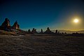
 Trona Pinnacles against the mountains.jpg 7,268 × 4,851; 24.66 MB
-
 Trona Pinnacles at Sunrise Late Winter.jpg 6,016 × 4,016; 4.32 MB
-
 Trona Pinnacles at Sunset.jpg 7,360 × 4,708; 12.13 MB
-
 Trona Pinnacles Broad Landscape.jpg 4,103 × 2,739; 5.18 MB
-
 Trona Pinnacles Close Up at Sunrise.jpg 6,016 × 4,016; 5 MB
-
 Trona Pinnacles Just Before Sunrise.jpg 6,016 × 4,016; 6.47 MB
-
 Trona Pinnacles Looking South in Early Morning Sun.jpg 6,016 × 2,993; 3.95 MB
-
 Trona Pinnacles Looking West at Sunset.jpg 7,360 × 4,660; 17.09 MB
-
 Trona Pinnacles Sunset Last Light.jpg 7,360 × 4,696; 14.13 MB
-
 Trona Pinnacles with Sunrise Peeking Above Mountains.jpg 6,016 × 4,016; 9.45 MB
-
 View from Badwaer Road in Death Valley National Park in California LCCN2013631098.tif 7,360 × 4,912; 206.9 MB
-
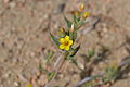
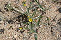
 Wildflowers at Death Valley National Park in California 2.jpg 2,048 × 1,536; 2.83 MB
-
 Wildflowers at Death Valley National Park in California 4.jpg 2,048 × 1,536; 2.81 MB
-
 Wildflowers at Death Valley National Park in California 5.jpg 2,048 × 1,536; 2.74 MB


.jpg)


_(20325804289).jpg)


