Category:Derrykeighan
Jump to navigation
Jump to search
townland in County Antrim, Northern Ireland | |||||
| Upload media | |||||
| Instance of | |||||
|---|---|---|---|---|---|
| Location |
| ||||
 | |||||
English: Derrykeighan is a hamlet, civil parish and townland of 161 acres in the Electoral Division of Benvardin, in Civil Parish of Derrykeighan, in the Barony of Dunluce Lower, in the County of Antrim, 7.5km north of Ballymoney
Media in category "Derrykeighan"
The following 10 files are in this category, out of 10 total.
-
 Converted Manse - geograph.org.uk - 792604.jpg 640 × 360; 68 KB
-
 Country Residence, Derrykeighan - geograph.org.uk - 114877.jpg 640 × 479; 164 KB
-
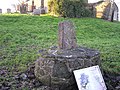 Derrykeighan Stone - geograph.org.uk - 114869.jpg 640 × 479; 183 KB
-
 Gravestone, Derrykeighan - geograph.org.uk - 5699603.jpg 1,280 × 1,280; 1.87 MB
-
 Lisconnan Road - geograph.org.uk - 5634145.jpg 3,200 × 2,144; 4.63 MB
-

-

-
 Near Dervock - geograph.org.uk - 5632855.jpg 3,200 × 1,812; 3.88 MB
-
 Old fuel pumps, Derrykeighan - geograph.org.uk - 5699583.jpg 1,280 × 720; 1.06 MB
-


