Category:Derby Road, Long Eaton
Jump to navigation
Jump to search
Section of the A6005 road in Long Eaton, Borough of Erewash, Derbyshire.
| Object location | | View all coordinates using: OpenStreetMap |
|---|
Subcategories
This category has only the following subcategory.
D
Media in category "Derby Road, Long Eaton"
The following 19 files are in this category, out of 19 total.
-
 Angled Shops - geograph.org.uk - 1154435.jpg 640 × 425; 122 KB
-
 Barclays Bank, Long Eaton - geograph.org.uk - 1749916.jpg 1,024 × 683; 252 KB
-
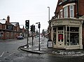
 Derby Road (A6005) - geograph.org.uk - 3572934.jpg 640 × 480; 54 KB
-
 Derby Road after sunset - geograph.org.uk - 1972011.jpg 640 × 427; 80 KB
-
 Derby Road canal bridge, Long Eaton - geograph.org.uk - 5658643.jpg 1,280 × 960; 288 KB
-
 Derby Road canal bridge, Long Eaton - geograph.org.uk - 692361.jpg 453 × 640; 220 KB
-
 Derby Road in Long Eaton - geograph.org.uk - 4846191.jpg 800 × 543; 138 KB
-
 Derby Road, Long Eaton - geograph.org.uk - 1022593.jpg 640 × 426; 198 KB
-
 Derby Road, Long Eaton - geograph.org.uk - 1150658.jpg 640 × 474; 115 KB
-
 Derby Road, Long Eaton - geograph.org.uk - 1197111.jpg 640 × 480; 116 KB
-
 Derby Road, Long Eaton - geograph.org.uk - 2177064.jpg 1,024 × 683; 240 KB
-
 Derby Road, Long Eaton - geograph.org.uk - 657566.jpg 640 × 427; 198 KB
-
 Derby Road, Long Eaton - geograph.org.uk - 793213.jpg 427 × 640; 103 KB
-
 Derby Road, Long Eaton town centre - geograph.org.uk - 3740780.jpg 1,024 × 768; 124 KB
-
 Derby Road, Long Eaton, Derbyshire - geograph.org.uk - 3340044.jpg 2,780 × 3,174; 1.75 MB
-
 House on Derby Road, Long Eaton - geograph.org.uk - 935707.jpg 640 × 480; 103 KB
-
 Red Court, Long Eaton.jpg 1,280 × 960; 590 KB
-
 Shops on Derby Road - geograph.org.uk - 1154412.jpg 640 × 448; 120 KB
-
 The Harrington Arms - geograph.org.uk - 5398852.jpg 1,280 × 719; 256 KB


_-_geograph.org.uk_-_3572934.jpg)


