Category:Der deutsche Krieg von 1866. Historisch, politisch und kriegswissenschaftlich dargestellt (1868) von Heinrich Blankenburg
Jump to navigation
Jump to search
Deutsch: Der deutsche Krieg von 1866. Historisch, politisch und kriegswissenschaftlich dargestellt ... Mit Karten und Plänen von Heinrich Blankenburg (1868)
| This category includes images from a book scanned for the British Library Mechanical Curator collection.
The full set of images from the book is available on Flickr. |
1868 edition of book by Heinrich Blankenburg | |||||
| Upload media | |||||
| Instance of |
| ||||
|---|---|---|---|---|---|
| Author |
| ||||
| Place of publication |
| ||||
| Distribution format |
| ||||
| Full work available at URL | |||||
| Collection | |||||
| Publication date |
| ||||
| |||||
Media in category "Der deutsche Krieg von 1866. Historisch, politisch und kriegswissenschaftlich dargestellt (1868) von Heinrich Blankenburg"
The following 11 files are in this category, out of 11 total.
-
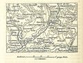
 Spezialkarte des Kriegsschauplatzes an der Tauber und bei Würzburg.jpg 2,509 × 1,789; 1.19 MB
-
 Umgebungskarte der Schlacht bei Gitschin.jpg 1,129 × 885; 371 KB
-
 Umgebungskarte der Schlacht bei Kissingen.jpg 1,290 × 1,344; 608 KB
-
 Umgebungskarte der Schlacht bei Königgrätz.jpg 2,409 × 1,489; 1.32 MB
-
 Umgebungskarte der Schlacht bei Münchengrätz.jpg 1,204 × 1,486; 664 KB
-
 Umgebungskarte der Schlacht bei Skalitz.jpg 1,301 × 984; 505 KB
-
 Umgebungskarte des Gefechtes bei Blumenau.jpg 1,338 × 1,566; 711 KB
-
 Umgebungskarte Schlacht bei Trautenau.jpg 1,276 × 1,034; 532 KB
-
 Übersichtskarte des Kriegsschauplatzes in Böhmen.jpg 3,451 × 2,503; 2.14 MB
-
 Übersichtskarte des Kriegsschauplatzes in Mittel- und Westdeutschland.jpg 1,976 × 2,772; 1.62 MB
-
 Übersichtskarte des Kriegsschauplatzes in Mähren, Niederösterreich etc.jpg 2,439 × 2,975; 1.64 MB


