Category:Denstone
Jump to navigation
Jump to search
English: Denstone is a village and civil parish situated between the towns of Uttoxeter in East Staffordshire and Ashbourne in Derbyshire. It is located next to the River Churnet. The All Saints village church, vicarage and school were built by Sir Thomas Percival Heywood in the mid nineteenth century. Denstone College is situated to the west of the village.
village in United Kingdom  | |||||
| Upload media | |||||
| Instance of | |||||
|---|---|---|---|---|---|
| Location | East Staffordshire, Staffordshire, West Midlands, England | ||||
| Population |
| ||||
| Said to be the same as | Denstone (Wikimedia duplicated page, civil parish) | ||||
 | |||||
Subcategories
This category has the following 8 subcategories, out of 8 total.
Media in category "Denstone"
The following 129 files are in this category, out of 129 total.
-
 A dead end^ - geograph.org.uk - 6647292.jpg 2,736 × 2,736; 3.23 MB
-
 A sharp bend in the River Churnet - geograph.org.uk - 3921432.jpg 3,872 × 2,592; 6.42 MB
-
 All Saints Church, Denstone - geograph.org.uk - 6493143.jpg 2,000 × 1,333; 2.11 MB
-
 An overgrown stile and sheep - geograph.org.uk - 5098804.jpg 1,280 × 960; 575 KB
-
 B5030 towards Rocester - geograph.org.uk - 4539385.jpg 640 × 480; 55 KB
-
 B5031, Denstone - geograph.org.uk - 4539376.jpg 640 × 480; 61 KB
-
 Barrowhill Hall - geograph.org.uk - 3923062.jpg 3,872 × 2,592; 1.28 MB
-
 Barrowhill Hall, B5030, Rocester - geograph.org.uk - 4434843.jpg 3,677 × 2,452; 4.54 MB
-
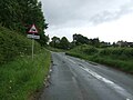
 Beware cows on road - geograph.org.uk - 4533734.jpg 640 × 447; 51 KB
-
 Bluebells on Saltersford Lane - geograph.org.uk - 1842205.jpg 1,200 × 900; 263 KB
-
 Bridleway on old North Staffordshire Railway line - geograph.org.uk - 6648454.jpg 2,736 × 2,736; 2.83 MB
-
 Bridleway on old North Staffordshire Railway line - geograph.org.uk - 6648457.jpg 2,708 × 2,280; 2.48 MB
-
 Brookleys Lake, Wootton Lodge Estate - geograph.org.uk - 2250753.jpg 640 × 480; 119 KB
-
 Calwich Cottage Farm - geograph.org.uk - 3921389.jpg 3,872 × 2,592; 4.01 MB
-

-
 Closed Lane - geograph.org.uk - 3404184.jpg 1,200 × 900; 398 KB
-

-
 Crumpwood Pumping Station - geograph.org.uk - 5670890.jpg 640 × 427; 141 KB
-
 Crumpwood Pumping Station - geograph.org.uk - 5686284.jpg 640 × 422; 114 KB
-
 Crumpwood Pumping Station - geograph.org.uk - 5987948.jpg 640 × 427; 76 KB
-
 Crumpwood Weir - geograph.org.uk - 413004.jpg 640 × 480; 102 KB
-
 Crumpwood Weir - geograph.org.uk - 5670869.jpg 640 × 427; 110 KB
-
 Crumpwood Weir - geograph.org.uk - 5987964.jpg 427 × 640; 89 KB
-
 Crumpwood Weir - geograph.org.uk - 6058807.jpg 640 × 427; 119 KB
-
 Crumpwood Weir Pumping Station - geograph.org.uk - 5670900.jpg 640 × 411; 111 KB
-
 Crumpwood Weir Pumping Station - geograph.org.uk - 5987957.jpg 640 × 408; 97 KB
-
 Crumpwood Weir Pumping Station - geograph.org.uk - 5987988.jpg 640 × 427; 133 KB
-

-
 Dalesgap - geograph.org.uk - 3923014.jpg 3,767 × 2,511; 2.95 MB
-
-
 Denstone - Village Cross And Drinking Fountain - 20220925170920.jpg 1,816 × 3,493; 1.91 MB
-
 Denstone - Village Cross And Drinking Fountain - 20220925171025.jpg 1,816 × 3,702; 2.55 MB
-
 Denstone College Road - geograph.org.uk - 99123.jpg 480 × 640; 202 KB
-
 Denstone Hall Farm Shop - geograph.org.uk - 5859913.jpg 2,000 × 1,333; 2.35 MB
-
 Denstone Hall Farm Shop - geograph.org.uk - 6649751.jpg 640 × 480; 68 KB
-
 Denstone Lane (B5032) - geograph.org.uk - 4539378.jpg 640 × 480; 63 KB
-
 Denstone Lane (B5032), Denstone - geograph.org.uk - 4539374.jpg 640 × 480; 64 KB
-
 Denstone Station (Closed 1965) - geograph.org.uk - 6492982.jpg 2,000 × 1,333; 3.15 MB
-
 Denstone Village cross and drinking fountain - geograph.org.uk - 6493013.jpg 1,333 × 2,000; 2.61 MB
-
 Denstone War Memorial - geograph.org.uk - 6493000.jpg 2,000 × 1,333; 2.72 MB
-
 Denstone, Staffordshire ... Post Office. (5975013097).jpg 3,710 × 2,743; 6.25 MB
-
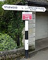
 Direction Sign – Signpost - geograph.org.uk - 6538760.jpg 641 × 855; 199 KB
-
 Doveleys Manor Parkland - geograph.org.uk - 6645940.jpg 640 × 480; 84 KB
-

-
 End of the Road - geograph.org.uk - 381014.jpg 640 × 480; 100 KB
-
 Entering Denstone - geograph.org.uk - 4539370.jpg 640 × 480; 54 KB
-
 Entrance to JCB test track facility - geograph.org.uk - 6647275.jpg 2,708 × 2,268; 1.6 MB
-
 Farm on the Hill, Prestwood - geograph.org.uk - 6647270.jpg 3,408 × 2,200; 1.78 MB
-
 Farmland above the Dove - geograph.org.uk - 3922990.jpg 3,872 × 2,592; 5.6 MB
-
 Farmland north of Hollington Road - geograph.org.uk - 4071360.jpg 640 × 480; 83 KB
-
 Farmland off Denstone Lane - geograph.org.uk - 4533725.jpg 640 × 480; 80 KB
-
 Field entrance, Quixhill Bank - geograph.org.uk - 4539381.jpg 640 × 480; 66 KB
-
 Footpath from Stubwood - geograph.org.uk - 161621.jpg 640 × 480; 388 KB
-
 Footpath near Denstone - geograph.org.uk - 3921373.jpg 3,872 × 2,592; 5.46 MB
-
 Footpath to Norbury - geograph.org.uk - 3921570.jpg 3,771 × 2,514; 3.98 MB
-
 Former bridge piers in the River Dove - geograph.org.uk - 5263219.jpg 1,280 × 960; 521 KB
-
 Former entrance to Alton Park - geograph.org.uk - 6648461.jpg 3,521 × 1,683; 1.37 MB
-

-
 Grazing towards Alverton Hall Farm - geograph.org.uk - 4539365.jpg 640 × 480; 76 KB
-
 Hollington Road - geograph.org.uk - 4071361.jpg 640 × 480; 65 KB
-
 Houses on Greenfields, Denstone - geograph.org.uk - 4533736.jpg 640 × 439; 63 KB
-
 Jardines Lane at Stubwood - geograph.org.uk - 2914126.jpg 640 × 425; 75 KB
-
 JCB Test site for the Charity mud run - geograph.org.uk - 5060544.jpg 1,500 × 1,000; 1.15 MB
-
 Leigh's Plantation - geograph.org.uk - 5263204.jpg 1,280 × 960; 426 KB
-
 Livestock by the River Dove - geograph.org.uk - 3664466.jpg 4,000 × 3,000; 3.22 MB
-
 Lower House - geograph.org.uk - 3404230.jpg 1,200 × 900; 241 KB
-
 Lower House - geograph.org.uk - 6644694.jpg 640 × 480; 106 KB
-
 Micklin Farm - geograph.org.uk - 458853.jpg 640 × 480; 42 KB
-
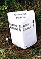
 Mile Post on the edge of Denstone - geograph.org.uk - 99146.jpg 480 × 640; 141 KB
-
 Milepost at SK1098841244.jpg 492 × 701; 56 KB
-
 Milepost near Prestwood Lane.jpg 492 × 701; 65 KB
-
 Milepost opposite Stone Bank.jpg 986 × 1,436; 197 KB
-
 New gateway to Saltersford Lane - geograph.org.uk - 1842095.jpg 1,200 × 900; 288 KB
-
-
 Old Direction Sign and Painted Bus Stop, Denstone - geograph.org.uk - 6492474.jpg 2,000 × 1,333; 2.89 MB
-
 Part of a Cabbage Field - geograph.org.uk - 381017.jpg 640 × 480; 120 KB
-
 Path beside River Dove - geograph.org.uk - 6648336.jpg 3,648 × 1,744; 1.81 MB
-
 Path in Doveleys Manor Park - geograph.org.uk - 6648339.jpg 3,648 × 1,744; 2.86 MB
-
 Path junction near Quixhill - geograph.org.uk - 6647593.jpg 640 × 480; 96 KB
-
 Pheasant near Ellastone - geograph.org.uk - 3921593.jpg 2,955 × 1,970; 2.76 MB
-
 Planting the next crop - geograph.org.uk - 381033.jpg 640 × 480; 53 KB
-
 Ploughed field on the edge of Denstone - geograph.org.uk - 3921354.jpg 3,872 × 2,592; 5.38 MB
-
 Post office and village shop, Denstone - geograph.org.uk - 3934982.jpg 3,872 × 2,592; 3.61 MB
-

-
 Quixhill Bank (B5032) - geograph.org.uk - 4539384.jpg 640 × 480; 65 KB
-
 Quixhill Lane - geograph.org.uk - 6647596.jpg 640 × 480; 68 KB
-
 Quixhill Lodge Farm - geograph.org.uk - 1213976.jpg 640 × 480; 62 KB
-
 Replaced Mile Marker 24-06, Churnet Way - geograph.org.uk - 6492961.jpg 2,000 × 1,333; 3.76 MB
-
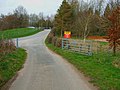
 Road junction near Denstone - geograph.org.uk - 3921411.jpg 3,872 × 2,592; 5.69 MB
-
 Saltersford Lane - geograph.org.uk - 1214043.jpg 640 × 480; 110 KB
-
 Seventy Bridge - geograph.org.uk - 413486.jpg 640 × 480; 135 KB
-

-
 Snowdrifts on Broomfield Lane - geograph.org.uk - 3404086.jpg 1,200 × 900; 215 KB
-
 Staffordshire Way, Approaching Denstone - geograph.org.uk - 6492587.jpg 2,000 × 1,333; 2.04 MB
-
 The Churnet valley Denstone at dawn - geograph.org.uk - 922903.jpg 640 × 512; 42 KB
-
 The floods are subsiding - geograph.org.uk - 3921584.jpg 3,872 × 2,592; 5.82 MB
-
 The Limestone Way - geograph.org.uk - 3664459.jpg 4,000 × 3,000; 2.04 MB
-
 The Limestone Way near Dalesgap - geograph.org.uk - 3923010.jpg 3,872 × 2,592; 5.18 MB
-
 The Limestone Way near Rocester - geograph.org.uk - 3664447.jpg 3,996 × 2,994; 1.67 MB
-
 The River Churnet at Quixhill - geograph.org.uk - 3404146.jpg 1,200 × 900; 313 KB
-
 The River Churnet from Quixhill Bridge - geograph.org.uk - 3921454.jpg 3,872 × 2,592; 6.27 MB
-
 The River Dove downstream from Norbury - geograph.org.uk - 3922825.jpg 3,872 × 2,592; 6.05 MB
-
 The River Dove near Ellastone - geograph.org.uk - 3664463.jpg 4,000 × 3,000; 2.45 MB
-
 The Staffordshire Way at Denstone - geograph.org.uk - 6647587.jpg 640 × 480; 121 KB
-
 The World Headquarters of JCB - geograph.org.uk - 6645945.jpg 640 × 360; 47 KB
-
 Track off Quixhill Lane - geograph.org.uk - 3921512.jpg 3,872 × 2,592; 5.43 MB
-
 Track to Holbrook Farm - geograph.org.uk - 4533723.jpg 640 × 480; 80 KB
-
 Track to Woodhouse Fields Farm - geograph.org.uk - 4071357.jpg 640 × 480; 92 KB
-
 Tree in a field of stubble - geograph.org.uk - 6645938.jpg 640 × 480; 96 KB
-
 Tree-lined road near Denstone - geograph.org.uk - 6649750.jpg 640 × 480; 134 KB
-
 Trees by the River Dove - geograph.org.uk - 3922837.jpg 3,872 × 2,592; 5.7 MB
-
 Triumphal arch and lodge at Quixhill - geograph.org.uk - 6649756.jpg 640 × 480; 62 KB
-
 Undefined path, part of Limestone Way - geograph.org.uk - 6648346.jpg 3,454 × 1,733; 1,005 KB
-
 St. Chad's School and grounds, Denstone, Staffordshire. Wood Wellcome V0012533.jpg 3,300 × 2,151; 3.43 MB
-
 Building continues in Denstone - geograph.org.uk - 163703.jpg 640 × 480; 54 KB
-
 Cattle in a field, Denstone - geograph.org.uk - 163694.jpg 640 × 480; 95 KB
-
 Fields at Stubwood - geograph.org.uk - 163667.jpg 480 × 640; 95 KB
-
 Hole Farm - geograph.org.uk - 381023.jpg 640 × 480; 60 KB
-
 JCB Test Track - geograph.org.uk - 366161.jpg 640 × 480; 118 KB
-
 JCB Training Area - geograph.org.uk - 381011.jpg 640 × 480; 90 KB
-
 Limestone Way near Rocester - geograph.org.uk - 231420.jpg 640 × 480; 93 KB
-

-

-
 Oakmoor to Denstone Disused Railway Line - geograph.org.uk - 100062.jpg 480 × 640; 116 KB
-
 Old building in Denstone - geograph.org.uk - 230970.jpg 640 × 480; 163 KB
-
 Road leaving Denstone - geograph.org.uk - 99127.jpg 640 × 480; 81 KB
-

-
 The Tavern, Denstone - geograph.org.uk - 230961.jpg 640 × 480; 96 KB
-
 Waste Farm - geograph.org.uk - 381085.jpg 640 × 480; 57 KB


_-_geograph.org.uk_-_4539378.jpg)
,_Denstone_-_geograph.org.uk_-_4539374.jpg)
_-_geograph.org.uk_-_6492982.jpg)


.jpg)


_-_geograph.org.uk_-_4539368.jpg)


_-_geograph.org.uk_-_4539384.jpg)


